Old Maps of Daaquam, Powers Gore for Genealogy
Trace your family roots with 7 historic maps of Daaquam. These high-res maps reveal old neighborhoods, homesites, landmarks, and streets — helping you uncover where your ancestors lived and how the area evolved over time.
- Explore historic neighborhoods: Identify where your relatives may have lived in the 1800s or 1900s.
- Compare maps over time: Trace the changes in streets, buildings, and landmarks for multi-generational research.
- Perfect for genealogy & ancestry research: Used by family historians and researchers to map out lineage and migration.
These maps are an incredible resource for exploring your personal connection to Daaquam's past.
Daaquam, Powers Gore maps
(7)- 1962 Map of Quebec, 1966 Print
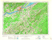 1962 Quebec1966 Print · USGSThe cross-border region between Quebec and Northern Maine is captured here during the mid-1960s, showing the dense settlement of the St. Lawrence valley and the rugged timberlands of the frontier. Genealogists can trace family roots through numerous parishes like St-Joseph-de-Beauce or locate the industrial hubs of Thetford Mines and Levis.3 unique versions available
 - 1987 Map of Daaquam
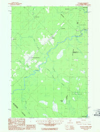 1987 Daaquam1987 Print · USGSThe Maine-Quebec borderlands come into focus in the late 1980s, showcasing the international crossings and remote townships of Somerset County. Researchers can trace the Daaquam River across the boundary, locating the Customhouse and settlements like Saint-Juste-de-Bretenieres.
 - 1993 Map of Montmagny, 1994 Print
 1993 Montmagny1994 Print · USGSThe international borderlands of Maine and Quebec come into focus during the early nineties, from the Saint Lawrence riverfront to the deep North Woods. Researchers can trace historic settlements like Montmagny or follow the remote heights of the Monts Notre-Dame toward Lac Frontière.
 - 2011 Map of Daaquam, 2011 Print
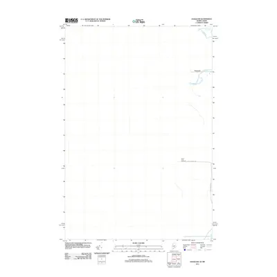 2011 Daaquam2011 Print · USGSCovers Daaquam, including Saint-Just-de-Bretenières, Lac-Frontière, and other nearby areas
 - 2014 Map of Daaquam, 2014 Print
 2014 Daaquam2014 Print · USGSCovers Daaquam, including Saint-Just-de-Bretenières, Lac-Frontière, and other nearby areas
 - 2021 Map of Daaquam, 2021 Print
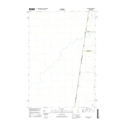
 2021 Daaquam2021 Print · USGSCovers Daaquam, including Saint-Just-de-Bretenières, Lac-Frontière, and other nearby areas
 - 2024 Map of Daaquam, 2024 Print
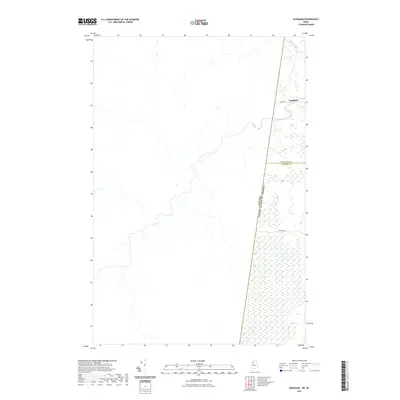
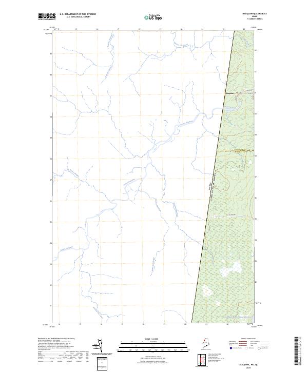 2024 Daaquam2024 Print · USGSThe Maine-Quebec borderlands come into focus in this contemporary survey of the Somerset County wilderness. Researchers can trace the international boundary line near Daaquam and explore the remote river networks of the Southwest Branch Saint John River and Rivière Daaquam.
End of results
Showing maps 1-7 of 7
Frequently asked questions
- What are the different types of historical maps available for Daaquam?
- What is the oldest map of Daaquam?
- Where can I purchase historical maps of Daaquam for my home or office?
- Where can I download high-res historical maps of Daaquam?
- Are there historical topographic maps available for Daaquam?
- Is there historical aerial imagery available for Daaquam?
- Where are historical maps of Daaquam sourced from?