1970s Maps of Saint John Plantation, Maine
Explore 4 historic maps of Saint John Plantation from the 1970s. These maps offer a rare glimpse into what life looked like during the 1970s — showing old roads, neighborhoods, homes, and landmarks that have changed or disappeared over time.
Whether you're researching your family's past, planning a metal detecting trip, or studying how Saint John Plantation's landscape evolved across the 1970s, these high-resolution maps are a powerful tool for exploring the history of this region.
- Focus on a specific era: All maps on this page are from the 1970s, giving you a focused view of this time period.
- See what’s changed: Compare century-old streets, trails, and buildings to today's modern landscape using overlays and satellite layers.
- Research with precision: Use these maps for genealogy, historical research, land use analysis, or educational projects.
- View, download, or print: Maps are fully viewable online in high resolution, and can be downloaded or printed for your own records.
Start exploring Saint John Plantation's history through authentic maps from the 1970s. This is your window into the past.
Saint John Plantation, ME maps
(4)- 1975 Map of St Francis SE, 1981 Print
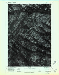 1975 St Francis SE1981 Print · USGSNorthern Maine's timberlands and remote lakes are captured through aerial photography in the mid-seventies. Researchers can observe the unmodified terrain around Wallagrass Mtn and the shorelines of Mc Lean Lake and Third Lake.
 - 1975 Map of St Francis NE, 1981 Print
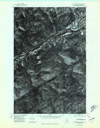 1975 St Francis NE1981 Print · USGSThe northern Maine borderlands appear in mid-1970s detail on this aerial survey of the upper St John River. Researchers can trace the riverside settlement of St John and identify remote water bodies like Hunnewell Lake deep in the timberlands.
 - 1975 Map of Eagle Lake SW, 1981 Print
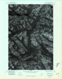 1975 Eagle Lake SW1981 Print · USGSAroostook County's deep woodlands and water systems are seen here in the mid-seventies via detailed aerial imagery. Researchers can trace the natural flow of Wallagrass Stream or examine the remote shorelines of Dickwood Lake and Wallagrass Lakes.
 - 1975 Map of Eagle Lake NW, 1981 Print
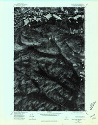 1975 Eagle Lake NW1981 Print · USGSThe international border along the St. John River is captured in this mid-seventies aerial survey of Aroostook County. Researchers can trace the layout of the Wheelock settlement and locate rural landmarks like Wheelock Lake and the riverfront Ledges.
End of results
Showing maps 1-4 of 4
Top cities near Saint John Plantation
- Fort Kent historical maps
- Eagle Lake historical maps
- Wallagrass historical maps
- Saint Francis historical maps
- New Canada historical maps
- Allagash historical maps
See more
Top neighborhoods of Saint John Plantation
Frequently asked questions
- What are the different types of historical maps available for Saint John Plantation?
- What is the oldest map of Saint John Plantation?
- Where can I purchase historical maps of Saint John Plantation for my home or office?
- Where can I download high-res historical maps of Saint John Plantation?
- Are there historical topographic maps available for Saint John Plantation?
- Is there historical aerial imagery available for Saint John Plantation?
- Where are historical maps of Saint John Plantation sourced from?