1950s Maps of Scopan Township, Maine
Explore 5 historic maps of Scopan Township from the 1950s. These maps offer a rare glimpse into what life looked like during the 1950s — showing old roads, neighborhoods, homes, and landmarks that have changed or disappeared over time.
Whether you're researching your family's past, planning a metal detecting trip, or studying how Scopan Township's landscape evolved across the 1950s, these high-resolution maps are a powerful tool for exploring the history of this region.
- Focus on a specific era: All maps on this page are from the 1950s, giving you a focused view of this time period.
- See what’s changed: Compare century-old streets, trails, and buildings to today's modern landscape using overlays and satellite layers.
- Research with precision: Use these maps for genealogy, historical research, land use analysis, or educational projects.
- View, download, or print: Maps are fully viewable online in high resolution, and can be downloaded or printed for your own records.
Start exploring Scopan Township's history through authentic maps from the 1950s. This is your window into the past.
Scopan Township, ME maps
(5)- 1953 Map of Ashland, 1955 Print
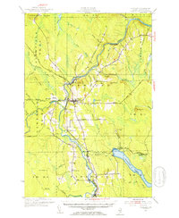 1953 Ashland1955 Print · USGSAroostook County timber and rail networks are in sharp focus during the early fifties, centering on the river valley south of Portage Lake. Genealogists can trace family footprints at Winslow Cem, Rockwell Sch, and the rail sidings of Sheridan and Masardis.4 unique versions available
 - 1953 Map of Presque Isle, 1955 Print
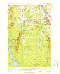 1953 Presque Isle1955 Print · USGSCentral Aroostook County is seen here during the mid-century expansion of Presque Isle, featuring a landscape shaped by rail and river. Researchers can trace the early Presque Isle Air Force Base, old schoolhouses like Hillside Sch, and landmarks including Hedgehog Mountain.5 unique versions available
 - 1954 Map of Howe Brook, 1955 Print
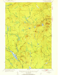 1954 Howe Brook1955 Print · USGSAroostook County's deep woods are documented in the mid-fifties, showing a landscape of timber-industry rail and seasonal sporting camps. Researchers can locate remote outposts like Old Klondike Camp, the community of Little Canada, and the Bangor and Ar00stook line.2 unique versions available
 - 1954 Map of Presque Isle, 1968 Print
 1954 Presque Isle1968 Print · USGSNorth Woods logging and rail history come alive in this mid-century survey of the Maine-Quebec borderlands. Genealogists and historians can trace the Bangor and Aroostook railroad through timber hubs like Ashland, Smyrna Mills, and Presque Isle.2 unique versions available
 - 1958 Map of Presque Isle
 1958 Presque Isle1958 Print · USGSThe Aroostook timber and potato country is captured here during the late fifties, showing the vital rail-to-river network of Northern Maine. Genealogists and historians can trace the Bangor & Aroostook RR through Mapleton and Ashland, or locate remote sites like Chamberlain Farm and Seven Islands.
End of results
Showing maps 1-5 of 5
Top cities near Scopan Township
- Presque Isle historical maps
- Mapleton historical maps
- Ashland historical maps
- Chapman historical maps
- Westfield historical maps
- Castle Hill historical maps
See more
Top neighborhoods of Scopan Township
Frequently asked questions
- What are the different types of historical maps available for Scopan Township?
- What is the oldest map of Scopan Township?
- Where can I purchase historical maps of Scopan Township for my home or office?
- Where can I download high-res historical maps of Scopan Township?
- Are there historical topographic maps available for Scopan Township?
- Is there historical aerial imagery available for Scopan Township?
- Where are historical maps of Scopan Township sourced from?