Old Maps of Deadmans Corner, T10 R3 WELS for Academic Research
Study the evolution of Deadmans Corner with 13 high-resolution historic maps. Whether you're teaching, researching, or modeling changes in land use, these maps provide essential visual documentation of urban, environmental, and geographic change.
- Analyze long-term change: Track patterns in development, transportation, and natural features.
- Ideal for environmental or urban studies: Support academic projects with primary historical map data.
- Use in the classroom or lab: Educators and researchers rely on these maps to bring historical context to life.
These maps are a powerful tool for teaching, research, and visualizing how Deadmans Corner has changed over the decades.
Deadmans Corner, T10 R3 WELS maps
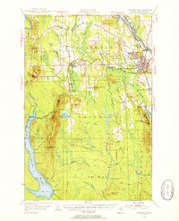
(13)- 1935 Map of Presque Isle
 1935 Presque Isle1935 Print · USGSAroostook County agriculture and industry are at their peak in the 1930s, centered on the river-and-rail hub of Presque Isle. Genealogists and historians can trace dozens of rural schoolhouses like Richardson Sch and find landmarks such as the Landing Field and the State Experimental Farm.3 unique versions available
 - 1953 Map of Presque Isle, 1955 Print
 1953 Presque Isle1955 Print · USGSCentral Aroostook County is seen here during the mid-century expansion of Presque Isle, featuring a landscape shaped by rail and river. Researchers can trace the early Presque Isle Air Force Base, old schoolhouses like Hillside Sch, and landmarks including Hedgehog Mountain.5 unique versions available
 - 1954 Map of Presque Isle, 1968 Print
 1954 Presque Isle1968 Print · USGSNorth Woods logging and rail history come alive in this mid-century survey of the Maine-Quebec borderlands. Genealogists and historians can trace the Bangor and Aroostook railroad through timber hubs like Ashland, Smyrna Mills, and Presque Isle.2 unique versions available
 - 1958 Map of Presque Isle
 1958 Presque Isle1958 Print · USGSThe Aroostook timber and potato country is captured here during the late fifties, showing the vital rail-to-river network of Northern Maine. Genealogists and historians can trace the Bangor & Aroostook RR through Mapleton and Ashland, or locate remote sites like Chamberlain Farm and Seven Islands.
 - 1960 Map of Presque Isle
 1960 Presque Isle1960 Print · USGSNorthern Maine during the mid-century was a land of timber, rails, and strategic airfields. Genealogists and historians can trace the growth of Presque Isle and Ashland or explore the remote northern reaches of Baxter State Park and Presque Isle AFB.3 unique versions available
 - 1975 Map of Presque Isle SE, 1981 Print
 1975 Presque Isle SE1981 Print · USGSNorthern Maine forest and farmland emerge in this mid-seventies aerial study of the Aroostook landscape. Researchers can trace the winding course of Presque Isle Stream and identify early land clearings near Quaggy Joe and Echo Lake.
 - 1984 Map of Echo Lake
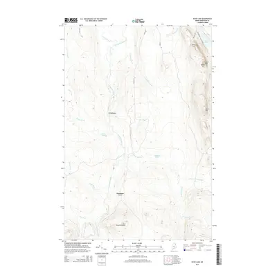
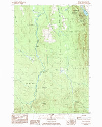 1984 Echo Lake1984 Print · USGSThe Aroostook County highlands come into sharp focus in the mid-1980s, centered on the rugged peaks of the state's first park. Researchers can trace land divisions across Westfield and Chapman, or locate remote spots like Deadmans Corner and Echo Lake.
 - 1994 Map of Presque Isle
 1994 Presque Isle1994 Print · USGSAroostook County in the mid-nineties shows a landscape defined by timber, rail, and river-valley farming. Genealogists and historians can trace the Bangor & Aroostook RR through small stations and settlements like Winterville Sta, Buffalo, and Sheridan.
 - 2011 Map of Echo Lake, 2011 Print
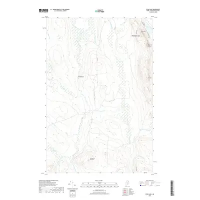
 2011 Echo Lake2011 Print · USGSCovers Deadmans Corner, including Presque Isle, Chapman, and other nearby areas
 - 2014 Map of Echo Lake, 2014 Print
 2014 Echo Lake2014 Print · USGSCovers Deadmans Corner, including Presque Isle, Chapman, and other nearby areas
 - 2018 Map of Echo Lake, 2018 Print
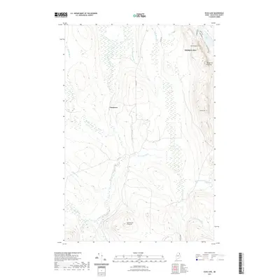
 2018 Echo Lake2018 Print · USGSCovers Deadmans Corner, including Presque Isle, Chapman, and other nearby areas
 - 2021 Map of Echo Lake, 2021 Print
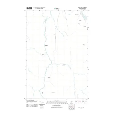
 2021 Echo Lake2021 Print · USGSCovers Deadmans Corner, including Presque Isle, Chapman, and other nearby areas
 - 2024 Map of Echo Lake, 2024 Print
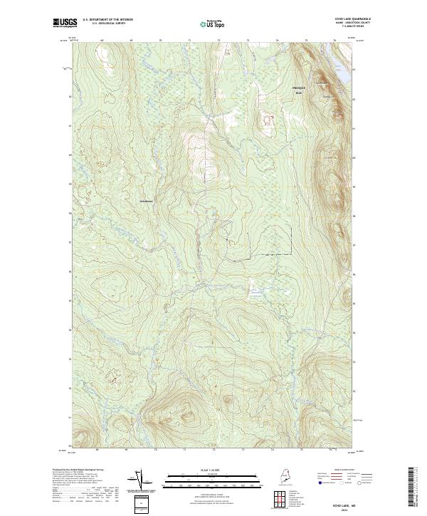 2024 Echo Lake2024 Print · USGSAroostook County's interior forest and waterways are charted here in the mid-2020s, showing the intersection of parkland and peak. Researchers can trace the drainage of Presque Isle Stream and locate landmarks like Quaggy Joe and the settlement of Grindstone.
End of results
Showing maps 1-13 of 13
Top cities near Deadmans Corner
- Presque Isle historical maps
- Fort Fairfield historical maps
- Mapleton historical maps
- Washburn historical maps
- Mars Hill historical maps
- Easton historical maps
See more
Frequently asked questions
- What are the different types of historical maps available for Deadmans Corner?
- What is the oldest map of Deadmans Corner?
- Where can I purchase historical maps of Deadmans Corner for my home or office?
- Where can I download high-res historical maps of Deadmans Corner?
- Are there historical topographic maps available for Deadmans Corner?
- Is there historical aerial imagery available for Deadmans Corner?
- Where are historical maps of Deadmans Corner sourced from?