Old Maps of Sebago, Maine for Metal Detecting
Plan your next treasure hunt with 40 historic maps of Sebago. Find old homesites, ghost towns, trails, and gathering spots that may be lost to time — perfect for identifying promising metal detecting locations.
- Locate forgotten sites: Uncover places like long-lost settlements, abandoned rail lines, or gathering spots.
- Plan better hunts: Use map overlays combined with LiDAR or satellite views to narrow in on historically rich areas.
- Made for detectorists: Thousands of hobbyists use these maps to discover relics, coins, and hidden history.
Use these historic maps to boost your research and find new opportunities beneath the surface of Sebago.
Sebago, ME maps
(40)- 1896 Map of Sebago
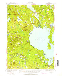
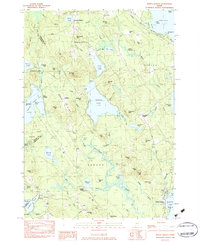
 1896 Sebago1896 Print · USGSCumberland County’s lake country thrived on a network of water and rail transport at the end of the Victorian era. Researchers can trace the Steamboat Route through Sebago Lake and locate old industrial sites like Songo Lock, Cooks Mills, and Steep Falls.8 unique versions available
 - 1910 Map of Kezar Falls
 1910 Kezar Falls1910 Print · USGSMaine and New Hampshire borderlands are captured here at the height of the railroad era, as the Maine Central linked river towns. Genealogists can trace family footprints through sites like the Parsonsfield Seminary, Merrill Corner, and the Haley School.5 unique versions available
 - 1911 Map of Kezar Falls
 1911 Kezar Falls1911 Print · USGSThe Saco River valley at the turn of the century shows a landscape defined by riverside industry and mountain schools. Genealogists and historians can trace rail depots like Bridgton Junction and early landmarks such as Parsonsfield Seminary and Rankins Mill.5 unique versions available
 - 1942 Map of Sebago Lake, 1959 Print
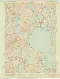
 1942 Sebago Lake1959 Print · USGSCumberland County’s lakes and ridges were well-established as a summer destination in the early 1940s, centered around the expanse of Sebago Lake. Researchers can trace old rail routes at East Baldwin Mattocks Sta, find the historic Potter Academy, or locate family sites near South Naples.3 unique versions available
 - 1943 Map of Sebago Lake
 1943 Sebago Lake1943 Print · USGSMaine's lake country thrived during the early 1940s as a hub of rail commerce and early recreation. You can trace the Maine Central Railroad through Steep Falls or find local landmarks like Potter Academy and Songo Lock.3 unique versions available
 - 1949 Map of Portland
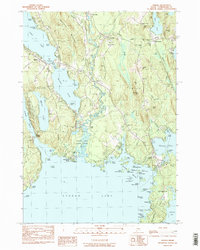
 1949 Portland1949 Print · USGSCoastal Maine and the New Hampshire interior are shown in detail during the late forties, from the bustling harbors to the lakeside villages. Researchers can trace historical rail networks like the Boston & Maine RR and locate coastal defenses such as Fort Preble.3 unique versions available
 - 1956 Map of Portland, 1963 Print
 1956 Portland1963 Print · USGSSouthern Maine and eastern New Hampshire are captured here in the mid-fifties, during a time of major highway expansion and military growth. You can trace the path of the Maine Turnpike and locate landmarks like the Portsmouth Naval Shipyard and Sebago Lake.4 unique versions available
 - 1959 Map of Portland
 1959 Portland1959 Print · USGSThe Maine and New Hampshire coastlines meet in this mid-century portrait of maritime commerce and inland rail networks. Researchers can trace the legacy of coastal defense at Fort Williams and follow the historic path of the Maine Central RR through the White Mountain National Forest.2 unique versions available
 - 1963 Map of Portland
 1963 Portland1963 Print · USGSCoastal Maine and New Hampshire thrived as maritime and industrial hubs during the mid-sixties, linked by a dense network of rail and river. Researchers can trace historic transit corridors like the Maine Central RR and locate key sites such as the Portsmouth Naval Shipyard or Pease Air Force Base.3 unique versions available
 - 1964 Map of Hiram, 1966 Print
 1964 Hiram1966 Print · USGSOxford County in the 1960s reveals a landscape of river-tied commerce and quiet lakeside settlements. Researchers can locate numerous family burial sites like Harnden Cem, trace the Maine Central Railroad, and explore historic locales like Rankins Mill or Heads Corner.2 unique versions available
 - 1983 Map of Steep Falls, 1984 Print
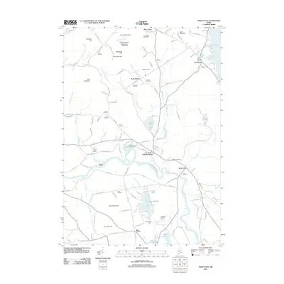
 1983 Steep Falls1984 Print · USGSMaine's riverfront settlements and family farmsteads are detailed here in the early 1980s. Genealogists can locate numerous family burial sites like Emerson-Thorne Cem and Lord Cem, or trace the winding Saco River past Steep Falls.2 unique versions available
 - 1983 Map of Sebago Lake, 1984 Print
 1983 Sebago Lake1984 Print · USGSCumberland County’s lakefront and forest lands are documented here during the early eighties, capturing the character of Standish and Raymond. Researchers can trace the Maine Central rail line and locate community staples like Richville, the Johnson Sch, and Friendship Cem.2 unique versions available
 - 1983 Map of North Sebago, 1984 Print
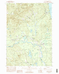
 1983 North Sebago1984 Print · USGSThe Sebago and Bridgton area in the early eighties shows a rural landscape of inland lakes and high ridges before modern expansion. Researchers can find dozens of family burial sites like Haley Cem and trace old routes through Sebago Center and Convene.3 unique versions available
 - 1983 Map of Naples, 1984 Print
 1983 Naples1984 Print · USGSThe Cumberland County lake country shows its late-century character through the intricate waterway system connecting Long Lake and Sebago Lake. Genealogists and local historians can trace family burial sites like Maxfield Cem and Skinner Cem near the historic Songo Lock.3 unique versions available
 - 1985 Map of Portland, 1986 Print
 1985 Portland1986 Print · USGSThe Maine coast and Sebago Lake region are captured in the mid-1980s, showcasing the transition from traditional maritime centers to a modern transportation hub. Genealogists and historians can trace rail lines like the Grand Trunk RR and find local landmarks such as the U.S. Marine Hospital or Old Orchard Beach.2 unique versions available
 - 2011 Map of Naples, 2011 Print
 2011 Naples2011 Print · USGSCovers Sebago, including Raymond, Naples, and other nearby areas
 - 2011 Map of Steep Falls, 2011 Print
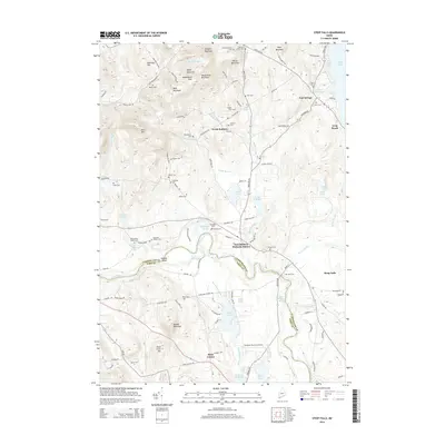
 2011 Steep Falls2011 Print · USGSCovers Sebago, including Standish, Limington, and other nearby areas
 - 2011 Map of Hiram, 2011 Print
 2011 Hiram2011 Print · USGSCovers Sebago, including Bridgton, Brownfield, and other nearby areas
 - 2011 Map of North Sebago, 2011 Print
 2011 North Sebago2011 Print · USGSCovers Sebago, including Bridgton, Naples, and other nearby areas
 - 2011 Map of Sebago Lake, 2011 Print
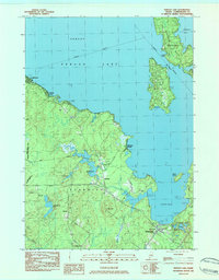
 2011 Sebago Lake2011 Print · USGSCovers Sebago, including Gorham, Standish, and other nearby areas
 - 2014 Map of Naples, 2014 Print
 2014 Naples2014 Print · USGSCovers Sebago, including Raymond, Naples, and other nearby areas
 - 2014 Map of Hiram, 2014 Print
 2014 Hiram2014 Print · USGSCovers Sebago, including Bridgton, Brownfield, and other nearby areas
 - 2014 Map of North Sebago, 2014 Print
 2014 North Sebago2014 Print · USGSCovers Sebago, including Bridgton, Naples, and other nearby areas
 - 2014 Map of Steep Falls, 2014 Print
 2014 Steep Falls2014 Print · USGSCovers Sebago, including Standish, Limington, and other nearby areas
 - 2014 Map of Sebago Lake, 2014 Print
 2014 Sebago Lake2014 Print · USGSCovers Sebago, including Gorham, Standish, and other nearby areas
Showing maps 1-25 of 40
Top cities near Sebago
- Windham historical maps
- Gorham historical maps
- Standish historical maps
- Buxton historical maps
- Gray historical maps
- Waterboro historical maps
See more
Top neighborhoods of Sebago
- Douglas Hill historical maps
- Hillside historical maps
- Macs Corner historical maps
- Sebago Center historical maps
- West Sebago historical maps
- Convene historical maps
See more
Frequently asked questions
- What are the different types of historical maps available for Sebago?
- What is the oldest map of Sebago?
- Where can I purchase historical maps of Sebago for my home or office?
- Where can I download high-res historical maps of Sebago?
- Are there historical topographic maps available for Sebago?
- Is there historical aerial imagery available for Sebago?
- Where are historical maps of Sebago sourced from?