
1942 Map of Sebago Lake
USGS Topo · Published 1959About this map
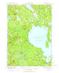
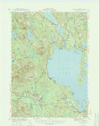
The Crooked River and Muddy River drain into the northern reaches of Sebago Lake in this 1942 survey of the Maine lakes region. The landscape is defined by the transition from water to high ground, with peaks like Douglas Mtn and Bald Pate Mtn overlooking the basin. The legendary Songo Lock is a central landmark, connecting the smaller water bodies to the main lake system.
Find a feature on this map
109 named features on this map. Tap any name to fly to it.
Don’t see what you’re looking for? This feature index may not catch every label — zoom into the map to look around manually.
Map Details
Editions of this 1942 Sebago Lake Map
3 editions found
Other maps of this area

1891 · Portland
USGS Topo · 1:62,500

1891 · Buxton
USGS Topo · 1:62,500

1891 · Newfield
USGS Topo · 1:62,500

1892 · Buxton
USGS Topo · 1:62,500

1893 · Portland
USGS Topo · 1:62,500

1893 · Buxton
USGS Topo · 1:62,500

1893 · Newfield
USGS Topo · 1:62,500

1894 · Gray
USGS Topo · 1:62,500

1896 · Norway
USGS Topo · 1:62,500

1896 · Sebago
USGS Topo · 1:62,500