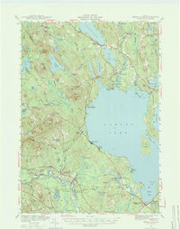
1942 Map of Sebago Lake
USGS Topo · Published 1973About this map
Sebago Lake dominates this 1942 landscape, serving as a hydraulic hub for the surrounding settlements and industry just before mid-century. The Maine Central railroad tracks skirt the southern edge of the water, connecting stops like East Baldwin Mattocks Sta and Steep Falls to the broader regional economy. Further north, the connection between Long Lake and the Bay of Naples is facilitated by the Songo River, where the legendary Songo Lock marks a critical point of navigation for timber and early recreational travel.
Find a feature on this map
120 named features on this map. Tap any name to fly to it.
Don’t see what you’re looking for? This feature index may not catch every label — zoom into the map to look around manually.
Map Details
Editions of this 1942 Sebago Lake Map
3 editions found

Other maps of this area

1891 · Portland
USGS Topo · 1:62,500

1891 · Buxton
USGS Topo · 1:62,500

1891 · Newfield
USGS Topo · 1:62,500

1892 · Buxton
USGS Topo · 1:62,500

1893 · Portland
USGS Topo · 1:62,500

1893 · Buxton
USGS Topo · 1:62,500

1893 · Newfield
USGS Topo · 1:62,500

1894 · Gray
USGS Topo · 1:62,500

1896 · Norway
USGS Topo · 1:62,500

1896 · Sebago
USGS Topo · 1:62,500