Old Maps of Westbrook, Maine for Academic Research
Study the evolution of Westbrook with 41 high-resolution historic maps. Whether you're teaching, researching, or modeling changes in land use, these maps provide essential visual documentation of urban, environmental, and geographic change.
- Analyze long-term change: Track patterns in development, transportation, and natural features.
- Ideal for environmental or urban studies: Support academic projects with primary historical map data.
- Use in the classroom or lab: Educators and researchers rely on these maps to bring historical context to life.
These maps are a powerful tool for teaching, research, and visualizing how Westbrook has changed over the decades.
Westbrook, ME maps
(41)- 1891 Map of Portland
 1891 Portland1891 Print · USGSCoastal Maine at the height of its rail-and-milling era shows the rapid development of the Portland suburbs and industrial waterfront. Genealogists can trace early homesteads and rail stops like Cape Elizabeth Depot, Saccarappa, and Prout's Neck.
 - 1893 Map of Portland
 1893 Portland1893 Print · USGSCumberland County at the close of the nineteenth century centers on the bustling rail hub of Portland and its surrounding mill towns. Researchers can trace the Victorian-era development of Saccarappa, the seaside sprawl of Old Orchard, and the river industry at Cumberland Mills.6 unique versions available
 - 1894 Map of Gray
 1894 Gray1894 Print · USGSMaine's Sebago Lake region at the close of the nineteenth century shows a network of mill towns and early rail lines. Trace family roots and vanished landmarks through New Gloucester, Sabbathday Lake, and the depots along the Maine Central R. R.
 - 1898 Map of Gray
 1898 Gray1898 Print · USGSIn the 1890s, this area of southern Maine was a landscape of evolving rail connections and traditional mill towns. Genealogists can trace family roots through settlements like New Gloucester and Cumberland Center, or locate early landmarks such as Webbs Mills and Sabbathday Lake.7 unique versions available
 - 1914 Map of Portland
 1914 Portland1914 Print · USGSCoastal Maine at the start of the twentieth century shows a landscape tied together by industrial rivers and an expanding network of electric railroads. Genealogists can locate family names at Hillside Cemetery or trace old rural schoolhouses like the Babb School and Beech Ridge School.
 - 1916 Map of Portland
 1916 Portland1916 Print · USGSGreater Portland and the Cumberland County coast are documented here during the height of the trolley and rail era. Researchers can trace ancestral property near the Evergreen Cemetery, early industries at Cumberland Mills, and vanished local sites like the State Reform School.7 unique versions available
 - 1916 Map of Portland And Vicinity
 1916 Portland And Vicinity1916 Print · USGSCoastal Maine at the start of the Great War reveals a landscape of heavy coastal fortifications and bustling rail terminals. Trace old neighborhood boundaries and family landmarks like Milliken Mills, Hillside Cemetery, and the Portland Head lighthouse.
 - 1918 Map of Portland And Vicinity, 1926 Print
 1918 Portland And Vicinity1926 Print · USGSCoastal Maine at the height of the Great War reveals a landscape of harbor forts, railroad junctions, and seaside settlements. Genealogists and historians can trace family roots through labels for Evergreen Cemetery, Spurwink Church, and dozens of rural schoolhouses like Babb School.
 - 1941 Map of Portland
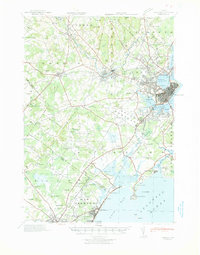 1941 Portland1941 Print · USGSCoastal Maine at the start of the 1940s reveals a bustling corridor of river mills and seaside settlements. Genealogists and historians can trace family roots through numerous local schools and landmarks like Cumberland Mills, Spurwink Ch, and Prouts Neck.
 - 1942 Map of Gray, 1956 Print
 1942 Gray1956 Print · USGSCumberland County’s interior landscape comes into focus during the early 1940s, revealing a network of rail-side stations and crossroads hamlets. Genealogists and historians can trace family locations near Suckerville, Purinton Cem, and the Friends Ch.
 - 1944 Map of Gray
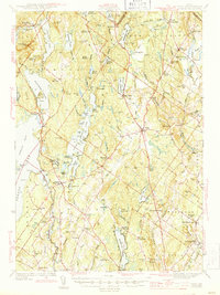 1944 Gray1944 Print · USGSCumberland County village life and the rail-and-water economy are captured here just after the war. You can trace the Maine Central line through several depots or locate historic family landmarks like Purinton Cem and the Opportunity Sch.3 unique versions available
 - 1944 Map of Gorham
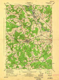 1944 Gorham1944 Print · USGSCumberland County during the mid-forties reveals a network of mill towns and crossroads communities linked by rail. Genealogists can trace family footprints near Hillside Cemetery or the State Normal School, while finding old rural routes through Newhall and South Gorham.
 - 1944 Map of Portland West, 1948 Print
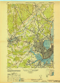 1944 Portland West1948 Print · USGSCoastal Maine during the mid-forties reveals a bustling network of rail yards and expanding neighborhoods west of the harbor. Researchers can trace the layout of the Portland Airport, find the historic Barker School, and locate vanished rail stops like West Falmouth Station.
 - 1948 Map of Portland West
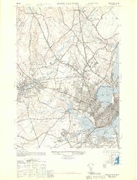 1948 Portland West1948 Print · USGSCoastal Maine during the late 1940s reveals a bustling intersection of rail and river industry between the city and its growing suburbs. Genealogists and historians can trace old neighborhoods like Woodfords or locate ancestors at Evergreen Cemetery and the State Reform School.
 - 1949 Map of Portland
 1949 Portland1949 Print · USGSCoastal Maine and the New Hampshire interior are shown in detail during the late forties, from the bustling harbors to the lakeside villages. Researchers can trace historical rail networks like the Boston & Maine RR and locate coastal defenses such as Fort Preble.3 unique versions available
 - 1950 Map of Gorham
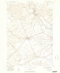 1950 Gorham1950 Print · USGSCumberland County at mid-century reveals a bustling network of river-powered mill towns and railroad corridors. Genealogists can locate family landmarks like Winship Corner, local institutions such as the State Normal Sch, and several rural burial sites including Browns Cem.2 unique versions available
 - 1956 Map of Portland West, 1958 Print
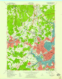 1956 Portland West1958 Print · USGSGreater Portland and Westbrook are seen here during the mid-century peak of their rail and river industries. Genealogists and historians can trace neighborhood growth through local schools like Longfellow Sch, industrial sites along the Fore River, and numerous burial grounds including Evergreen Cemetery.6 unique versions available
 - 1956 Map of Portland, 1963 Print
 1956 Portland1963 Print · USGSSouthern Maine and eastern New Hampshire are captured here in the mid-fifties, during a time of major highway expansion and military growth. You can trace the path of the Maine Turnpike and locate landmarks like the Portsmouth Naval Shipyard and Sebago Lake.4 unique versions available
 - 1957 Map of Gorham, 1958 Print
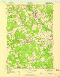 1957 Gorham1958 Print · USGSCumberland County in the late fifties shows a landscape of classic New England town centers and rural corners. Researchers can locate the State Teachers College, early schools like Whitney Sch, and family sites at Gag Corner or Fort Hill Cem.3 unique versions available
 - 1957 Map of Cumberland Center, 1959 Print
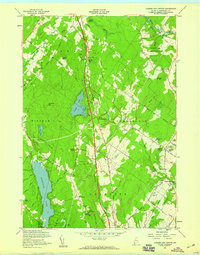 1957 Cumberland Center1959 Print · USGSCoastal Maine townships show their mid-century character as the new turnpike era begins to reshape the local geography. Genealogists and historians can trace family-named sites like Farris Cem, Dutton Hill, and the historic Greely Institute campus.4 unique versions available
 - 1957 Map of Gray, 1960 Print
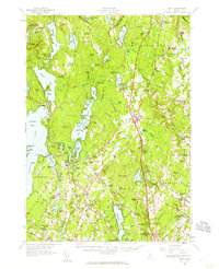 1957 Gray1960 Print · USGSCumberland County during the mid-fifties shows a landscape of established rail towns and growing turnpike access. Genealogists and historians can trace family locations near crossroads like Ireland Corner, find old schools such as Gloucester Hill School, and locate rural landmarks like Windham Plains Chapel.5 unique versions available
 - 1957 Map of Portland, 1960 Print
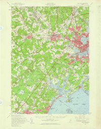 1957 Portland1960 Print · USGSCoastal Maine during the mid-fifties shows the transition from historic maritime centers to the suburban era. Researchers can trace family roots through numerous sites like Evergreen Cem, Thornton Academy, and the State Reformatory for Men.3 unique versions available
 - 1959 Map of Portland
 1959 Portland1959 Print · USGSThe Maine and New Hampshire coastlines meet in this mid-century portrait of maritime commerce and inland rail networks. Researchers can trace the legacy of coastal defense at Fort Williams and follow the historic path of the Maine Central RR through the White Mountain National Forest.2 unique versions available
 - 1963 Map of Portland
 1963 Portland1963 Print · USGSCoastal Maine and New Hampshire thrived as maritime and industrial hubs during the mid-sixties, linked by a dense network of rail and river. Researchers can trace historic transit corridors like the Maine Central RR and locate key sites such as the Portsmouth Naval Shipyard or Pease Air Force Base.3 unique versions available
 - 1975 Map of Gorham, 1979 Print
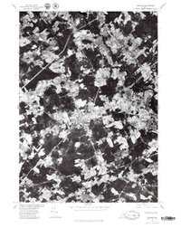 1975 Gorham1979 Print · USGSCumberland County communities are seen in transition during the mid-seventies as suburban patterns emerge among older farmsteads. Researchers can trace land use near Gorham and Westbrook or follow the courses of the Presumpscot River and Nonesuch River.
Showing maps 1-25 of 41
Top cities near Westbrook
- Portland historical maps
- South Portland historical maps
- Biddeford historical maps
- Scarborough historical maps
- Saco historical maps
- Windham historical maps
See more
Top neighborhoods of Westbrook
- Colonial Acres historical maps
- Highland Lake historical maps
- Frenchtown historical maps
- Prides Corner historical maps
- The Hamlet historical maps
- Cumberland Mills historical maps
Frequently asked questions
- What are the different types of historical maps available for Westbrook?
- What is the oldest map of Westbrook?
- Where can I purchase historical maps of Westbrook for my home or office?
- Where can I download high-res historical maps of Westbrook?
- Are there historical topographic maps available for Westbrook?
- Is there historical aerial imagery available for Westbrook?
- Where are historical maps of Westbrook sourced from?