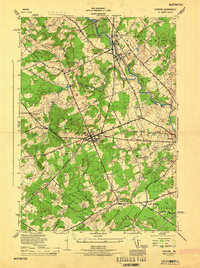
1944 Map of Gorham
USGS Topo · Published 1944About this map
Gorham and the Presumpscot River valley are shown here in the mid-1940s, highlighting a landscape defined by its transition from agricultural townships to regional hubs. The village centers of South Windham and Little Falls stand at significant crossings, where Mallison Falls once powered early industry. Education and civic life are anchored by the State Normal School in Gorham and several rural institutions such as the Whitney School and Longfellow School.
Find a feature on this map
66 named features on this map. Tap any name to fly to it.
Don’t see what you’re looking for? This feature index may not catch every label — zoom into the map to look around manually.
Map Details
Editions of this 1944 Gorham Map
This is the sole edition of this map. No revisions or reprints were ever made.
Other maps of this area

1891 · Portland
USGS Topo · 1:62,500

1891 · Buxton
USGS Topo · 1:62,500

1892 · Buxton
USGS Topo · 1:62,500

1893 · Portland
USGS Topo · 1:62,500

1893 · Buxton
USGS Topo · 1:62,500

1894 · Gray
USGS Topo · 1:62,500

1896 · Sebago
USGS Topo · 1:62,500

1898 · Gray
USGS Topo · 1:62,500

1914 · Portland
USGS Topo · 1:48,000

1916 · Portland
USGS Topo · 1:62,500