Old Maps of Beattie Township, Maine for Genealogy
Trace your family roots with 20 historic maps of Beattie Township. These high-res maps reveal old neighborhoods, homesites, landmarks, and streets — helping you uncover where your ancestors lived and how the area evolved over time.
- Explore historic neighborhoods: Identify where your relatives may have lived in the 1800s or 1900s.
- Compare maps over time: Trace the changes in streets, buildings, and landmarks for multi-generational research.
- Perfect for genealogy & ancestry research: Used by family historians and researchers to map out lineage and migration.
These maps are an incredible resource for exploring your personal connection to Beattie Township's past.
Beattie Township, ME maps
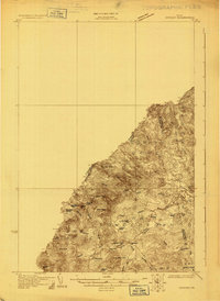
(20)- 1928 Map of Chain Lakes
 1928 Chain Lakes1928 Print · USGSCovers Beattie Township, including Frontenac, Saint-Augustin-de-Woburn, and other nearby areas
 - 1928 Map of Skinner
 1928 Skinner1928 Print · USGSCovers Beattie Township, including Frontenac, Saint-Robert-Bellarmin, and other nearby areas4 unique versions available
 - 1931 Map of Skinner
 1931 Skinner1931 Print · USGSCovers Beattie Township, including Frontenac, Saint-Robert-Bellarmin, and other nearby areas3 unique versions available
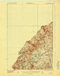
 - 1932 Map of Chain Lakes, 1961 Print
 1932 Chain Lakes1961 Print · USGSCovers Beattie Township, including Frontenac, Saint-Augustin-de-Woburn, and other nearby areas2 unique versions available
 - 1935 Map of Chain Lakes
 1935 Chain Lakes1935 Print · USGSCovers Beattie Township, including Frontenac, Saint-Augustin-de-Woburn, and other nearby areas4 unique versions available
 - 1949 Map of Jackman
 1949 Jackman1949 Print · USGSCovers Beattie Township, including Sherbrooke, Saint-Georges, and other nearby areas2 unique versions available
 - 1951 Map of Chain Lakes
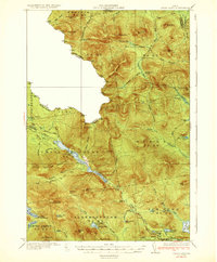
 1951 Chain Lakes1951 Print · USGSCovers Beattie Township, including Frontenac, Saint-Augustin-de-Woburn, and other nearby areas
 - 1963 Map of Jackman
 1963 Jackman1963 Print · USGSCovers Beattie Township, including Sherbrooke, Saint-Georges, and other nearby areas
 - 1966 Map of Sherbrooke
 1966 Sherbrooke1966 Print · USGSCovers Beattie Township, including Sherbrooke, Saint-Georges, and other nearby areas
 - 1970 Map of Merrill Mountain, 1973 Print
 1970 Merrill Mountain1973 Print · USGSCovers Beattie Township, including Frontenac, Saint-Augustin-de-Woburn, and other nearby areas
 - 1970 Map of Boundary Pond, 1973 Print
 1970 Boundary Pond1973 Print · USGSCovers Beattie Township, including Frontenac, Audet, and other nearby areas
 - 1976 Map of Sherbrooke
 1976 Sherbrooke1976 Print · USGSCovers Beattie Township, including Sherbrooke, Saint-Georges, and other nearby areas2 unique versions available
 - 1977 Map of Boundary Pond, 1983 Print
 1977 Boundary Pond1983 Print · USGSCovers Beattie Township, including Frontenac, Audet, and other nearby areas
 - 1977 Map of Merrill Mountain, 1983 Print
 1977 Merrill Mountain1983 Print · USGSCovers Beattie Township, including Frontenac, Saint-Augustin-de-Woburn, and other nearby areas
 - 1986 Map of Flagstaff Lake
 1986 Flagstaff Lake1986 Print · USGSCovers Beattie Township, including Frontenac, Rangeley, and other nearby areas
 - 1986 Map of Megantic
 1986 Megantic1986 Print · USGSCovers Beattie Township, including Saint-Georges, Lac-Mégantic, and other nearby areas
 - 1994 Map of Megantic
 1994 Megantic1994 Print · USGSCovers Beattie Township, including Saint-Georges, Lac-Mégantic, and other nearby areas
 - 1994 Map of Flagstaff Lake
 1994 Flagstaff Lake1994 Print · USGSCovers Beattie Township, including Frontenac, Rangeley, and other nearby areas
 - 2024 Map of Boundary Pond, 2024 Print
 2024 Boundary Pond2024 Print · USGSCovers Beattie Township, including Frontenac, Gorham Gore, and other nearby areas
 - 2024 Map of Merrill Mountain, 2024 Print
 2024 Merrill Mountain2024 Print · USGSCovers Beattie Township, including Frontenac, Saint-Augustin-de-Woburn, and other nearby areas
End of results
Showing maps 1-20 of 20
Top neighborhoods of Beattie Township
Frequently asked questions
- What are the different types of historical maps available for Beattie Township?
- What is the oldest map of Beattie Township?
- Where can I purchase historical maps of Beattie Township for my home or office?
- Where can I download high-res historical maps of Beattie Township?
- Are there historical topographic maps available for Beattie Township?
- Is there historical aerial imagery available for Beattie Township?
- Where are historical maps of Beattie Township sourced from?