1900s (20th Century) Maps of Mount Abram Township, Maine
Explore 27 historic maps of Mount Abram Township from the 1900s (20th Century). These maps offer a rare glimpse into what life looked like during the 1900s — showing old roads, neighborhoods, homes, and landmarks that have changed or disappeared over time.
Whether you're researching your family's past, planning a metal detecting trip, or studying how Mount Abram Township's landscape evolved across the 1900s, these high-resolution maps are a powerful tool for exploring the history of this region.
- Focus on a specific era: All maps on this page are from the 1900s, giving you a focused view of this time period.
- See what’s changed: Compare century-old streets, trails, and buildings to today's modern landscape using overlays and satellite layers.
- Research with precision: Use these maps for genealogy, historical research, land use analysis, or educational projects.
- View, download, or print: Maps are fully viewable online in high resolution, and can be downloaded or printed for your own records.
Start exploring Mount Abram Township's history through authentic maps from the 1900s. This is your window into the past.
Mount Abram Township, ME maps
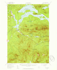
(27)- 1928 Map of Stratton
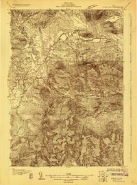 1928 Stratton1928 Print · USGSThe village of Flagstaff and the Dead River valley appear here in the late 1920s, just decades before the landscape was transformed by damming. You can trace the original valley settlements and landmarks like Morgan Farm, Cathedral Pines, and Morgan Camp.3 unique versions available
 - 1929 Map of Phillips
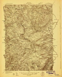 1929 Phillips1929 Print · USGSFranklin County in the late 1920s is captured here as a network of mountain hamlets and valley mills centered on the Phillips hub. Genealogists and historians can trace defunct schoolhouses like Butterfield Sch and old rail stops at Perham Junction or Madrid Junction.3 unique versions available
 - 1932 Map of Phillips
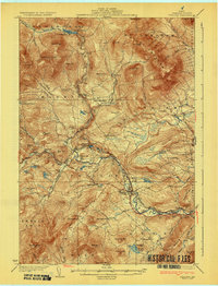 1932 Phillips1932 Print · USGSFranklin County's mountain-and-valley landscape is captured here in the late twenties, centered on the Sandy River rail corridor. Trace the path of the Rangeley Lakes and Berlin Mills RR past old schoolhouses like Cushman Sch and Avon Valley Sch.4 unique versions available
 - 1932 Map of Stratton
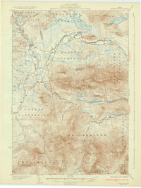 1932 Stratton1932 Print · USGSThe northern Maine woods in the late twenties and early thirties are captured here during a time of river-driven logging and remote plantation life. Local historians can trace the foundations of Eustis, the original layout of Flagstaff Pond, and rural schoolhouses like Browns Sch.3 unique versions available
 - 1949 Map of Jackman
 1949 Jackman1949 Print · USGSThe Quebec and Maine borderlands are shown in great detail during the late 1940s, highlighting the industrial and natural geography of the region. Trace old rail lines like the Canadian Pacific and locate settlements from Sherbrooke to Scotstown.2 unique versions available
 - 1950 Map of Lewiston
 1950 Lewiston1950 Print · USGSThe Maine and New Hampshire borderlands come alive in this post-war survey of the White Mountains and Androscoggin valley. Genealogists and historians can trace rail lines like the Maine Central Railroad and find high-altitude landmarks from Mount Washington to Bretton Woods.2 unique versions available
 - 1956 Map of Stratton, 1959 Print
 1956 Stratton1959 Print · USGSThe Franklin County highlands in the mid-1950s show a landscape defined by the expansion of Flagstaff Lake and the timber economy. Researchers can trace the Appalachian Trail over Bigelow Mountain or locate the Flagstaff Memorial Church and the Coplin School.3 unique versions available
 - 1956 Map of Lewiston, 1975 Print
 1956 Lewiston1975 Print · USGSThe Northern New England interior is documented here in the mid-fifties, from the industrial Androscoggin River to the high peaks of the White Mountains. Trace the Grand Trunk Railway through mountain passes or locate family landmarks near Sabbathday Lake and Bretton Woods.
 - 1961 Map of Lewiston
 1961 Lewiston1961 Print · USGSWestern Maine and the White Mountains appear here during the early sixties, showing the industrial river towns and vast timberlands before the modern interstate era. Genealogists and historians can trace the Grand Trunk RR through Berlin or locate landmarks like Old Speck Mountain and Elephant Mountain.
 - 1962 Map of Lewiston
 1962 Lewiston1962 Print · USGSThe industrial river valleys and high peaks of Maine and New Hampshire define the region in the early sixties. Trace the rail-and-river network from Lewiston to the White Mountains, passing through mill towns like Berlin and Rumford.
 - 1963 Map of Jackman
 1963 Jackman1963 Print · USGSThe international borderlands of Maine and Quebec come alive in the mid-twentieth century, showing a landscape of timber towns and rail connections. Genealogists and historians can trace the paths of the Canadian Pacific Railway through Jackman or locate families in Sherbrooke and Megantic.
 - 1966 Map of Sherbrooke
 1966 Sherbrooke1966 Print · USGSThe borderlands of Quebec and Maine come alive in the mid-1960s, documenting the industrial towns and deep woods of the Northeast. Genealogists can trace family lines through Sherbrooke and Coaticook, or locate remote logging outposts along the Moose River and Flagstaff Lake.
 - 1969 Map of Lewiston
 1969 Lewiston1969 Print · USGSThe northern New England highlands come into focus during the mid-fifties, showing the vital rail and river networks connecting industrial centers to the deep woods. Researchers can trace the path of the Grand Trunk RR or locate landmarks like Mt Washington and Rangeley Lake.
 - 1976 Map of Sherbrooke
 1976 Sherbrooke1976 Print · USGSThe northern Maine woods and Quebec’s Eastern Townships meet in this mid-century survey of the rugged international borderlands. Genealogists and historians can trace rail-and-river connections through Thetford Mines, follow the Dead River to Flagstaff Lake, or locate small border crossings at Stanhope and Beecher Falls.2 unique versions available
 - 1977 Map of Mount Abraham, 1983 Print
 1977 Mount Abraham1983 Print · USGSThe Franklin County highlands are captured in late autumn during the late seventies, showing the rugged timberlands of the western mountains. Trace the footprints of Salem and Barnjum or follow the paths of Rapid Stream and Quick Stream.
 - 1977 Map of Redington, 1983 Print
 1977 Redington1983 Print · USGSDeep in the Maine woods during the late 1970s, this aerial study shows the timberlands and remote settlements of Franklin County. Trace the forest clearings and road networks near Redington, Perham Junction, and the waters of Orbeton Stream.
 - 1977 Map of Black Nubble, 1983 Print
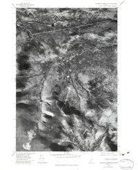
 1977 Black Nubble1983 Print · USGSFranklin County's wilderness is captured in the late seventies through this detailed aerial orthophotoquad. Researchers can trace the path of Nash Stream and examine the timbered slopes around Crocker Mountain and Black Nubble.
 - 1977 Map of Sugarloaf Mtn, 1983 Print
 1977 Sugarloaf Mtn1983 Print · USGSFranklin County's high peaks and ski slopes are captured in the late seventies through this detailed aerial orthophotograph. Trace the development of Sugarloaf Mountain and the winding course of the South Branch Carrabassett River.2 unique versions available
 - 1984 Map of Redington, 1985 Print
 1984 Redington1985 Print · USGSFranklin County's high ridges and timber valleys are captured in the early 1980s, showcasing the intersection of wilderness recreation and industrial history. Researchers can trace the Old RR Grade along Orbeton Stream and locate small settlements like Perham Junction or East Madrid.2 unique versions available
 - 1984 Map of Mount Abraham, 1985 Print
 1984 Mount Abraham1985 Print · USGSFranklin County's high ridges and river valleys are captured in the mid-eighties as timber and recreation shaped the local economy. Researchers can trace the Old RR Grade near Salem or follow the Appalachian National Scenic Trail over Spalding Mtn.2 unique versions available
 - 1986 Map of Flagstaff Lake
 1986 Flagstaff Lake1986 Print · USGSThe Maine North Woods and the Dead River valley are captured here in the mid-1980s, an era of established hydroelectric lakes and outdoor recreation. Genealogists and researchers can trace the vicinity of Kennebago Settlement, Langtown Mill, and the villages of Stratton and Eustis.
 - 1986 Map of Rumford
 1986 Rumford1986 Print · USGSWestern Maine in the mid-eighties shows a rugged landscape of industrial river towns and high-country timber plantations. Trace the rail-and-river economy through Rumford, Dixfield, and the Maine Central RR or locate the historic campus of Farmington State College.
 - 1989 Map of Black Nubble
 1989 Black Nubble1989 Print · USGSHigh-altitude Franklin County terrain and military history intersect in the late 1980s. Trace the boundaries of the US Navy Survival Facility and local peaks like Black Nubble and Mount Redington.2 unique versions available
 - 1989 Map of Sugarloaf Mtn
 1989 Sugarloaf Mtn1989 Print · USGSFranklin County's high peaks and the Carrabassett Valley are documented here during the late 1980s. Hikers and historians can trace the Appalachian National Scenic Trail past Sugarloaf Mtn and the remote Caribou Pond.2 unique versions available
 - 1994 Map of Rumford
 1994 Rumford1994 Print · USGSWestern Maine's mountains and glacial lakes are shown here in the mid-1990s, from the peaks of the Mahoosuc Range to the banks of the Androscoggin River. Trace the Maine Central RR through Dixfield or locate lakeside settlements like Oquossoc.
Showing maps 1-25 of 27
Top cities near Mount Abram Township
- Farmington historical maps
- Strong historical maps
- Kingfield historical maps
- Phillips historical maps
- Industry historical maps
- New Portland historical maps
See more
Top neighborhoods of Mount Abram Township
Frequently asked questions
- What are the different types of historical maps available for Mount Abram Township?
- What is the oldest map of Mount Abram Township?
- Where can I purchase historical maps of Mount Abram Township for my home or office?
- Where can I download high-res historical maps of Mount Abram Township?
- Are there historical topographic maps available for Mount Abram Township?
- Is there historical aerial imagery available for Mount Abram Township?
- Where are historical maps of Mount Abram Township sourced from?