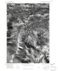
1977 Map of Sugarloaf Mtn
USGS Topo · Published 1983About this map
Sugarloaf Mountain dominates this orthophotoquad, which uses rectified aerial imagery to document the high-elevation terrain of Franklin County in the late 1970s. The visual data reveals the distinct development of ski trails carved into the mountainside, contrasting sharply with the surrounding dense forest cover. Flowing through the valley, the South Branch Carrabassett River provides a natural corridor beneath the peaks of Spaulding Mountain and Burnt Hill. This perspective also documents the northern water features, such as Stratton Brook Pond, near the mountain known as Bigelow. Unlike traditional topographic maps, this imagery records the exact density of vegetation and the precise footprint of human activity on the slopes at a time of significant winter recreation growth.
Find a feature on this map
6 named features on this map. Tap any name to fly to it.
Don’t see what you’re looking for? This feature index may not catch every label — zoom into the map to look around manually.
Map Details
Editions of this 1977 Sugarloaf Mtn Map
2 editions found
Other maps of this area

1928 · Dead River
USGS Topo · 1:62,500

1928 · Stratton
USGS Topo · 1:48,000

1929 · Phillips
USGS Topo · 1:48,000

1930 · Kingfield
USGS Topo · 1:48,000

1931 · Dead River
USGS Topo · 1:48,000

1932 · Phillips
USGS Topo · 1:62,500

1932 · Stratton
USGS Topo · 1:62,500

1932 · Kingfield
USGS Topo · 1:62,500

1944 · Dead River
USGS Topo · 1:62,500

1949 · Jackman
USGS Topo · 1:250,000
Featured Places
- Kingfield, ME
- Carrabassett Valley, ME
- Wyman Township, ME
- Dead River Township, ME
- Mount Abram Township, ME