Old Maps of Mingo Springs, Rangeley for Hiking & Exploration
Hike through history with 18 historic maps of Mingo Springs. Explore old trails, ghost towns, and forgotten backroads — perfect for outdoor adventurers and local explorers.
- Rediscover forgotten places: Map out old mining camps, roads, and footpaths that no longer exist on modern maps.
- Layer with modern tools: Combine with LiDAR or satellite views to plan hikes through historical terrain.
- Made for exploration: Popular among hikers, overlanders, and local history lovers.
Use these maps to find adventure and explore the hidden past of Mingo Springs.
Mingo Springs, Rangeley maps
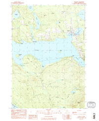
(18)- 1933 Map of Rangeley
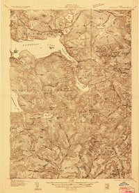 1933 Rangeley1933 Print · USGSThe Rangeley Lakes region is shown here in the early 1930s, capturing a landscape of timber townships and mountain peaks. Genealogists and historians can locate rural schoolhouses like the Lakeside School, the Dallas station railroad stop, and the abandoned Flagg Dam.2 unique versions available
 - 1939 Map of Rangeley
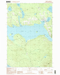
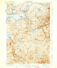 1939 Rangeley1939 Print · USGSRangeley and the surrounding Maine high country are shown here in the years before the Second World War. Researchers can trace the original path of the Appalachian Trail past Saddleback Mtn and locate old rural landmarks like Lakeside Sch.5 unique versions available
 - 1949 Map of Rangeley, 1955 Print
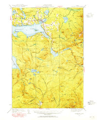 1949 Rangeley1955 Print · USGSThe western Maine highlands come into focus in the late 1940s, showcasing the region's transition into a premier recreation destination. Track the Appalachian Trail as it crosses peaks like Saddleback Mtn and Bemis Mtn, or locate the Airport and landmarks around Rangeley Lake.4 unique versions available
 - 1950 Map of Lewiston
 1950 Lewiston1950 Print · USGSThe Maine and New Hampshire borderlands come alive in this post-war survey of the White Mountains and Androscoggin valley. Genealogists and historians can trace rail lines like the Maine Central Railroad and find high-altitude landmarks from Mount Washington to Bretton Woods.2 unique versions available
 - 1956 Map of Lewiston, 1975 Print
 1956 Lewiston1975 Print · USGSThe Northern New England interior is documented here in the mid-fifties, from the industrial Androscoggin River to the high peaks of the White Mountains. Trace the Grand Trunk Railway through mountain passes or locate family landmarks near Sabbathday Lake and Bretton Woods.
 - 1961 Map of Lewiston
 1961 Lewiston1961 Print · USGSWestern Maine and the White Mountains appear here during the early sixties, showing the industrial river towns and vast timberlands before the modern interstate era. Genealogists and historians can trace the Grand Trunk RR through Berlin or locate landmarks like Old Speck Mountain and Elephant Mountain.
 - 1962 Map of Lewiston
 1962 Lewiston1962 Print · USGSThe industrial river valleys and high peaks of Maine and New Hampshire define the region in the early sixties. Trace the rail-and-river network from Lewiston to the White Mountains, passing through mill towns like Berlin and Rumford.
 - 1969 Map of Lewiston
 1969 Lewiston1969 Print · USGSThe northern New England highlands come into focus during the mid-fifties, showing the vital rail and river networks connecting industrial centers to the deep woods. Researchers can trace the path of the Grand Trunk RR or locate landmarks like Mt Washington and Rangeley Lake.
 - 1977 Map of Rangeley, 1983 Print
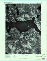 1977 Rangeley1983 Print · USGSRangeley and its famous lakes are captured in high-resolution aerial detail during the late seventies. Researchers can trace the shoreline developments of Rangeley Lake or locate specific buildings and clearings in Mingo Springs and Rangeley.
 - 1984 Map of Rangeley, 1985 Print
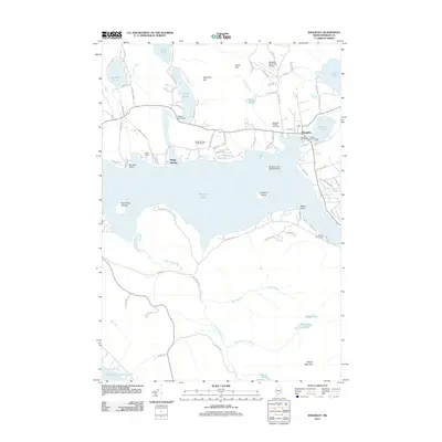
 1984 Rangeley1985 Print · USGSThe Rangeley Lakes region in the early eighties is captured here as a premier outdoor destination centered on the expansive Rangeley Lake. Researchers can locate lakeside landmarks like Mingo Springs, the local Cem, and the Rangeley Municipal Airport.
 - 1986 Map of Rumford
 1986 Rumford1986 Print · USGSWestern Maine in the mid-eighties shows a rugged landscape of industrial river towns and high-country timber plantations. Trace the rail-and-river economy through Rumford, Dixfield, and the Maine Central RR or locate the historic campus of Farmington State College.
 - 1994 Map of Rumford
 1994 Rumford1994 Print · USGSWestern Maine's mountains and glacial lakes are shown here in the mid-1990s, from the peaks of the Mahoosuc Range to the banks of the Androscoggin River. Trace the Maine Central RR through Dixfield or locate lakeside settlements like Oquossoc.
 - 1997 Map of Rangeley, 1999 Print
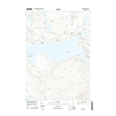
 1997 Rangeley1999 Print · USGSRangeley and its surrounding plantations are captured in the late 1990s as the lakeside community continued its growth. Genealogists and researchers can trace local landmarks from Mingo Springs to the town Cem and the borders of Rangeley Lake State Park.
 - 2011 Map of Rangeley, 2011 Print
 2011 Rangeley2011 Print · USGSCovers Mingo Springs, including Rangeley, Dallas Plantation, and other nearby areas
 - 2014 Map of Rangeley, 2014 Print
 2014 Rangeley2014 Print · USGSCovers Mingo Springs, including Rangeley, Dallas Plantation, and other nearby areas
 - 2018 Map of Rangeley, 2018 Print
 2018 Rangeley2018 Print · USGSCovers Mingo Springs, including Rangeley, Dallas Plantation, and other nearby areas
 - 2021 Map of Rangeley, 2021 Print
 2021 Rangeley2021 Print · USGSCovers Mingo Springs, including Rangeley, Dallas Plantation, and other nearby areas
 - 2024 Map of Rangeley, 2024 Print
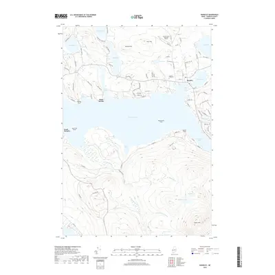
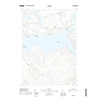
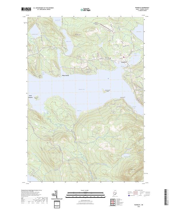 2024 Rangeley2024 Print · USGSRangeley and its famous lakes are captured here in the early twenty-first century, showing the community's modern layout and surrounding peaks. Genealogists and researchers can locate the Rangeley Village Cem or trace shorelines at Mingo Springs and Bonney Point.
End of results
Showing maps 1-18 of 18
Frequently asked questions
- What are the different types of historical maps available for Mingo Springs?
- What is the oldest map of Mingo Springs?
- Where can I purchase historical maps of Mingo Springs for my home or office?
- Where can I download high-res historical maps of Mingo Springs?
- Are there historical topographic maps available for Mingo Springs?
- Is there historical aerial imagery available for Mingo Springs?
- Where are historical maps of Mingo Springs sourced from?