2020s Maps of Oqiton Township, Maine
Explore 10 historic maps of Oqiton Township from the 2020s. These maps offer a rare glimpse into what life looked like during the 2020s — showing old roads, neighborhoods, homes, and landmarks that have changed or disappeared over time.
Whether you're researching your family's past, planning a metal detecting trip, or studying how Oqiton Township's landscape evolved across the 2020s, these high-resolution maps are a powerful tool for exploring the history of this region.
- Focus on a specific era: All maps on this page are from the 2020s, giving you a focused view of this time period.
- See what’s changed: Compare century-old streets, trails, and buildings to today's modern landscape using overlays and satellite layers.
- Research with precision: Use these maps for genealogy, historical research, land use analysis, or educational projects.
- View, download, or print: Maps are fully viewable online in high resolution, and can be downloaded or printed for your own records.
Start exploring Oqiton Township's history through authentic maps from the 2020s. This is your window into the past.
Oqiton Township, ME maps
(10)- 2021 Map of West Lake, 2021 Print
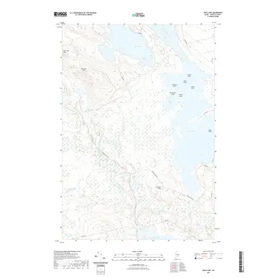 2021 West Lake2021 Print · USGSCovers Oqiton Township, including Great Pond, T35 MD BPP, and other nearby areas
 - 2021 Map of Spring Lake, 2021 Print
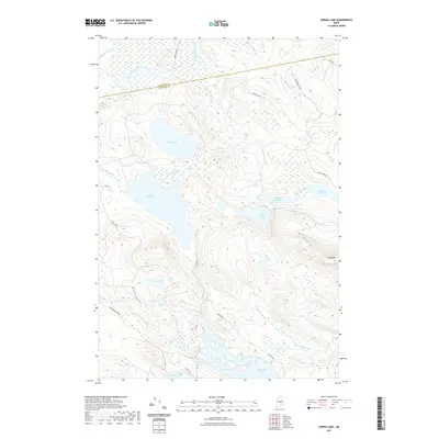 2021 Spring Lake2021 Print · USGSCovers Oqiton Township, including Lakeville, Twombly Ridge, and other nearby areas
 - 2021 Map of Gassabias Lake, 2021 Print
 2021 Gassabias Lake2021 Print · USGSCovers Oqiton Township, including T42 MD BPP, T36 MD BPP, and other nearby areas
 - 2021 Map of Duck Lake, 2021 Print
 2021 Duck Lake2021 Print · USGSCovers Oqiton Township, including Lakeville, T42 MD BPP, and other nearby areas
 - 2021 Map of Bottle Lake, 2021 Print
 2021 Bottle Lake2021 Print · USGSCovers Oqiton Township, including Springfield, Carroll Plantation, and other nearby areas
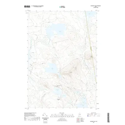
 - 2024 Map of Gassabias Lake, 2024 Print
 2024 Gassabias Lake2024 Print · USGSMaine’s working forest and northern lakes are captured here in the early twenty-first century along the Hancock and Washington county lines. Trace old timber routes like Stud Mill Rd and explore the shorelines of Gassabias Lake and Upper Sabao Lake.
 - 2024 Map of Bottle Lake, 2024 Print
 2024 Bottle Lake2024 Print · USGSThe interconnected lakes of eastern Maine are shown in fine detail in this modern survey, highlighting the rugged terrain of Penobscot County. Researchers can locate family landmarks and early industry sites like South Springfield, Mill Privilege Lake, and Almanac Mtn.
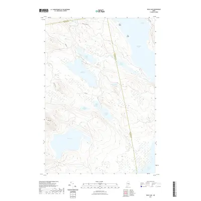
 - 2024 Map of West Lake, 2024 Print
 2024 West Lake2024 Print · USGSThe interior woodlands and waters of Hancock County are shown in this recent survey. Local researchers can trace the shorelines of Nicatous Lake and West Lake or locate remote landmarks like Morrison Ridge and Loon Pond.
 - 2024 Map of Spring Lake, 2024 Print
 2024 Spring Lake2024 Print · USGSEastern Maine's lake country is captured here during the 2020s, showing the intricate water system along the Hancock and Penobscot county line. Researchers can trace the drainage of Spring Lake through Pistol Stream and locate remote landmarks like Duck Mtn or Trueworthy Pond.
 - 2024 Map of Duck Lake, 2024 Print
 2024 Duck Lake2024 Print · USGSMaine's interior lake country is captured in the early twenty-first century as a network of interconnected waterways. Researchers can trace the timber and access roads between Upper Chain Lake, the multi-basin Unknown Lakes, and Duck Lake.
End of results
Showing maps 1-10 of 10
Top cities near Oqiton Township
- Lee historical maps
- Winn historical maps
- Burlington historical maps
- Springfield historical maps
- Carroll Plantation historical maps
- Lakeville historical maps
See more
Frequently asked questions
- What are the different types of historical maps available for Oqiton Township?
- What is the oldest map of Oqiton Township?
- Where can I purchase historical maps of Oqiton Township for my home or office?
- Where can I download high-res historical maps of Oqiton Township?
- Are there historical topographic maps available for Oqiton Township?
- Is there historical aerial imagery available for Oqiton Township?
- Where are historical maps of Oqiton Township sourced from?