Old Maps of Winter Harbor, Maine for Hiking & Exploration
Hike through history with 42 historic maps of Winter Harbor. Explore old trails, ghost towns, and forgotten backroads — perfect for outdoor adventurers and local explorers.
- Rediscover forgotten places: Map out old mining camps, roads, and footpaths that no longer exist on modern maps.
- Layer with modern tools: Combine with LiDAR or satellite views to plan hikes through historical terrain.
- Made for exploration: Popular among hikers, overlanders, and local history lovers.
Use these maps to find adventure and explore the hidden past of Winter Harbor.
Winter Harbor, ME maps
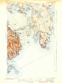
(42)- 1904 Map of Bar Harbor
 1904 Bar Harbor1904 Print · USGSThe granite coast of Maine appears at the height of its maritime era, with a dense network of steamboat routes and ferry crossings. Genealogists and historians can trace the early layout of Bar Harbor, the rail terminus at Mount Desert Ferry, and the fishing outposts of Islesford and Sorrento.6 unique versions available
 - 1904 Map of Petit Manan
 1904 Petit Manan1904 Print · USGSThe rugged coastline of Washington and Hancock Counties comes alive in this early-century survey. Trace maritime history through the Steamboat Route and local landmarks like Corea, the Petit Manan I. L.H., and Bois Bubert Island.4 unique versions available
 - 1942 Map of Bar Harbor
 1942 Bar Harbor1942 Print · USGSMount Desert Island and the Schoodic Peninsula are shown just before the war in this detailed coastal survey. Genealogists and historians can trace the foundations of Bar Harbor, locate the village of Islesford, and explore landmarks like Chicken Mill Pond.4 unique versions available
 - 1948 Map of Bangor
 1948 Bangor1948 Print · USGSThe Maine coast and its industrial river valleys are captured here shortly after the war, showing the vital shipping and rail hubs of the late 1940s. Genealogists and historians can trace the tracks of the Maine Central RR connecting Bangor, Augusta, and Old Town.
 - 1950 Map of Petit Manan
 1950 Petit Manan1950 Print · USGSCoastal Washington and Hancock counties are seen here at mid-century, defined by lobster harbors and the shifting tides of the Atlantic. Researchers can trace family names and local landmarks from Corea to Dyer Harbor, including the Corea Cem and Long Mill Cove.
 - 1956 Map of Bar Harbor, 1960 Print
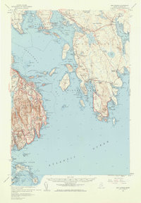 1956 Bar Harbor1960 Print · USGSThe Maine coast in the mid-1950s reveals a landscape defined by seafaring villages and the protected peaks of Acadia National Park. Genealogists and historians can trace coastal life from the streets of Bar Harbor to remote island settlements like Islesford and Gerrishville.3 unique versions available
 - 1956 Map of Bangor, 1966 Print
 1956 Bangor1966 Print · USGSMid-century Maine comes alive in this survey of the rugged coast and river valleys during the 1950s. Genealogists and historians can trace the vital rail corridors of the Maine Central RR connecting timber towns like Old Town to the coast at Bar Harbor.3 unique versions available
 - 1960 Map of Bangor
 1960 Bangor1960 Print · USGSCentral Maine in the sixties reveals a landscape of river-powered industry and sprawling coastal island chains. Researchers can trace the rail corridors of the Maine Central or locate mid-century aviation landmarks like Dow Air Force Base.
 - 1961 Map of Bangor
 1961 Bangor1961 Print · USGSMid-century Maine comes alive through its busy river ports and rocky archipelagoes during a period of steady maritime and rail commerce. Researchers can trace the path of the Maine Central railroad and locate coastal landmarks from Acadia National Park to Vinalhaven Island.
 - 1961 Map of Eastport
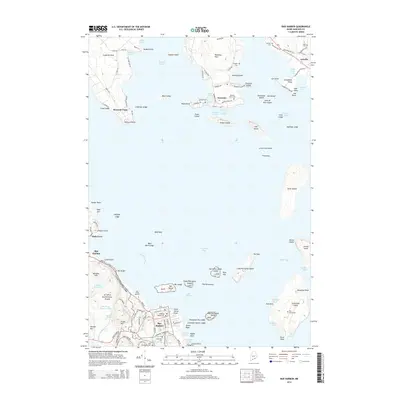
 1961 Eastport1961 Print · USGSThe maritime borderlands of Maine and New Brunswick are captured here in the early sixties, showing a world defined by the Bay of Fundy. Researchers can trace the Maine Central Railroad to Machiasport or explore remote island villages like Grand Harbour and Welchpool.
 - 1969 Map of Eastport
 1969 Eastport1969 Print · USGSThe maritime borderlands of Washington County and New Brunswick appear in detail during the late sixties. Researchers can trace historic rail lines like the Maine Central Railroad and explore coastal settlements from Machias to St. Andrews.
 - 1976 Map of Eastport
 1976 Eastport1976 Print · USGSThe maritime borderlands of Maine and Nova Scotia come alive in this mid-seventies survey of the Downeast coast. Genealogists and historians can trace the shoreline settlements of Eastport, Lubec, and Machias, or cross the channel to find Acadian villages like Church Point and Meteghan Centre.
 - 1982 Map of Bar Harbor, 1983 Print
 1982 Bar Harbor1983 Print · USGSCoastal Maine in the early eighties reveals a bustling maritime landscape centered on the Bar Harbor waterfront and the protected lands of Acadia National Park. Genealogists and historians can trace local landmarks like the Holy Redeemer Ch, the Bragdon Cem, and the old Sorrento Sch.2 unique versions available
 - 1983 Map of Seal Harbor
 1983 Seal Harbor1983 Print · USGSMount Desert Island's rugged coast is documented in the early 1980s, from the summit of Cadillac Mountain to the outlying Cranberry Isles. Trace island life and history at Islesford, the Lighthouse at Egg Rock, and the seasonal hub of Seal Harbor.2 unique versions available
 - 1984 Map of Winter Harbor, 1985 Print
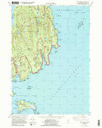
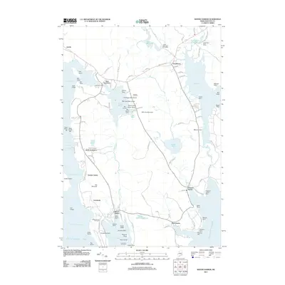
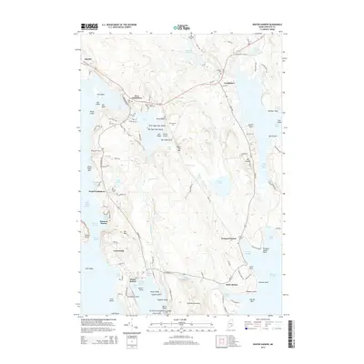
 1984 Winter Harbor1985 Print · USGSCoastal Hancock County at the mid-eighties shows a landscape of fishing villages and early conservation efforts. Researchers can locate family landmarks like Taft Cem, the historic Gouldsboro Sch, and the Prospect Harbor Point Lighthouse.2 unique versions available
 - 1984 Map of Schoodic Head, 1985 Print
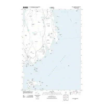
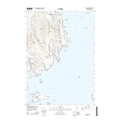
 1984 Schoodic Head1985 Print · USGSThe Schoodic Peninsula in the 1980s reveals a rugged coastal landscape where federal conservation and military presence met. Researchers can trace the granite ridges of Schoodic Head and locate historic maritime markers like Winter Harbor Light and the U S Naval Res.
 - 1985 Map of Bar Harbor
 1985 Bar Harbor1985 Print · USGSCoastal Hancock County in the mid-eighties shows an intricate landscape of island communities and protected wilderness. Trace the boundaries of Acadia National Park or locate seafaring hubs like Stonington and Bar Harbor.2 unique versions available
 - 1986 Map of Petit Manan Point
 1986 Petit Manan Point1986 Print · USGSThe Downeast Maine coastline in the mid-eighties was a complex landscape of harbors and island chains. Genealogists and historians can trace coastal settlements and maritime landmarks like the Lighthouse on Petit Manan Point and the islands of Mistake Harbor.2 unique versions available
 - 2011 Map of Winter Harbor, 2011 Print
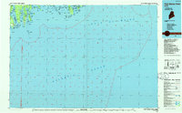
 2011 Winter Harbor2011 Print · USGSCovers Winter Harbor, including Gouldsboro, Sullivan, and other nearby areas
 - 2011 Map of Seal Harbor, 2011 Print
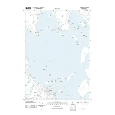
 2011 Seal Harbor2011 Print · USGSCovers Winter Harbor, including Bar Harbor, Mount Desert, and other nearby areas
 - 2011 Map of Schoodic Head, 2011 Print
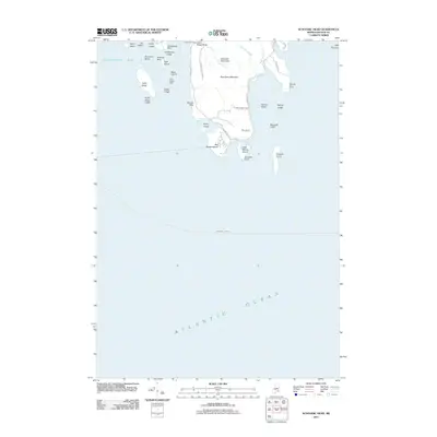 2011 Schoodic Head2011 Print · USGSCovers Winter Harbor, including Gouldsboro, Cranberry Isles, and other nearby areas
 - 2011 Map of Bar Harbor, 2011 Print
 2011 Bar Harbor2011 Print · USGSCovers Winter Harbor, including Bar Harbor, Hancock, and other nearby areas
 - 2014 Map of Winter Harbor, 2014 Print
 2014 Winter Harbor2014 Print · USGSCovers Winter Harbor, including Gouldsboro, Sullivan, and other nearby areas
 - 2014 Map of Bar Harbor, 2014 Print
 2014 Bar Harbor2014 Print · USGSCovers Winter Harbor, including Bar Harbor, Hancock, and other nearby areas
 - 2014 Map of Seal Harbor, 2014 Print
 2014 Seal Harbor2014 Print · USGSCovers Winter Harbor, including Bar Harbor, Mount Desert, and other nearby areas
Showing maps 1-25 of 42
Top cities near Winter Harbor
- Bar Harbor historical maps
- Hancock historical maps
- Mount Desert historical maps
- Southwest Harbor historical maps
- Lamoine historical maps
- Gouldsboro historical maps
See more
Top neighborhoods of Winter Harbor
Frequently asked questions
- What are the different types of historical maps available for Winter Harbor?
- What is the oldest map of Winter Harbor?
- Where can I purchase historical maps of Winter Harbor for my home or office?
- Where can I download high-res historical maps of Winter Harbor?
- Are there historical topographic maps available for Winter Harbor?
- Is there historical aerial imagery available for Winter Harbor?
- Where are historical maps of Winter Harbor sourced from?