Old Maps of Camden, Maine for Academic Research
Study the evolution of Camden with 38 high-resolution historic maps. Whether you're teaching, researching, or modeling changes in land use, these maps provide essential visual documentation of urban, environmental, and geographic change.
- Analyze long-term change: Track patterns in development, transportation, and natural features.
- Ideal for environmental or urban studies: Support academic projects with primary historical map data.
- Use in the classroom or lab: Educators and researchers rely on these maps to bring historical context to life.
These maps are a powerful tool for teaching, research, and visualizing how Camden has changed over the decades.
Camden, ME maps
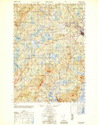
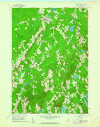
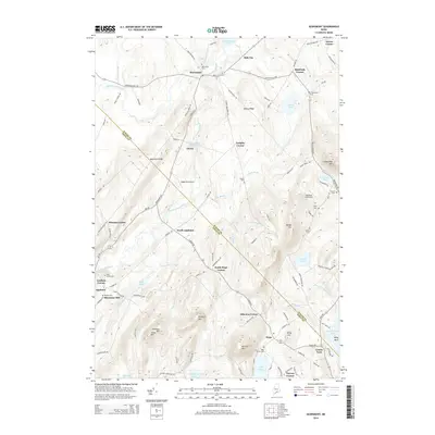
(38)- 1904 Map of Rockland, 1961 Print
 1904 Rockland1961 Print · USGSCoastal Knox County comes alive in this early twentieth-century survey of the harbor towns and the rocky Penobscot Bay shoreline. Trace the routes of the Maine Central RR and ELECTRIC lines to historic settlements like Blackinton Corners and Sharkeyville.
 - 1906 Map of Rockland
 1906 Rockland1906 Print · USGSCoastal Knox County comes alive in the first decade of the century, showing a bustling network of harbors and early transit systems. Genealogists and historians can trace family roots through crossroads like Blackinton Corners or investigate the old Wattons Mill and the Electric RR lines.7 unique versions available
 - 1915 Map of Belfast, 1962 Print
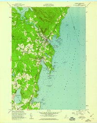
 1915 Belfast1962 Print · USGSMid-coast Maine at the start of the twentieth century shows a landscape of busy harbor towns and high-altitude farms. Genealogists can trace family names across dozens of rural landmarks, from Holmes Mill and Simpsons Corner to the numerous remote schoolhouses like Bartlett School.
 - 1917 Map of Belfast
 1917 Belfast1917 Print · USGSCoastal Waldo County hummed with maritime trade and small-scale milling during the years before the Great War. Researchers can trace ancestral property near Head of the Tide, locate district schoolhouses like Woods School, or follow the Maine Central Railroad into Belfast.6 unique versions available
 - 1941 Map of Belfast
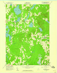
 1941 Belfast1941 Print · USGSCoastal Waldo County at the start of the 1940s reveals a landscape of tidal rivers and bustling rural crossroads. Genealogists and historians can trace family locations through numerous landmarks like Allens Hall, Holmes Mill, and the Belfast & Moosehead Lake RR corridor.
 - 1941 Map of Rockland
 1941 Rockland1941 Print · USGSThe Knox County shoreline during the early 1940s features a detailed look at maritime life and coastal industry. Genealogists and historians can trace the foundations of Rockland, locate the Rockland Breakwater Lighthouse, and explore villages like South Thomaston and Wattons Mill.
 - 1948 Map of Bangor
 1948 Bangor1948 Print · USGSThe Maine coast and its industrial river valleys are captured here shortly after the war, showing the vital shipping and rail hubs of the late 1940s. Genealogists and historians can trace the tracks of the Maine Central RR connecting Bangor, Augusta, and Old Town.
 - 1950 Map of Belfast
 1950 Belfast1950 Print · USGSMid-century Waldo County comes to life as a network of crossroads hamlets and coastal industry before the modern highway era. Genealogists can trace family names across schoolhouses like Apple Sch and rural intersections such as Hayford Corner and Vickerys Corner.
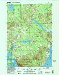
 - 1955 Map of West Rockport, 1959 Print
 1955 West Rockport1959 Print · USGSMidcoast Maine in the mid-fifties reveals a landscape of high granite peaks and working waterpower sites across Knox County. Genealogists can locate family burial grounds and landmarks like Goulds Hospital, Wattons Mill, and East Union.5 unique versions available
 - 1955 Map of Camden, 1959 Print
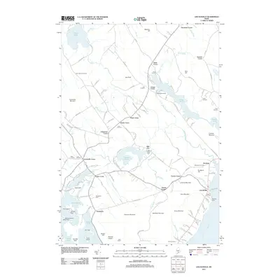
 1955 Camden1959 Print · USGSCoastal Maine centers on the busy harbors of the mid-1950s, showing the early expansion of coastal villages into the surrounding hills. Genealogists and historians can trace family plots in Oak Hill Cem or locate the old Fish Hatchery and Drive-in Theater.5 unique versions available
 - 1956 Map of Bangor, 1966 Print
 1956 Bangor1966 Print · USGSMid-century Maine comes alive in this survey of the rugged coast and river valleys during the 1950s. Genealogists and historians can trace the vital rail corridors of the Maine Central RR connecting timber towns like Old Town to the coast at Bar Harbor.3 unique versions available
 - 1960 Map of Bangor
 1960 Bangor1960 Print · USGSCentral Maine in the sixties reveals a landscape of river-powered industry and sprawling coastal island chains. Researchers can trace the rail corridors of the Maine Central or locate mid-century aviation landmarks like Dow Air Force Base.
 - 1960 Map of Lincolnville, 1962 Print
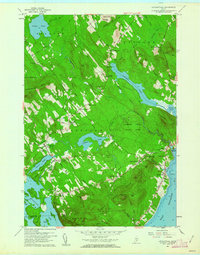 1960 Lincolnville1962 Print · USGSThe mid-coast Waldo County shoreline and hills appear here just as the post-war era transitioned into the 1960s. Genealogists and local historians can trace family locations through numerous rural corners and burial sites like Grange Corner, Slab City, and the South Belmont Cem.3 unique versions available
 - 1960 Map of Searsmont, 1962 Print
 1960 Searsmont1962 Print · USGSCoastal Maine’s rural interior is captured here in the early sixties as a network of crossroad hamlets and ridges. Family historians can trace ancestral sites at Gushees Corner, Slab City, and numerous burial grounds like Oak Grove Cem.4 unique versions available
 - 1961 Map of Bangor
 1961 Bangor1961 Print · USGSMid-century Maine comes alive through its busy river ports and rocky archipelagoes during a period of steady maritime and rail commerce. Researchers can trace the path of the Maine Central railroad and locate coastal landmarks from Acadia National Park to Vinalhaven Island.
 - 1984 Map of Augusta
 1984 Augusta1984 Print · USGSMid-coast and central Maine were undergoing steady change in the mid-eighties as traditional river and coastal industries met expanding recreation. You can trace the Maine Central RR through Augusta or explore the rugged shoreline from Rockland Harbor up to Mount Megunticook.
 - 2000 Map of Camden, 2001 Print
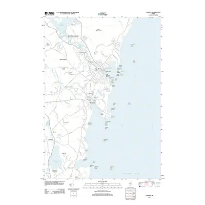
 2000 Camden2001 Print · USGSThe Maine coast near Camden and Rockport is shown here at the start of the new millennium, balancing deep-water harbors with high granite peaks. Researchers can locate family plots at Oak Hill Cem or trace the early paths of the Spring Brook Trail and Mount Battie observatory.
 - 2000 Map of Lincolnville, 2001 Print
 2000 Lincolnville2001 Print · USGSMid-coast Maine at the turn of the millennium retains its traditional network of crossroads settlements and coastal landmarks. Genealogists can locate family burial grounds like Union Cem and trace the area's rural development through points like Slab City and Grange Corner.
 - 2011 Map of Searsmont, 2011 Print
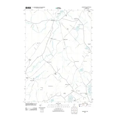 2011 Searsmont2011 Print · USGSCovers Camden, including Lincolnville, Hope, and other nearby areas
 - 2011 Map of West Rockport, 2011 Print
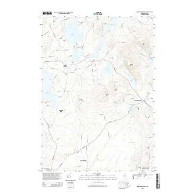
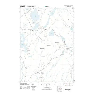 2011 West Rockport2011 Print · USGSCovers Camden, including Rockland, Warren, and other nearby areas
 - 2011 Map of Lincolnville, 2011 Print
 2011 Lincolnville2011 Print · USGSCovers Camden, including Belfast, Lincolnville, and other nearby areas
 - 2011 Map of Camden, 2011 Print
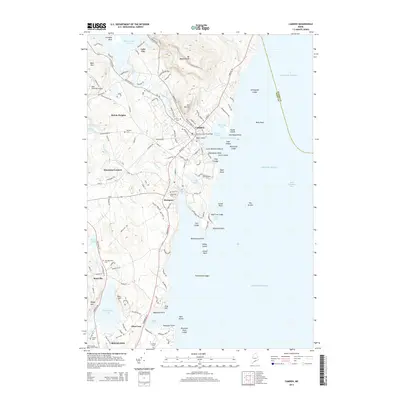
 2011 Camden2011 Print · USGSCovers Camden, including Rockland, Rockport, and other nearby areas
 - 2014 Map of Camden, 2014 Print
 2014 Camden2014 Print · USGSCovers Camden, including Rockland, Rockport, and other nearby areas
 - 2014 Map of West Rockport, 2014 Print
 2014 West Rockport2014 Print · USGSCovers Camden, including Rockland, Warren, and other nearby areas
 - 2014 Map of Searsmont, 2014 Print
 2014 Searsmont2014 Print · USGSCovers Camden, including Lincolnville, Hope, and other nearby areas
Showing maps 1-25 of 38
Top cities near Camden
- Rockland historical maps
- Belfast historical maps
- Warren historical maps
- Rockport historical maps
- Thomaston historical maps
- Searsport historical maps
See more
Top neighborhoods of Camden
Frequently asked questions
- What are the different types of historical maps available for Camden?
- What is the oldest map of Camden?
- Where can I purchase historical maps of Camden for my home or office?
- Where can I download high-res historical maps of Camden?
- Are there historical topographic maps available for Camden?
- Is there historical aerial imagery available for Camden?
- Where are historical maps of Camden sourced from?