1980s Maps of Lincoln County, Maine
Explore 7 historic maps of Lincoln County from the 1980s. These maps offer a rare glimpse into what life looked like during the 1980s — showing old roads, neighborhoods, homes, and landmarks that have changed or disappeared over time.
Whether you're researching your family's past, planning a metal detecting trip, or studying how Lincoln County's landscape evolved across the 1980s, these high-resolution maps are a powerful tool for exploring the history of this region.
- Focus on a specific era: All maps on this page are from the 1980s, giving you a focused view of this time period.
- See what’s changed: Compare century-old streets, trails, and buildings to today's modern landscape using overlays and satellite layers.
- Research with precision: Use these maps for genealogy, historical research, land use analysis, or educational projects.
- View, download, or print: Maps are fully viewable online in high resolution, and can be downloaded or printed for your own records.
Start exploring Lincoln County's history through authentic maps from the 1980s. This is your window into the past.
Lincoln County, ME maps
(7)- 1980 Map of Richmond
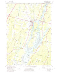 1980 Richmond1980 Print · USGSThe Kennebec River corridor comes alive in the early 1980s, documenting a landscape of tidal flats and riverfront settlements. Researchers can trace family lines through numerous burial grounds like Maple Grove Cem or locate the historic river crossings near Iceboro and Swan Island.2 unique versions available
 - 1980 Map of Gardiner
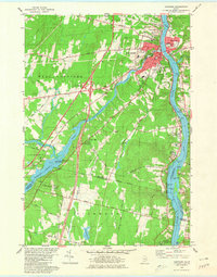 1980 Gardiner1980 Print · USGSGardiner and the Kennebec River valley are captured in the early 1980s as modern turnpike travel intersected with traditional riverfront industry. Genealogists can locate several burial grounds like St Josephs Cem and trace historical sites such as the Colburn House State Mem.3 unique versions available
 - 1980 Map of Gardiner, 1991 Print
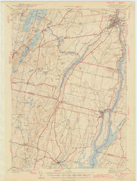 1980 Gardiner1991 Print · USGSMid-century Kennebec County comes alive in this 1940s survey of the river-and-rail corridor. Genealogists can trace family landmarks like Hathorn Hill, locate small rural schools such as Adams Sch, and find ancestors in Evergreen Cem.
 - 1982 Map of Weeks Mills, 1983 Print
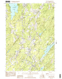 1982 Weeks Mills1983 Print · USGSKennebec County in the early eighties is a landscape of river valleys and small crossroads settlements. Genealogists and historians can locate family burial grounds like Chadwick Hill Cem or trace the rural footprint of Erskine Academy and the Windsor Fairgrounds.2 unique versions available
 - 1982 Map of Togus Pond, 1983 Print
 1982 Togus Pond1983 Print · USGSEast of Augusta in the early eighties, this survey captures the intersection of veteran history and the Maine lake district. Researchers can locate the Veterans Administrative Facility and its associated Togus National Cemeteries, or trace local roots at Bolton Hill Cem and Chelsea School.2 unique versions available
 - 1984 Map of Augusta
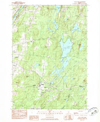
 1984 Augusta1984 Print · USGSMid-coast and central Maine were undergoing steady change in the mid-eighties as traditional river and coastal industries met expanding recreation. You can trace the Maine Central RR through Augusta or explore the rugged shoreline from Rockland Harbor up to Mount Megunticook.
 - 1985 Map of Bath, 1986 Print
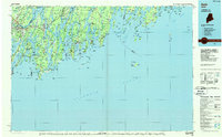 1985 Bath1986 Print · USGSMidcoast Maine in the mid-eighties shows a landscape of deep-water harbors and strategic military installations. Researchers can trace the coastal rail lines of the Maine Central RR and locate landmarks from Popham Beach to the remote Monhegan Plantation.2 unique versions available
End of results
Showing maps 1-7 of 7
Top cities of Lincoln County
- Wiscasset historical maps
- Boothbay historical maps
- Bristol historical maps
- Jefferson historical maps
- Whitefield historical maps
- Damariscotta historical maps
See more
Frequently asked questions
- What are the different types of historical maps available for Lincoln County?
- What is the oldest map of Lincoln County?
- Where can I purchase historical maps of Lincoln County for my home or office?
- Where can I download high-res historical maps of Lincoln County?
- Are there historical topographic maps available for Lincoln County?
- Is there historical aerial imagery available for Lincoln County?
- Where are historical maps of Lincoln County sourced from?