Old Maps of Denmark, Maine for Academic Research
Study the evolution of Denmark with 49 high-resolution historic maps. Whether you're teaching, researching, or modeling changes in land use, these maps provide essential visual documentation of urban, environmental, and geographic change.
- Analyze long-term change: Track patterns in development, transportation, and natural features.
- Ideal for environmental or urban studies: Support academic projects with primary historical map data.
- Use in the classroom or lab: Educators and researchers rely on these maps to bring historical context to life.
These maps are a powerful tool for teaching, research, and visualizing how Denmark has changed over the decades.
Denmark, ME maps
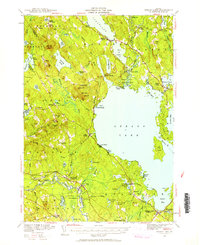
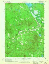
(49)- 1896 Map of Sebago
 1896 Sebago1896 Print · USGSCumberland County’s lake country thrived on a network of water and rail transport at the end of the Victorian era. Researchers can trace the Steamboat Route through Sebago Lake and locate old industrial sites like Songo Lock, Cooks Mills, and Steep Falls.8 unique versions available
 - 1909 Map of Fryeburg, 1960 Print
 1909 Fryeburg1960 Print · USGSOxford County and the borderlands of Maine and New Hampshire were defined by the shifting waters of the Saco and the Kezar at the century's turn. Genealogists can trace family homesteads near the Battle Monument or locate rural schoolhouses like Foxboro School and Menotomy School.3 unique versions available
 - 1910 Map of Kezar Falls
 1910 Kezar Falls1910 Print · USGSMaine and New Hampshire borderlands are captured here at the height of the railroad era, as the Maine Central linked river towns. Genealogists can trace family footprints through sites like the Parsonsfield Seminary, Merrill Corner, and the Haley School.5 unique versions available
 - 1911 Map of Fryeburg
 1911 Fryeburg1911 Print · USGSOxford County at the start of the century shows a landscape of lake-fed valleys and the bustling rail corridor of the Maine Central RR. Genealogists and historians can trace old school districts like Foxboro School, local landmarks like the Battle Monument, and early settlements at Slab City and Lynchville.6 unique versions available
 - 1911 Map of Kezar Falls
 1911 Kezar Falls1911 Print · USGSThe Saco River valley at the turn of the century shows a landscape defined by riverside industry and mountain schools. Genealogists and historians can trace rail depots like Bridgton Junction and early landmarks such as Parsonsfield Seminary and Rankins Mill.5 unique versions available
 - 1941 Map of Fryeburg
 1941 Fryeburg1941 Print · USGSOxford County and the Maine-New Hampshire borderlands are captured here just before the war, showcasing a landscape of isolated hills and interconnected lakes. Genealogists can locate family-named landmarks like Mc Daniels Hill and numerous rural schools including Plummer Sch and Black Mountain Sch.
 - 1942 Map of Sebago Lake, 1959 Print
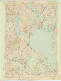
 1942 Sebago Lake1959 Print · USGSCumberland County’s lakes and ridges were well-established as a summer destination in the early 1940s, centered around the expanse of Sebago Lake. Researchers can trace old rail routes at East Baldwin Mattocks Sta, find the historic Potter Academy, or locate family sites near South Naples.3 unique versions available
 - 1943 Map of Sebago Lake
 1943 Sebago Lake1943 Print · USGSMaine's lake country thrived during the early 1940s as a hub of rail commerce and early recreation. You can trace the Maine Central Railroad through Steep Falls or find local landmarks like Potter Academy and Songo Lock.3 unique versions available
 - 1949 Map of Portland
 1949 Portland1949 Print · USGSCoastal Maine and the New Hampshire interior are shown in detail during the late forties, from the bustling harbors to the lakeside villages. Researchers can trace historical rail networks like the Boston & Maine RR and locate coastal defenses such as Fort Preble.3 unique versions available
 - 1950 Map of Lewiston
 1950 Lewiston1950 Print · USGSThe Maine and New Hampshire borderlands come alive in this post-war survey of the White Mountains and Androscoggin valley. Genealogists and historians can trace rail lines like the Maine Central Railroad and find high-altitude landmarks from Mount Washington to Bretton Woods.2 unique versions available
 - 1956 Map of Portland, 1963 Print
 1956 Portland1963 Print · USGSSouthern Maine and eastern New Hampshire are captured here in the mid-fifties, during a time of major highway expansion and military growth. You can trace the path of the Maine Turnpike and locate landmarks like the Portsmouth Naval Shipyard and Sebago Lake.4 unique versions available
 - 1956 Map of Lewiston, 1975 Print
 1956 Lewiston1975 Print · USGSThe Northern New England interior is documented here in the mid-fifties, from the industrial Androscoggin River to the high peaks of the White Mountains. Trace the Grand Trunk Railway through mountain passes or locate family landmarks near Sabbathday Lake and Bretton Woods.
 - 1959 Map of Portland
 1959 Portland1959 Print · USGSThe Maine and New Hampshire coastlines meet in this mid-century portrait of maritime commerce and inland rail networks. Researchers can trace the legacy of coastal defense at Fort Williams and follow the historic path of the Maine Central RR through the White Mountain National Forest.2 unique versions available
 - 1961 Map of Lewiston
 1961 Lewiston1961 Print · USGSWestern Maine and the White Mountains appear here during the early sixties, showing the industrial river towns and vast timberlands before the modern interstate era. Genealogists and historians can trace the Grand Trunk RR through Berlin or locate landmarks like Old Speck Mountain and Elephant Mountain.
 - 1962 Map of Lewiston
 1962 Lewiston1962 Print · USGSThe industrial river valleys and high peaks of Maine and New Hampshire define the region in the early sixties. Trace the rail-and-river network from Lewiston to the White Mountains, passing through mill towns like Berlin and Rumford.
 - 1963 Map of Portland
 1963 Portland1963 Print · USGSCoastal Maine and New Hampshire thrived as maritime and industrial hubs during the mid-sixties, linked by a dense network of rail and river. Researchers can trace historic transit corridors like the Maine Central RR and locate key sites such as the Portsmouth Naval Shipyard or Pease Air Force Base.3 unique versions available
 - 1963 Map of Pleasant Mtn, 1965 Print
 1963 Pleasant Mtn1965 Print · USGSWestern Maine's highlands and lakes appear here just as the early 1960s began, showing a landscape of small hill settlements and timbered ridges. Genealogists can locate over twenty distinct burial sites like Sawyer Cem and Hio Ridge Cem, or trace the old roads between West Bridgton and Liberty Corner.3 unique versions available
 - 1963 Map of Fryeburg, 1965 Print
 1963 Fryeburg1965 Print · USGSOxford County settlement and the meandering Saco River define this mid-century survey of the Maine-New Hampshire border. Genealogists and local historians can locate numerous family burial grounds like Riverside Cem and Wiley Cem, along with landmarks like Fryeburg Academy.2 unique versions available
 - 1964 Map of Hiram, 1966 Print
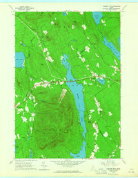
 1964 Hiram1966 Print · USGSOxford County in the 1960s reveals a landscape of river-tied commerce and quiet lakeside settlements. Researchers can locate numerous family burial sites like Harnden Cem, trace the Maine Central Railroad, and explore historic locales like Rankins Mill or Heads Corner.2 unique versions available
 - 1964 Map of Brownfield, 1966 Print
 1964 Brownfield1966 Print · USGSOxford County settlement and the Saco River valley are captured here in the mid-sixties. Genealogists and local historians can trace family burial sites at Merrill Cem and Wentworth Cem or follow the path of the Maine Central Railroad.2 unique versions available
 - 1969 Map of Lewiston
 1969 Lewiston1969 Print · USGSThe northern New England highlands come into focus during the mid-fifties, showing the vital rail and river networks connecting industrial centers to the deep woods. Researchers can trace the path of the Grand Trunk RR or locate landmarks like Mt Washington and Rangeley Lake.
 - 1983 Map of North Sebago, 1984 Print
 1983 North Sebago1984 Print · USGSThe Sebago and Bridgton area in the early eighties shows a rural landscape of inland lakes and high ridges before modern expansion. Researchers can find dozens of family burial sites like Haley Cem and trace old routes through Sebago Center and Convene.3 unique versions available
 - 1985 Map of Portland, 1986 Print
 1985 Portland1986 Print · USGSThe Maine coast and Sebago Lake region are captured in the mid-1980s, showcasing the transition from traditional maritime centers to a modern transportation hub. Genealogists and historians can trace rail lines like the Grand Trunk RR and find local landmarks such as the U.S. Marine Hospital or Old Orchard Beach.2 unique versions available
 - 1986 Map of Lewiston
 1986 Lewiston1986 Print · USGSMaine’s industrial river valleys and western mountain foothills are captured here in the mid-eighties as rail and road networks tied the region together. Genealogists and historians can trace the development of mill towns and lakefront settlements from Lisbon to Bethel, following the Androscoggin River and the path of the Maine Central Railroad.2 unique versions available
 - 2011 Map of Hiram, 2011 Print
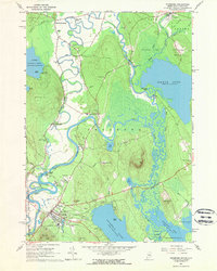
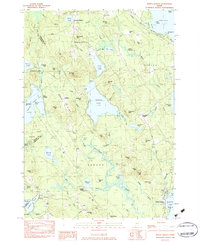
 2011 Hiram2011 Print · USGSCovers Denmark, including Bridgton, Sebago, and other nearby areas
Showing maps 1-25 of 49
Top cities near Denmark
- Standish historical maps
- Bridgton historical maps
- Norway historical maps
- Ossipee historical maps
- Naples historical maps
- Limington historical maps
See more
Top neighborhoods of Denmark
- East Denmark historical maps
- West Denmark historical maps
- Heads Corner historical maps
- Liberty Corner historical maps
Frequently asked questions
- What are the different types of historical maps available for Denmark?
- What is the oldest map of Denmark?
- Where can I purchase historical maps of Denmark for my home or office?
- Where can I download high-res historical maps of Denmark?
- Are there historical topographic maps available for Denmark?
- Is there historical aerial imagery available for Denmark?
- Where are historical maps of Denmark sourced from?