Old Maps of Ebeemee Township, Maine for Metal Detecting
Plan your next treasure hunt with 44 historic maps of Ebeemee Township. Find old homesites, ghost towns, trails, and gathering spots that may be lost to time — perfect for identifying promising metal detecting locations.
- Locate forgotten sites: Uncover places like long-lost settlements, abandoned rail lines, or gathering spots.
- Plan better hunts: Use map overlays combined with LiDAR or satellite views to narrow in on historically rich areas.
- Made for detectorists: Thousands of hobbyists use these maps to discover relics, coins, and hidden history.
Use these historic maps to boost your research and find new opportunities beneath the surface of Ebeemee Township.
Ebeemee Township, ME maps
(44)- 1940 Map of Sebec
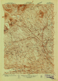 1940 Sebec1940 Print · USGSPiscataquis County in the early 1940s is captured here at a crossroads of the iron and timber industries. Researchers can locate the Katahdin Iron Works, trace the rail yards at Brownville Junction, and find rural schools like Williamsburg Sch.4 unique versions available
 - 1943 Map of Sebec
 1943 Sebec1943 Print · USGSPiscataquis County in the early 1940s is a landscape of iron works, timber rails, and remote schools. Genealogists and historians can trace the paths of the CANADIAN PACIFIC railroad and locate sites like the Williamsburg Sch, Katahdin Iron Works, and Barnard Corner.4 unique versions available
 - 1947 Map of Schoodic, 1956 Print
 1947 Schoodic1956 Print · USGSPiscataquis County in the late 1940s is shown here as a landscape of timber, rail, and isolated lake settlements. Genealogists and historians can trace old homesteads and landmarks like Evergreen Cem, the Maxfield Sch, and the rail stops at Packards or Lake View.3 unique versions available
 - 1949 Map of Schoodic
 1949 Schoodic1949 Print · USGSThe rail-and-river network of central Maine is captured here just after the war, showing the junction of two major rail lines. Genealogists and historians can trace old community sites like Lake View, Knights Landing, and the Maxfield Sch.2 unique versions available
 - 1951 Map of Norcross, 1953 Print
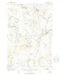 1951 Norcross1953 Print · USGSThe Maine North Woods at mid-century reveal a complex logging and sporting landscape centered on the village of Norcross. Researchers can trace the legacy of the timber trade and wilderness camps at the Boom House, Ambajejus Camps, and Stephensons Landing.5 unique versions available
 - 1952 Map of Jo-Mary Mountain, 1953 Print
 1952 Jo-Mary Mountain1953 Print · USGSCentral Maine's wilderness is captured here in the early fifties, showing the legendary Appalachian Trail as it crosses a landscape of high peaks and isolated ponds. Hikers and researchers can trace the old routes to the Wadleigh Lookout Tower or locate remote camps near Nahamakanta Lake and Jo-Mary Mtn.5 unique versions available
 - 1954 Map of Millinocket, 1968 Print
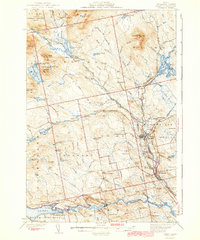
 1954 Millinocket1968 Print · USGSMaine's North Woods and the Penobscot Valley are captured here during the mid-century era of logging and rail dominance. You can trace the path of the Bangor and Aroostook Railroad through timber towns like Millinocket, Mattawamkeag, and Silver Ridge.3 unique versions available
 - 1958 Map of Millinocket
 1958 Millinocket1958 Print · USGSMaine's North Woods and the Penobscot river valley are captured here in the mid-1950s, showing a landscape of timber, rail, and wild waters. Researchers can trace the legacy of the Canadian Pacific railroad and find historic settlements like Millinocket, Sherman Station, and Mattawamkeag.
 - 1960 Map of Millinocket
 1960 Millinocket1960 Print · USGSThe Maine North Woods and Penobscot River valley are captured at mid-century during the height of the paper milling era. Researchers can trace the Appalachian Trail near Mount Katardin or locate family roots in towns like Dover-Foxcroft and Milo.3 unique versions available
 - 1978 Map of Jo-Mary Mountain, 1981 Print
 1978 Jo-Mary Mountain1981 Print · USGSThe Maine North Woods are captured in the late seventies via detailed aerial imagery of the high timberlands. Researchers can trace forest management patterns and mountain geography around Jo-Mary Mountain and the East Branch Pleasant River.
 - 1978 Map of Seboeis Lake, 1981 Print
 1978 Seboeis Lake1981 Print · USGSThe Maine North Woods are captured in the late seventies, showing a landscape defined by deep water and timberland. Researchers can trace the exact locations of lakeside outposts like Packards and Schoodic or examine the shorelines of Seboeis Lake.
 - 1978 Map of Ragged Mountain, 1981 Print
 1978 Ragged Mountain1981 Print · USGSPenobscot County timberlands are captured from the air in the late seventies, showing the intersection of Maine's wilderness and its logging industry. Researchers can trace the rail corridor at West Seboois and the shorelines of Upper Jo-Mary Lake and South Twin Lake.2 unique versions available
 - 1978 Map of Ebeemee Mountain, 1981 Print
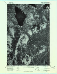
 1978 Ebeemee Mountain1981 Print · USGSPiscataquis County timberlands and waterways are captured in the late seventies just as the autumn foliage season ended. Trace the confluence of the West Branch Pleasant River near Prairie and the isolated shores of Ebeemee Lake.
 - 1985 Map of Moosehead Lake, 1986 Print
 1985 Moosehead Lake1986 Print · USGSThe Maine North Woods in the 1980s remain a landscape of vast timberlands, railroads, and the sprawling waters of the state's largest lake. Researchers can trace the Canadian Pacific line through Rockwood or locate historical townships from Seboomook to Kokadjo.
 - 1985 Map of Millinocket, 1986 Print
 1985 Millinocket1986 Print · USGSThe North Maine Woods were a landscape of industrial timber and wilderness recreation in the mid-eighties. Genealogists and researchers can trace local settlements and rail stops like Sherman Mills, Wytopitlock, and the Old Long A Siding near the Penobscot River.2 unique versions available
 - 1985 Map of Lincoln, 1994 Print
 1985 Lincoln1994 Print · USGSPenobscot County in the mid-eighties remains a landscape of river-based commerce and sprawling timberlands connected by rail. You can trace the historic paths of the Maine Central RR and Canadian Pacific RR or locate rural sites like Enfield Station and the Winn Cem.
 - 1986 Map of Dover-Foxcroft
 1986 Dover-Foxcroft1986 Print · USGSPiscataquis County at the edge of the great Maine woods is documented here in the mid-1980s, centered on the river-and-rail hubs of the interior. Trace the industrial footprints of Dover South Mills, the rail yards at Brownville Junction, or the historic Katahdin Iron Works.
 - 1986 Map of Lincoln
 1986 Lincoln1986 Print · USGSMid-century Maine settlement and industry converge along the Penobscot and Piscataquis rivers during the 1980s. Researchers can trace the rail networks of the Maine Central and Bangor and Aroostook through towns like Howland and Milo.
 - 1988 Map of Seboeis Lake
 1988 Seboeis Lake1988 Print · USGSPiscataquis County's interior waterways and mountains are documented here in the late eighties, just before the turn of the decade. Researchers can locate former settlements like Packards (Site) and trace the shorelines of Seboeis Lake and Schoodic Lake.
 - 1988 Map of Jo-Mary Mountain
 1988 Jo-Mary Mountain1988 Print · USGSPiscataquis County’s wild backcountry is captured here during the 1980s, documenting a landscape shaped by the timber industry and glacial waters. Researchers can trace the river's course through Gauntlet Falls and locate remote peaks like Big Wilkie Mountain or Jo-Mary Mountain.
 - 1988 Map of Ragged Mountain
 1988 Ragged Mountain1988 Print · USGSPenobscot and Piscataquis counties are shown here in the late eighties, documenting a remote landscape of interconnected lakes and mountain terrain. Trace the waterway from Upper Jo-Mary Lake to South Twin Lake or locate Balancing Rock on the slopes of Ragged Mountain.
 - 1988 Map of Ebeemee Mountain
 1988 Ebeemee Mountain1988 Print · USGSPiscataquis County's interior wilderness is captured here in the late twentieth century, showing the intersection of Maine's timberlands and industrial history. Researchers can trace the Mooresville Road to the Mooresville (Site) or locate remote spots like Strout Camp and the small settlement at Prairie.
 - 1994 Map of Dover-Foxcroft
 1994 Dover-Foxcroft1994 Print · USGSCentral Maine in the mid-nineties shows a landscape of timber-driven towns and deep glacial lakes. Trace the paths of the Canadian Pacific RR or locate the Moscow Air Force Station Transmit Site and Sebec Lake.
 - 1994 Map of Moosehead Lake
 1994 Moosehead Lake1994 Print · USGSThe Maine North Woods at the end of the twentieth century remains a landscape of vast timberlands and remote outposts. Researchers can trace the Appalachian National Scenic Trail and locate historic water controls like Chesuncook Dam and Ripogenus Dam.
 - 2011 Map of Jo-Mary Mountain, 2011 Print
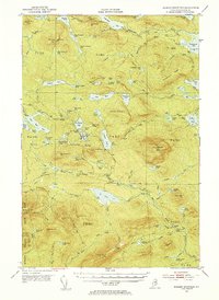
 2011 Jo-Mary Mountain2011 Print · USGSCovers Ebeemee Township, including TA R11 WELS, TA R10 WELS, and other nearby areas
Showing maps 1-25 of 44
Top cities near Ebeemee Township
- Dover-Foxcroft historical maps
- Milo historical maps
- Brownville historical maps
- Sebec historical maps
- LaGrange historical maps
- Medford historical maps
See more
Top neighborhoods of Ebeemee Township
Frequently asked questions
- What are the different types of historical maps available for Ebeemee Township?
- What is the oldest map of Ebeemee Township?
- Where can I purchase historical maps of Ebeemee Township for my home or office?
- Where can I download high-res historical maps of Ebeemee Township?
- Are there historical topographic maps available for Ebeemee Township?
- Is there historical aerial imagery available for Ebeemee Township?
- Where are historical maps of Ebeemee Township sourced from?