1980s Maps of T4 R14 WELS, Maine
Explore 6 historic maps of T4 R14 WELS from the 1980s. These maps offer a rare glimpse into what life looked like during the 1980s — showing old roads, neighborhoods, homes, and landmarks that have changed or disappeared over time.
Whether you're researching your family's past, planning a metal detecting trip, or studying how T4 R14 WELS's landscape evolved across the 1980s, these high-resolution maps are a powerful tool for exploring the history of this region.
- Focus on a specific era: All maps on this page are from the 1980s, giving you a focused view of this time period.
- See what’s changed: Compare century-old streets, trails, and buildings to today's modern landscape using overlays and satellite layers.
- Research with precision: Use these maps for genealogy, historical research, land use analysis, or educational projects.
- View, download, or print: Maps are fully viewable online in high resolution, and can be downloaded or printed for your own records.
Start exploring T4 R14 WELS's history through authentic maps from the 1980s. This is your window into the past.
T4 R14 WELS, ME maps
(6)- 1985 Map of Moosehead Lake, 1986 Print
 1985 Moosehead Lake1986 Print · USGSThe Maine North Woods in the 1980s remain a landscape of vast timberlands, railroads, and the sprawling waters of the state's largest lake. Researchers can trace the Canadian Pacific line through Rockwood or locate historical townships from Seboomook to Kokadjo.
 - 1986 Map of Chamberlain Lake
 1986 Chamberlain Lake1986 Print · USGSThe Maine North Woods in the mid-eighties appear here as a land of protected wilderness and logging heritage, centered on the Allagash Wilderness Waterway. Researchers can trace the historic Tramway at Chamberlain Lake and locate old outposts like Churchill Depot.
 - 1988 Map of Pine Stream Flowage
 1988 Pine Stream Flowage1988 Print · USGSPiscataquis County remains a deep wilderness in the late eighties, dominated by water and timber land. Researchers can trace the drainage of Pine Stream Flowage and locate landmarks like Salmon Pond, Little Lobster Lake, and the Monument Line.
 - 1988 Map of Chesuncook
 1988 Chesuncook1988 Print · USGSThe Maine wilderness of the late 1980s is captured here at the junction of the Penobscot River and Chesuncook Lake. Trace the settlement at Chesuncook, find Graveyard Point, and explore the Gero Island State Reserve Land.
 - 1989 Map of Ragmuff Stream
 1989 Ragmuff Stream1989 Print · USGSThe Maine North Woods in the late eighties are a landscape of timber tracts and river drainages within the Piscataquis County townships. Researchers can trace the network of forest roads and waterways including Ragmuff Stream, a remote Landing Strip, and the West Branch Penobscot River.
 - 1989 Map of Penobscot Farm
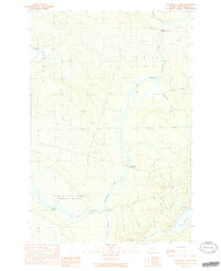 1989 Penobscot Farm1989 Print · USGSIn the Maine North Woods during the late eighties, this area shows the intersection of the timber industry and wilderness waterways. Researchers can trace the path of the Golden Road and locate historic sites like Penobscot Farm and Hannibals Crossing.2 unique versions available
End of results
Showing maps 1-6 of 6
Frequently asked questions
- What are the different types of historical maps available for T4 R14 WELS?
- What is the oldest map of T4 R14 WELS?
- Where can I purchase historical maps of T4 R14 WELS for my home or office?
- Where can I download high-res historical maps of T4 R14 WELS?
- Are there historical topographic maps available for T4 R14 WELS?
- Is there historical aerial imagery available for T4 R14 WELS?
- Where are historical maps of T4 R14 WELS sourced from?