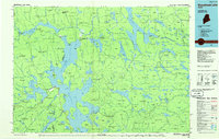
1985 Map of Moosehead Lake
USGS Topo · Published 1986About this map
Moosehead Lake dominates this 1980s landscape, serving as the central hub for the timber and rail networks of north-central Maine. The Canadian Pacific railroad cuts through the southern reaches of the lake, connecting remote outposts like Tarratine, Somerset Junction, and Moosehead to the larger regional economy. The map illustrates a complex system of townships, many designated by their historical survey codes like t4 r14 Wels, alongside established communities such as Greenville and Rockwood.
Find a feature on this map
93 named features on this map. Tap any name to fly to it.
Don’t see what you’re looking for? This feature index may not catch every label — zoom into the map to look around manually.
Map Details
Editions of this 1985 Moosehead Lake Map
This is the sole edition of this map. No revisions or reprints were ever made.
Other maps of this area

1905 · The Forks
USGS Topo · 1:62,500

1907 · The Forks
USGS Topo · 1:62,500

1920 · Moosehead Lake
USGS Topo · 1:62,500

1921 · Brassua Lake
USGS Topo · 1:62,500

1922 · Moosehead Lake
USGS Topo · 1:62,500

1922 · Long Pond
USGS Topo · 1:62,500

1923 · Brassua Lake
USGS Topo · 1:62,500

1924 · Long Pond
USGS Topo · 1:62,500

1925 · Pierce Pond
USGS Topo · 1:48,000

1927 · Pierce Pond
USGS Topo · 1:62,500