1970s Maps of T4 R9 WELS, Maine
Explore 4 historic maps of T4 R9 WELS from the 1970s. These maps offer a rare glimpse into what life looked like during the 1970s — showing old roads, neighborhoods, homes, and landmarks that have changed or disappeared over time.
Whether you're researching your family's past, planning a metal detecting trip, or studying how T4 R9 WELS's landscape evolved across the 1970s, these high-resolution maps are a powerful tool for exploring the history of this region.
- Focus on a specific era: All maps on this page are from the 1970s, giving you a focused view of this time period.
- See what’s changed: Compare century-old streets, trails, and buildings to today's modern landscape using overlays and satellite layers.
- Research with precision: Use these maps for genealogy, historical research, land use analysis, or educational projects.
- View, download, or print: Maps are fully viewable online in high resolution, and can be downloaded or printed for your own records.
Start exploring T4 R9 WELS's history through authentic maps from the 1970s. This is your window into the past.
T4 R9 WELS, ME maps
(4)- 1975 Map of The Traveler
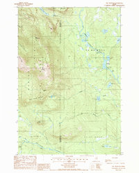 1975 The Traveler1975 Print · USGSBaxter State Park and the surrounding wildlands of the Maine North Woods appear in high detail during the mid-1980s. Trace the mountain geography from The Traveler to Old City, or follow the river system through Stair Falls and the Haskell Deadwater.2 unique versions available
 - 1975 Map of Traveler Mountain SW, 1981 Print
 1975 Traveler Mountain SW1981 Print · USGSThe Maine North Woods are revealed in this mid-seventies aerial survey of the Piscataquis County wilderness. Researchers can study the untouched timberlands and natural drainage surrounding Wassataquoik Lake and North Pogy Mountain.
 - 1978 Map of Mount Katahdin, 1981 Print
 1978 Mount Katahdin1981 Print · USGSThe high peaks of Maine are seen in sharp detail in the late 1970s through this orthophoto survey. Hikers and historians can trace the shadows and summits of Mount Katahdin and follow the path of Wassataquoik Stream.
 - 1978 Map of Katahdin Lake, 1981 Print
 1978 Katahdin Lake1981 Print · USGSThe Maine wilderness east of Mount Katahdin is captured here through detailed aerial imagery during the late seventies. Researchers can trace the timberline on North Turner Mountain and the clear water of Katahdin Lake and Wassataquoik Stream.
End of results
Showing maps 1-4 of 4
Frequently asked questions
- What are the different types of historical maps available for T4 R9 WELS?
- What is the oldest map of T4 R9 WELS?
- Where can I purchase historical maps of T4 R9 WELS for my home or office?
- Where can I download high-res historical maps of T4 R9 WELS?
- Are there historical topographic maps available for T4 R9 WELS?
- Is there historical aerial imagery available for T4 R9 WELS?
- Where are historical maps of T4 R9 WELS sourced from?