1970s Maps of Sagadahoc County, Maine
Explore 5 historic maps of Sagadahoc County from the 1970s. These maps offer a rare glimpse into what life looked like during the 1970s — showing old roads, neighborhoods, homes, and landmarks that have changed or disappeared over time.
Whether you're researching your family's past, planning a metal detecting trip, or studying how Sagadahoc County's landscape evolved across the 1970s, these high-resolution maps are a powerful tool for exploring the history of this region.
- Focus on a specific era: All maps on this page are from the 1970s, giving you a focused view of this time period.
- See what’s changed: Compare century-old streets, trails, and buildings to today's modern landscape using overlays and satellite layers.
- Research with precision: Use these maps for genealogy, historical research, land use analysis, or educational projects.
- View, download, or print: Maps are fully viewable online in high resolution, and can be downloaded or printed for your own records.
Start exploring Sagadahoc County's history through authentic maps from the 1970s. This is your window into the past.
Sagadahoc County, ME maps
(5)- 1970 Map of Wiscasset, 1974 Print
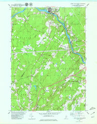
 1970 Wiscasset1974 Print · USGSCoastal Lincoln County is documented here during the early 1970s, showing the intricate relationship between the Sheepscot River and the village of Wiscasset. Genealogists can trace family landmarks across several townships, from Dresden Mills to ancestral burial sites like Herriman Cem and Marston Cem.2 unique versions available
 - 1970 Map of Westport, 1974 Print
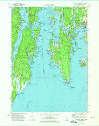
 1970 Westport1974 Print · USGSCoastal Lincoln County is defined by its deep estuaries and island communities in the early seventies. Genealogists can locate family landmarks like the Bergen Ch, Doggett Castle, and the Ocean View Cem near Boothbay.2 unique versions available
 - 1970 Map of Boothbay Harbor, 1974 Print
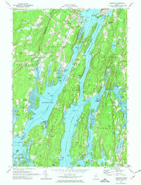
 1970 Boothbay Harbor1974 Print · USGSCoastal Maine's intricate network of harbors and islands is captured here during the 1970s, showcasing the region's enduring maritime character. Researchers can trace historic cemeteries and seasonal settlements from the bustling Boothbay Harbor to the quiet shores of Newagen and Reid State Park.2 unique versions available
 - 1979 Map of Lisbon Falls South
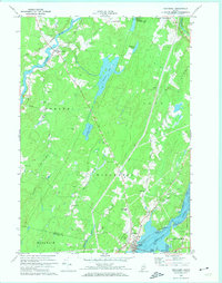
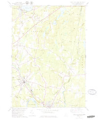
 1979 Lisbon Falls South1979 Print · USGSThe Androscoggin River valley in the late 1970s reveals a landscape of paper mill towns, rural crossroads, and family cemeteries. Genealogists and historians can locate heritage sites like Shiloh, Pejepscot, and the Lunt Memorial Cem along the Maine Central line.3 unique versions available
 - 1979 Map of Lisbon Falls North
 1979 Lisbon Falls North1979 Print · USGSLisbon and Sabattus appear at a crossroads of industry and tradition in the late seventies as the river-driven economy continued to shape the county. Researchers can trace family roots through numerous small burial grounds like Furbush Cem and Spear Cem or locate the old Webster School.3 unique versions available
End of results
Showing maps 1-5 of 5
Top cities of Sagadahoc County
- Topsham historical maps
- Bath historical maps
- Richmond historical maps
- Bowdoin historical maps
- Woolwich historical maps
- Bowdoinham historical maps
See more
Frequently asked questions
- What are the different types of historical maps available for Sagadahoc County?
- What is the oldest map of Sagadahoc County?
- Where can I purchase historical maps of Sagadahoc County for my home or office?
- Where can I download high-res historical maps of Sagadahoc County?
- Are there historical topographic maps available for Sagadahoc County?
- Is there historical aerial imagery available for Sagadahoc County?
- Where are historical maps of Sagadahoc County sourced from?