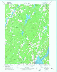
1970 Map of Wiscasset
USGS Topo · Published 1974About this map
The Sheepscot River and Eastern River define the watery landscape of this Lincoln County survey, anchored by the historic village of Wiscasset and the settlement at Dresden Mills. Local educational heritage is preserved through the locations of the Bridge Academy and Wiscasset High School. The terrain is characterized by tidal flats and inland wetlands like Dresden Bog, which stretches between the ridges of Blinn Hill and Call Hill.
Find a feature on this map
51 named features on this map. Tap any name to fly to it.
Don’t see what you’re looking for? This feature index may not catch every label — zoom into the map to look around manually.
Map Details
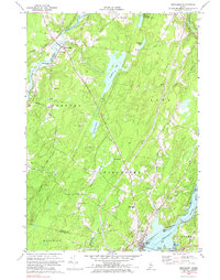
Editions of this 1970 Wiscasset Map
2 editions found
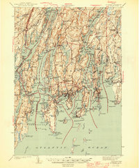
Other maps of this area

1892 · Gardiner
USGS Topo · 1:62,500

1893 · Wiscasset
USGS Topo · 1:62,500

1893 · Boothbay
USGS Topo · 1:62,500

1894 · Bath
USGS Topo · 1:62,500

1920 · Bath
USGS Topo · 1:62,500

1941 · Boothbay
USGS Topo · 1:62,500

1943 · Gardiner
USGS Topo · 1:62,500

1943 · Boothbay
USGS Topo · 1:62,500

1944 · Wiscasset
USGS Topo · 1:62,500
1944 · Boothbay
USGS Topo · 1:62,500