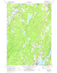
1970 Map of Wiscasset
USGS Topo · Published 1983About this map
The Sheepscot River and Eastern River define the intricate coastal geography of Lincoln County in this 1970 snapshot. Near the head of the Eastern River tide, the village of Dresden Mills serves as a local hub, anchored by the Bridge Academy and surrounded by a landscape of small family burial grounds such as Pine Grove Cem and Herriman Cem. The terrain transitions from the low-lying Dresden Bog to prominent rises like Blinn Hill and Call Hill, reflecting the traditional Maine balance of timberland and valley settlement.
Find a feature on this map
50 named features on this map. Tap any name to fly to it.
Don’t see what you’re looking for? This feature index may not catch every label — zoom into the map to look around manually.
Map Details
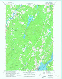
Editions of this 1970 Wiscasset Map
2 editions found
Other maps of this area

1892 · Gardiner
USGS Topo · 1:62,500

1893 · Wiscasset
USGS Topo · 1:62,500

1893 · Boothbay
USGS Topo · 1:62,500

1894 · Bath
USGS Topo · 1:62,500

1920 · Bath
USGS Topo · 1:62,500

1941 · Boothbay
USGS Topo · 1:62,500

1943 · Gardiner
USGS Topo · 1:62,500

1943 · Boothbay
USGS Topo · 1:62,500

1944 · Wiscasset
USGS Topo · 1:62,500

1944 · Boothbay
USGS Topo · 1:62,500