1960s Maps of Big Ten Township, Maine
Explore 3 historic maps of Big Ten Township from the 1960s. These maps offer a rare glimpse into what life looked like during the 1960s — showing old roads, neighborhoods, homes, and landmarks that have changed or disappeared over time.
Whether you're researching your family's past, planning a metal detecting trip, or studying how Big Ten Township's landscape evolved across the 1960s, these high-resolution maps are a powerful tool for exploring the history of this region.
- Focus on a specific era: All maps on this page are from the 1960s, giving you a focused view of this time period.
- See what’s changed: Compare century-old streets, trails, and buildings to today's modern landscape using overlays and satellite layers.
- Research with precision: Use these maps for genealogy, historical research, land use analysis, or educational projects.
- View, download, or print: Maps are fully viewable online in high resolution, and can be downloaded or printed for your own records.
Start exploring Big Ten Township's history through authentic maps from the 1960s. This is your window into the past.
Big Ten Township, ME maps
(3)- 1960 Map of Presque Isle
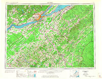
 1960 Presque Isle1960 Print · USGSNorthern Maine during the mid-century was a land of timber, rails, and strategic airfields. Genealogists and historians can trace the growth of Presque Isle and Ashland or explore the remote northern reaches of Baxter State Park and Presque Isle AFB.3 unique versions available
 - 1962 Map of Baker Lake, 1964 Print
 1962 Baker Lake1964 Print · USGSNorth Maine Woods townships were largely defined by timber and water during the early sixties. Researchers can trace remote logging infrastructure and river systems like the Baker Branch St John River, Baker Lake, and the Forest Service Camp.2 unique versions available
 - 1962 Map of Quebec, 1966 Print
 1962 Quebec1966 Print · USGSThe cross-border region between Quebec and Northern Maine is captured here during the mid-1960s, showing the dense settlement of the St. Lawrence valley and the rugged timberlands of the frontier. Genealogists can trace family roots through numerous parishes like St-Joseph-de-Beauce or locate the industrial hubs of Thetford Mines and Levis.3 unique versions available
End of results
Showing maps 1-3 of 3
Top neighborhoods of Big Ten Township
Frequently asked questions
- What are the different types of historical maps available for Big Ten Township?
- What is the oldest map of Big Ten Township?
- Where can I purchase historical maps of Big Ten Township for my home or office?
- Where can I download high-res historical maps of Big Ten Township?
- Are there historical topographic maps available for Big Ten Township?
- Is there historical aerial imagery available for Big Ten Township?
- Where are historical maps of Big Ten Township sourced from?