Old Maps of Big W Township, Maine for Hiking & Exploration
Hike through history with 35 historic maps of Big W Township. Explore old trails, ghost towns, and forgotten backroads — perfect for outdoor adventurers and local explorers.
- Rediscover forgotten places: Map out old mining camps, roads, and footpaths that no longer exist on modern maps.
- Layer with modern tools: Combine with LiDAR or satellite views to plan hikes through historical terrain.
- Made for exploration: Popular among hikers, overlanders, and local history lovers.
Use these maps to find adventure and explore the hidden past of Big W Township.
Big W Township, ME maps
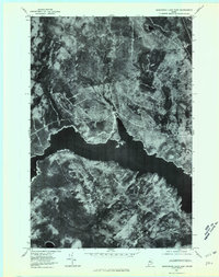
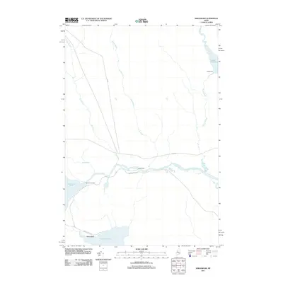
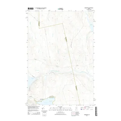
(35)- 1954 Map of Seboomook Lake, 1955 Print
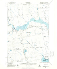 1954 Seboomook Lake1955 Print · USGSThe Maine North Woods in the 1950s was a landscape of timber tracts and managed waterways. You can trace early logging infrastructure and remote outposts like Pittston Farm and Seboomook Lake.6 unique versions available
 - 1954 Map of North East Carry, 1955 Print
 1954 North East Carry1955 Print · USGSThe Maine north woods and the upper reaches of Moosehead Lake are captured here in the mid-1950s. You can trace the historic portage at North East Carry and locate remote outposts like Smiths Halfway House and Penobscot Farm.9 unique versions available
 - 1954 Map of Millinocket, 1968 Print
 1954 Millinocket1968 Print · USGSMaine's North Woods and the Penobscot Valley are captured here during the mid-century era of logging and rail dominance. You can trace the path of the Bangor and Aroostook Railroad through timber towns like Millinocket, Mattawamkeag, and Silver Ridge.3 unique versions available
 - 1958 Map of Millinocket
 1958 Millinocket1958 Print · USGSMaine's North Woods and the Penobscot river valley are captured here in the mid-1950s, showing a landscape of timber, rail, and wild waters. Researchers can trace the legacy of the Canadian Pacific railroad and find historic settlements like Millinocket, Sherman Station, and Mattawamkeag.
 - 1960 Map of Millinocket
 1960 Millinocket1960 Print · USGSThe Maine North Woods and Penobscot River valley are captured at mid-century during the height of the paper milling era. Researchers can trace the Appalachian Trail near Mount Katardin or locate family roots in towns like Dover-Foxcroft and Milo.3 unique versions available
 - 1977 Map of Socatean Bay, 1981 Print
 1977 Socatean Bay1981 Print · USGSThe timberlands of Somerset County are captured in the late seventies, showing the intersection of Maine's deep woods and the shoreline. Trace the winding paths of logging roads near Socatean Bay and the drainage of Williams Brook.
 - 1977 Map of Seboomook, 1981 Print
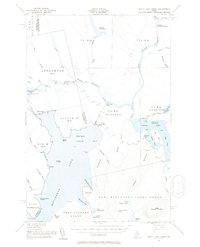
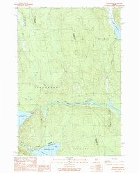
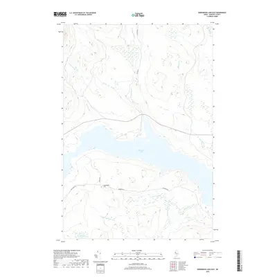
 1977 Seboomook1981 Print · USGSMaine's northern timberlands and the headwaters of the Penobscot are seen here in the late seventies. Trace the shoreline of Moosehead Lake up to the Seboomook settlement and follow the courses of Elm Stream and Negro Brook.
 - 1977 Map of North East Carry, 1981 Print
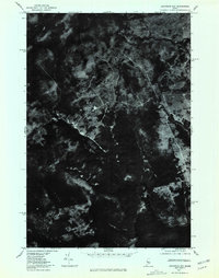
 1977 North East Carry1981 Print · USGSMoosehead Lake and the Maine north woods appear in sharp detail through 1970s aerial photography. Trace the historic portage at North East Carry and locate isolated landmarks like Folsom Farm and the heights of Eagle Mountain.
 - 1977 Map of Seboomook Lake East, 1981 Print
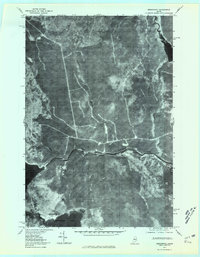
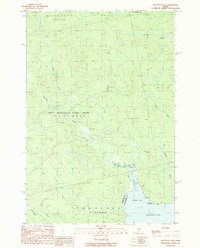
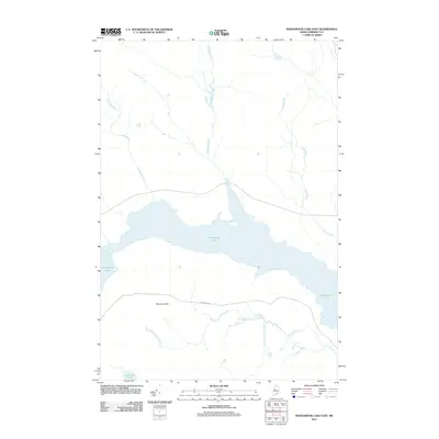
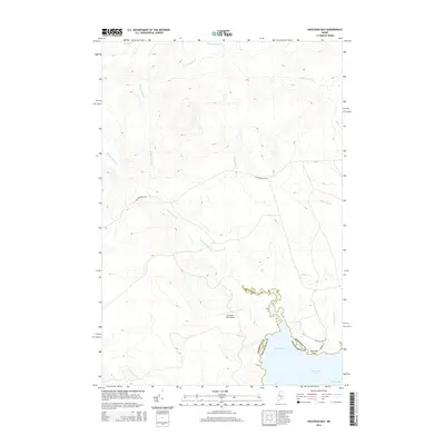
 1977 Seboomook Lake East1981 Print · USGSSomerset County, Maine, is captured during the late seventies in this aerial orthophotoquad. Researchers can trace the timberland landscape surrounding Seboomook Lake, including the drainage of Nulhedus Stream and the elevation at Sevenmile Hill.
 - 1985 Map of Moosehead Lake, 1986 Print
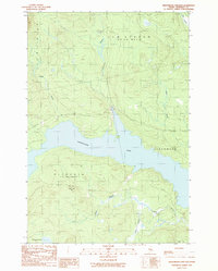
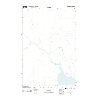
 1985 Moosehead Lake1986 Print · USGSThe Maine North Woods in the 1980s remain a landscape of vast timberlands, railroads, and the sprawling waters of the state's largest lake. Researchers can trace the Canadian Pacific line through Rockwood or locate historical townships from Seboomook to Kokadjo.
 - 1989 Map of Seboomook Lake East
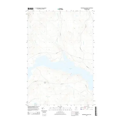
 1989 Seboomook Lake East1989 Print · USGSSomerset County, Maine, is captured here in the late twentieth century as a landscape of managed timberlands and expansive waters. Researchers can trace the network of logging roads and waterways like Seboomook Lake, Sevenmile Hill, and Carry Brook.
 - 1989 Map of North East Carry
 1989 North East Carry1989 Print · USGSThe northern reaches of Moosehead Lake are captured in the late 1980s, showcasing the traditional land grants and portage points of the Maine woods. Researchers can trace historical boundaries like the East Middlesex Canal Grant or locate specific sites like Folsom Farm and North East Carry.
 - 1989 Map of Seboomook
 1989 Seboomook1989 Print · USGSThe North Maine Woods at the close of the 1980s reveal a landscape shaped by timber and water management near the settlement of Seboomook. Researchers can trace the industrial Golden Road and locate historical water controls like Old Roll Dam and Seboomook Dam.
 - 1989 Map of Socatean Bay
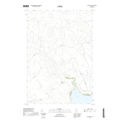
 1989 Socatean Bay1989 Print · USGSThe northwestern reaches of Moosehead Lake are captured in the late 1980s, showcasing a landscape of working timberlands and remote watercourses. Researchers can trace the bounds of the West Middlesex Canal Grant and locate features like Socatean Point and Tomhegan Stream.
 - 1994 Map of Moosehead Lake
 1994 Moosehead Lake1994 Print · USGSThe Maine North Woods at the end of the twentieth century remains a landscape of vast timberlands and remote outposts. Researchers can trace the Appalachian National Scenic Trail and locate historic water controls like Chesuncook Dam and Ripogenus Dam.
 - 2011 Map of Seboomook, 2011 Print
 2011 Seboomook2011 Print · USGSCovers Big W Township, including Northeast Carry Township, Elm Stream Township, and other nearby areas
 - 2011 Map of Seboomook Lake East, 2011 Print
 2011 Seboomook Lake East2011 Print · USGSCovers Big W Township, including Elm Stream Township, T4 R17 WELS, and other nearby areas
 - 2011 Map of Socatean Bay, 2011 Print
 2011 Socatean Bay2011 Print · USGSCovers Big W Township, including West Middlesex Canal Grant Township, Tomhegan Township, and other nearby areas
 - 2011 Map of North East Carry, 2011 Print
 2011 North East Carry2011 Print · USGSCovers Big W Township, including Northeast Carry Township, East Middlesex Canal Grant Township, and other nearby areas
 - 2014 Map of Seboomook Lake East, 2014 Print
 2014 Seboomook Lake East2014 Print · USGSCovers Big W Township, including Elm Stream Township, T4 R17 WELS, and other nearby areas
 - 2014 Map of Seboomook, 2014 Print
 2014 Seboomook2014 Print · USGSCovers Big W Township, including Northeast Carry Township, Elm Stream Township, and other nearby areas
 - 2014 Map of Socatean Bay, 2014 Print
 2014 Socatean Bay2014 Print · USGSCovers Big W Township, including West Middlesex Canal Grant Township, Tomhegan Township, and other nearby areas
 - 2014 Map of North East Carry, 2014 Print
 2014 North East Carry2014 Print · USGSCovers Big W Township, including Northeast Carry Township, East Middlesex Canal Grant Township, and other nearby areas
 - 2018 Map of Socatean Bay, 2018 Print
 2018 Socatean Bay2018 Print · USGSCovers Big W Township, including West Middlesex Canal Grant Township, Tomhegan Township, and other nearby areas
 - 2018 Map of Seboomook Lake East, 2018 Print
 2018 Seboomook Lake East2018 Print · USGSCovers Big W Township, including Elm Stream Township, T4 R17 WELS, and other nearby areas
Showing maps 1-25 of 35
Top neighborhoods of Big W Township
Frequently asked questions
- What are the different types of historical maps available for Big W Township?
- What is the oldest map of Big W Township?
- Where can I purchase historical maps of Big W Township for my home or office?
- Where can I download high-res historical maps of Big W Township?
- Are there historical topographic maps available for Big W Township?
- Is there historical aerial imagery available for Big W Township?
- Where are historical maps of Big W Township sourced from?