1900s (20th Century) Maps of Brighton Plantation, Maine
Explore 29 historic maps of Brighton Plantation from the 1900s (20th Century). These maps offer a rare glimpse into what life looked like during the 1900s — showing old roads, neighborhoods, homes, and landmarks that have changed or disappeared over time.
Whether you're researching your family's past, planning a metal detecting trip, or studying how Brighton Plantation's landscape evolved across the 1900s, these high-resolution maps are a powerful tool for exploring the history of this region.
- Focus on a specific era: All maps on this page are from the 1900s, giving you a focused view of this time period.
- See what’s changed: Compare century-old streets, trails, and buildings to today's modern landscape using overlays and satellite layers.
- Research with precision: Use these maps for genealogy, historical research, land use analysis, or educational projects.
- View, download, or print: Maps are fully viewable online in high resolution, and can be downloaded or printed for your own records.
Start exploring Brighton Plantation's history through authentic maps from the 1900s. This is your window into the past.
Brighton Plantation, ME maps
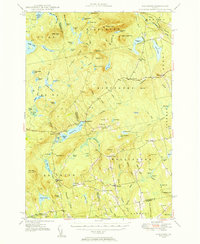
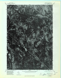
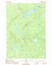
(29)- 1903 Map of Bingham, 1957 Print
 1903 Bingham1957 Print · USGSCovers Brighton Plantation, including Bingham, Moscow, and other nearby areas
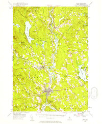
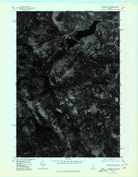
 - 1904 Map of Anson
 1904 Anson1904 Print · USGSCovers Brighton Plantation, including Skowhegan, Madison, and other nearby areas4 unique versions available
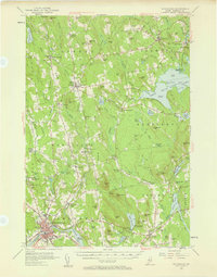
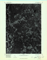
 - 1905 Map of Bingham
 1905 Bingham1905 Print · USGSCovers Brighton Plantation, including Bingham, Moscow, and other nearby areas5 unique versions available
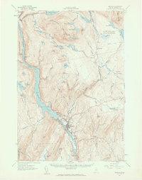
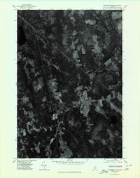
 - 1913 Map of Skowhegan
 1913 Skowhegan1913 Print · USGSCovers Brighton Plantation, including Skowhegan, Madison, and other nearby areas4 unique versions available
 - 1948 Map of Bangor
 1948 Bangor1948 Print · USGSCovers Brighton Plantation, including Bangor, Augusta, and other nearby areas
 - 1948 Map of Kingsbury, 1953 Print
 1948 Kingsbury1953 Print · USGSCovers Brighton Plantation, including Athens, Harmony, and other nearby areas3 unique versions available
 - 1950 Map of Kingsbury
 1950 Kingsbury1950 Print · USGSCovers Brighton Plantation, including Athens, Harmony, and other nearby areas2 unique versions available
 - 1954 Map of Millinocket, 1968 Print
 1954 Millinocket1968 Print · USGSCovers Brighton Plantation, including Old Town, Lincoln, and other nearby areas3 unique versions available
 - 1955 Map of Anson, 1957 Print
 1955 Anson1957 Print · USGSCovers Brighton Plantation, including Skowhegan, Madison, and other nearby areas4 unique versions available
 - 1955 Map of Skowhegan, 1958 Print
 1955 Skowhegan1958 Print · USGSCovers Brighton Plantation, including Skowhegan, Madison, and other nearby areas4 unique versions available
 - 1956 Map of Bingham, 1962 Print
 1956 Bingham1962 Print · USGSCovers Brighton Plantation, including Bingham, Moscow, and other nearby areas2 unique versions available
 - 1956 Map of Bangor, 1966 Print
 1956 Bangor1966 Print · USGSCovers Brighton Plantation, including Bangor, Augusta, and other nearby areas3 unique versions available
 - 1958 Map of Millinocket
 1958 Millinocket1958 Print · USGSCovers Brighton Plantation, including Old Town, Lincoln, and other nearby areas
 - 1960 Map of Bangor
 1960 Bangor1960 Print · USGSCovers Brighton Plantation, including Bangor, Augusta, and other nearby areas
 - 1960 Map of Millinocket
 1960 Millinocket1960 Print · USGSCovers Brighton Plantation, including Old Town, Lincoln, and other nearby areas3 unique versions available
 - 1961 Map of Bangor
 1961 Bangor1961 Print · USGSCovers Brighton Plantation, including Bangor, Augusta, and other nearby areas
 - 1975 Map of Bingham SE, 1980 Print
 1975 Bingham SE1980 Print · USGSCovers Brighton Plantation, including Bingham, Moscow, and other nearby areas
 - 1975 Map of Kingsbury SW, 1980 Print
 1975 Kingsbury SW1980 Print · USGSCovers Brighton Plantation, including Athens, Wellington, and other nearby areas
 - 1975 Map of Anson NE, 1980 Print
 1975 Anson NE1980 Print · USGSCovers Brighton Plantation, including Madison, Anson, and other nearby areas
 - 1975 Map of Kingsbury SE, 1980 Print
 1975 Kingsbury SE1980 Print · USGSCovers Brighton Plantation, including Athens, Harmony, and other nearby areas
 - 1975 Map of Skowhegan NW, 1980 Print
 1975 Skowhegan NW1980 Print · USGSCovers Brighton Plantation, including Madison, Cornville, and other nearby areas
 - 1985 Map of Skowhegan, 1986 Print
 1985 Skowhegan1986 Print · USGSCovers Brighton Plantation, including Waterville, Winslow, and other nearby areas2 unique versions available
 - 1986 Map of Dover-Foxcroft
 1986 Dover-Foxcroft1986 Print · USGSCovers Brighton Plantation, including Dover-Foxcroft, Dexter, and other nearby areas
 - 1989 Map of Kingsbury
 1989 Kingsbury1989 Print · USGSCovers Brighton Plantation, including Athens, Wellington, and other nearby areas
 - 1989 Map of Wellington
 1989 Wellington1989 Print · USGSCovers Brighton Plantation, including Athens, Harmony, and other nearby areas
Showing maps 1-25 of 29
Top cities near Brighton Plantation
- Skowhegan historical maps
- Madison historical maps
- Pittsfield historical maps
- Anson historical maps
- Canaan historical maps
- Saint Albans historical maps
See more
Top neighborhoods of Brighton Plantation
Frequently asked questions
- What are the different types of historical maps available for Brighton Plantation?
- What is the oldest map of Brighton Plantation?
- Where can I purchase historical maps of Brighton Plantation for my home or office?
- Where can I download high-res historical maps of Brighton Plantation?
- Are there historical topographic maps available for Brighton Plantation?
- Is there historical aerial imagery available for Brighton Plantation?
- Where are historical maps of Brighton Plantation sourced from?