1980s Maps of Comstock Township, Maine
Explore 8 historic maps of Comstock Township from the 1980s. These maps offer a rare glimpse into what life looked like during the 1980s — showing old roads, neighborhoods, homes, and landmarks that have changed or disappeared over time.
Whether you're researching your family's past, planning a metal detecting trip, or studying how Comstock Township's landscape evolved across the 1980s, these high-resolution maps are a powerful tool for exploring the history of this region.
- Focus on a specific era: All maps on this page are from the 1980s, giving you a focused view of this time period.
- See what’s changed: Compare century-old streets, trails, and buildings to today's modern landscape using overlays and satellite layers.
- Research with precision: Use these maps for genealogy, historical research, land use analysis, or educational projects.
- View, download, or print: Maps are fully viewable online in high resolution, and can be downloaded or printed for your own records.
Start exploring Comstock Township's history through authentic maps from the 1980s. This is your window into the past.
Comstock Township, ME maps
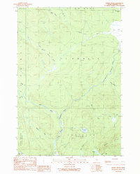
(8)- 1985 Map of Moosehead Lake, 1986 Print
 1985 Moosehead Lake1986 Print · USGSThe Maine North Woods in the 1980s remain a landscape of vast timberlands, railroads, and the sprawling waters of the state's largest lake. Researchers can trace the Canadian Pacific line through Rockwood or locate historical townships from Seboomook to Kokadjo.
 - 1986 Map of Megantic
 1986 Megantic1986 Print · USGSSettlement and industry along the international border define this mid-1980s survey of the Maine north woods. Genealogists and historians can trace the Canadian Pacific rail line through Jackman Station, Lowelltown, and the Jackman Mill.
 - 1986 Map of Chamberlain Lake
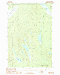
 1986 Chamberlain Lake1986 Print · USGSThe Maine North Woods in the mid-eighties appear here as a land of protected wilderness and logging heritage, centered on the Allagash Wilderness Waterway. Researchers can trace the historic Tramway at Chamberlain Lake and locate old outposts like Churchill Depot.
 - 1986 Map of Lac Etchemin
 1986 Lac Etchemin1986 Print · USGSThe Maine North Woods at the Quebec border are shown here as a landscape of timber management and remote river branches. Genealogists and historians can trace the logging history at Billy-Jack Depot and the headwaters of the St John River.
 - 1989 Map of Norris Brook
 1989 Norris Brook1989 Print · USGSSomerset County's north woods in the late eighties are defined by the winding North Branch Penobscot River and its tributary streams. Local historians and hunters can trace the drainage of Norris Brook or locate remote landmarks like Truesdale Pond and the expansive Big Bog.
 - 1989 Map of St. John Ponds
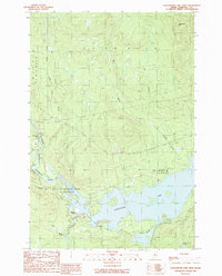
 1989 St. John Ponds1989 Print · USGSSomerset County, Maine, was a remote expanse of timberland and interconnected waterways in the late eighties. Researchers can trace the path of the Baker Branch St John River through a series of namesake ponds, from Fifth St John Pond down to Second St John Pond.
 - 1989 Map of Seboomook Lake West
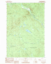
 1989 Seboomook Lake West1989 Print · USGSThe Maine North Woods in the late eighties show a landscape dominated by the timber industry and the expansive Seboomook Lake. Researchers can locate historic sites like Pittston Farm, follow the path of the Golden Road, and trace the various forks of the North Branch Penobscot River.
 - 1989 Map of Foley Pond
 1989 Foley Pond1989 Print · USGSThe North Maine Woods in the late eighties are defined by the remote timberlands of the Pittston Academy Grant. Researchers can map out old logging infrastructure, including a Lookout Tower on Green Mountain and resource sites like the Shale Pit.
End of results
Showing maps 1-8 of 8
Frequently asked questions
- What are the different types of historical maps available for Comstock Township?
- What is the oldest map of Comstock Township?
- Where can I purchase historical maps of Comstock Township for my home or office?
- Where can I download high-res historical maps of Comstock Township?
- Are there historical topographic maps available for Comstock Township?
- Is there historical aerial imagery available for Comstock Township?
- Where are historical maps of Comstock Township sourced from?