1970s Maps of Fairfield, Maine
Explore 6 historic maps of Fairfield from the 1970s. These maps offer a rare glimpse into what life looked like during the 1970s — showing old roads, neighborhoods, homes, and landmarks that have changed or disappeared over time.
Whether you're researching your family's past, planning a metal detecting trip, or studying how Fairfield's landscape evolved across the 1970s, these high-resolution maps are a powerful tool for exploring the history of this region.
- Focus on a specific era: All maps on this page are from the 1970s, giving you a focused view of this time period.
- See what’s changed: Compare century-old streets, trails, and buildings to today's modern landscape using overlays and satellite layers.
- Research with precision: Use these maps for genealogy, historical research, land use analysis, or educational projects.
- View, download, or print: Maps are fully viewable online in high resolution, and can be downloaded or printed for your own records.
Start exploring Fairfield's history through authentic maps from the 1970s. This is your window into the past.
Fairfield, ME maps
(6)- 1975 Map of Waterville NE, 1980 Print
 1975 Waterville NE1980 Print · USGSKennebec County farmland and riverfronts are captured in the mid-seventies, documenting the rural character of the Maine interior. Trace old field patterns and property lines near Clinton, Shawmut, and the Sebasticook River.
 - 1975 Map of Waterville SE, 1980 Print
 1975 Waterville SE1980 Print · USGSThe Kennebec and Sebasticook River corridors in the mid-1970s reveal a landscape of riverside industry and expanding rural neighborhoods. Genealogists and local historians can trace the footprints of Waterville, Winslow, and the outlying settlement at Goodwin Corner.
 - 1975 Map of Norridgewock NE, 1980 Print
 1975 Norridgewock NE1980 Print · USGSSomerset County's riverfront and woodlands are captured here in the mid-seventies, showing the intersection of rural life and the Kennebec River. Trace land use patterns near Norridgewock, the rise of Mount Tom, and the shorelines of North Pond.
 - 1975 Map of Norridgewock SE, 1980 Print
 1975 Norridgewock SE1980 Print · USGSThe Belgrade Lakes region comes into sharp focus in the mid-1970s through this detailed orthophoto. Researchers can trace the exact development of shoreline settlements and rural crossroads like North Belgrade, Tyler Corner, and Rome.
 - 1975 Map of Waterville NW, 1980 Print
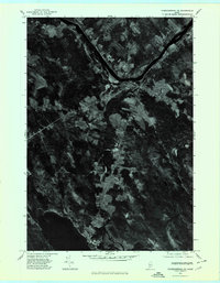
 1975 Waterville NW1980 Print · USGSNorth Fairfield and the Kennebec River valley are captured in the mid-seventies just as the rural landscape of central Maine was entering a new era of growth. Local historians can trace the footprint of crossroads settlements like Holway Corner and the riverfront community of Hinckley.
 - 1975 Map of Waterville SW, 1980 Print
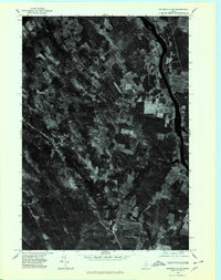
 1975 Waterville SW1980 Print · USGSThe mid-1970s landscape of Kennebec County is captured in this aerial survey, showcasing the urban layout and industrial riverfronts of central Maine. Local historians can trace the growth of Waterville and Oakland alongside the Kennebec River.
End of results
Showing maps 1-6 of 6
Top cities near Fairfield
- Waterville historical maps
- Winslow historical maps
- Skowhegan historical maps
- Oakland historical maps
- Madison historical maps
- Sidney historical maps
See more
Top neighborhoods of Fairfield
- Shawmut historical maps
- Hinckley historical maps
- Holway Corner historical maps
- Hoxies historical maps
- Larone historical maps
- North Fairfield historical maps
See more
Frequently asked questions
- What are the different types of historical maps available for Fairfield?
- What is the oldest map of Fairfield?
- Where can I purchase historical maps of Fairfield for my home or office?
- Where can I download high-res historical maps of Fairfield?
- Are there historical topographic maps available for Fairfield?
- Is there historical aerial imagery available for Fairfield?
- Where are historical maps of Fairfield sourced from?