Old Maps of Hinckley, Fairfield for Academic Research
Study the evolution of Hinckley with 15 high-resolution historic maps. Whether you're teaching, researching, or modeling changes in land use, these maps provide essential visual documentation of urban, environmental, and geographic change.
- Analyze long-term change: Track patterns in development, transportation, and natural features.
- Ideal for environmental or urban studies: Support academic projects with primary historical map data.
- Use in the classroom or lab: Educators and researchers rely on these maps to bring historical context to life.
These maps are a powerful tool for teaching, research, and visualizing how Hinckley has changed over the decades.
Hinckley, Fairfield maps
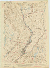
(15)- 1892 Map of Waterville
 1892 Waterville1892 Print · USGSCentral Maine thrived along the river valleys during the late nineteenth-century rail boom. Researchers can trace the development of the Maine Central Railroad through Waterville or locate older river crossings like Pishon Ferry.7 unique versions available
 - 1943 Map of Waterville
 1943 Waterville1943 Print · USGSThe Kennebec and Sebasticook river valleys are shown in detail during the early 1940s, highlighting the rail hubs of Waterville and Winslow. Genealogists can trace family landmarks like Pratt Cem or the rural Covell Sch and Ten Lots Chapel.2 unique versions available
 - 1948 Map of Bangor
 1948 Bangor1948 Print · USGSThe Maine coast and its industrial river valleys are captured here shortly after the war, showing the vital shipping and rail hubs of the late 1940s. Genealogists and historians can trace the tracks of the Maine Central RR connecting Bangor, Augusta, and Old Town.
 - 1956 Map of Bangor, 1966 Print
 1956 Bangor1966 Print · USGSMid-century Maine comes alive in this survey of the rugged coast and river valleys during the 1950s. Genealogists and historians can trace the vital rail corridors of the Maine Central RR connecting timber towns like Old Town to the coast at Bar Harbor.3 unique versions available
 - 1957 Map of Waterville, 1959 Print
 1957 Waterville1959 Print · USGSThe Kennebec River valley in the late fifties shows a bustling industrial landscape centered on the rail-and-river hub of Waterville. Researchers can trace historic institutions like Colby College, the Central Maine Sanatorium, and family-named sites such as Pishon Ferry or Ten Lots Chapel.3 unique versions available
 - 1960 Map of Bangor
 1960 Bangor1960 Print · USGSCentral Maine in the sixties reveals a landscape of river-powered industry and sprawling coastal island chains. Researchers can trace the rail corridors of the Maine Central or locate mid-century aviation landmarks like Dow Air Force Base.
 - 1961 Map of Bangor
 1961 Bangor1961 Print · USGSMid-century Maine comes alive through its busy river ports and rocky archipelagoes during a period of steady maritime and rail commerce. Researchers can trace the path of the Maine Central railroad and locate coastal landmarks from Acadia National Park to Vinalhaven Island.
 - 1975 Map of Waterville NW, 1980 Print
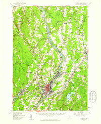
 1975 Waterville NW1980 Print · USGSNorth Fairfield and the Kennebec River valley are captured in the mid-seventies just as the rural landscape of central Maine was entering a new era of growth. Local historians can trace the footprint of crossroads settlements like Holway Corner and the riverfront community of Hinckley.
 - 1982 Map of Hinckley
 1982 Hinckley1982 Print · USGSThe Kennebec River corridor comes into focus in the early 1980s as it winds past the hills of Somerset and Kennebec counties. Genealogists and local historians can trace family burial sites like Tozier Cem and landmarks such as the Hinckley Home Farm Sch.
 - 1985 Map of Skowhegan, 1986 Print
 1985 Skowhegan1986 Print · USGSCentral Maine in the mid-eighties shows a landscape of river-driven industry and rural crossroads. Genealogists can trace family names and farmsteads near Lake George or along the Maine Central Railroad through Pittsfield and Burnham.2 unique versions available
 - 2011 Map of Hinckley, 2011 Print
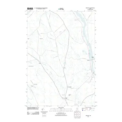 2011 Hinckley2011 Print · USGSCovers Hinckley, including Fairfield, Skowhegan, and other nearby areas
 - 2014 Map of Hinckley, 2014 Print
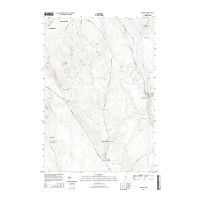 2014 Hinckley2014 Print · USGSCovers Hinckley, including Fairfield, Skowhegan, and other nearby areas
 - 2018 Map of Hinckley, 2018 Print
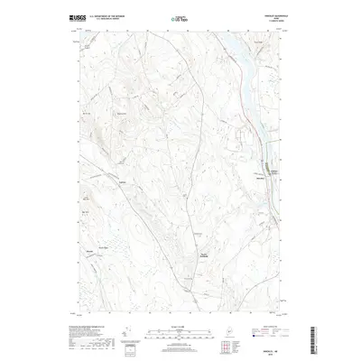 2018 Hinckley2018 Print · USGSCovers Hinckley, including Fairfield, Skowhegan, and other nearby areas
 - 2021 Map of Hinckley, 2021 Print
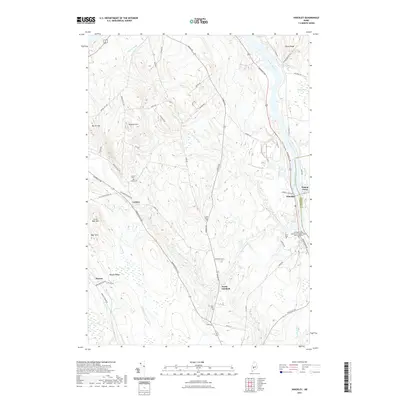 2021 Hinckley2021 Print · USGSCovers Hinckley, including Fairfield, Skowhegan, and other nearby areas
 - 2024 Map of Hinckley, 2024 Print
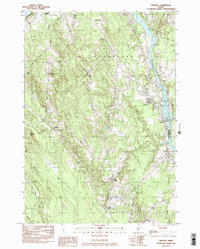
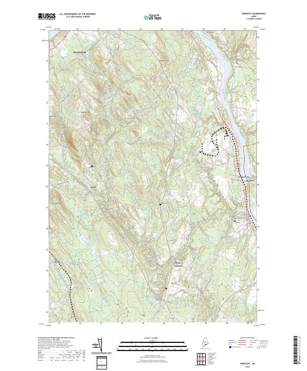 2024 Hinckley2024 Print · USGSThe Kennebec River valley in Somerset County is captured here in the early twenty-first century, showing the rural communities of Central Maine. Researchers can locate historic burial sites like Ellis Cem and Tozier Cem or trace the early crossing at Pishon Ferry.
End of results
Showing maps 1-15 of 15
Top cities near Hinckley
- Waterville historical maps
- Winslow historical maps
- Fairfield historical maps
- Skowhegan historical maps
- Oakland historical maps
- Madison historical maps
See more
Frequently asked questions
- What are the different types of historical maps available for Hinckley?
- What is the oldest map of Hinckley?
- Where can I purchase historical maps of Hinckley for my home or office?
- Where can I download high-res historical maps of Hinckley?
- Are there historical topographic maps available for Hinckley?
- Is there historical aerial imagery available for Hinckley?
- Where are historical maps of Hinckley sourced from?