Old Maps of Harmony, Maine for Genealogy
Trace your family roots with 48 historic maps of Harmony. These high-res maps reveal old neighborhoods, homesites, landmarks, and streets — helping you uncover where your ancestors lived and how the area evolved over time.
- Explore historic neighborhoods: Identify where your relatives may have lived in the 1800s or 1900s.
- Compare maps over time: Trace the changes in streets, buildings, and landmarks for multi-generational research.
- Perfect for genealogy & ancestry research: Used by family historians and researchers to map out lineage and migration.
These maps are an incredible resource for exploring your personal connection to Harmony's past.
Harmony, ME maps
(48)- 1913 Map of Skowhegan
 1913 Skowhegan1913 Print · USGSSomerset County thrives as a hub of rail and river industry in this pre-war survey. Genealogists can trace family names through dozens of rural landmarks like Malbons Mills, the Union Church, and neighborhood schoolhouses from Athens to Canaan.4 unique versions available
 - 1930 Map of Pittsfield
 1930 Pittsfield1930 Print · USGSSomerset County in the early thirties reveals a network of farming hamlets and lakeside communities connected by rail and river. Genealogists can trace family names through landmarks like Todds Corner West Ripley PO, Nutter Cemetery, and Town Farm Sch.
 - 1932 Map of Pittsfield
 1932 Pittsfield1932 Print · USGSMaine's Sebasticook Valley thrived in the early 1930s as a hub of rail transport and rural commerce. Genealogists and historians can trace the many family-named schoolhouses and crossroads, from Lincoln Mills and Dixie Corner to the Wing Cemetery.3 unique versions available
 - 1933 Map of Pittsfield
 1933 Pittsfield1933 Print · USGSSomerset County in the early 1930s is a landscape of river-driven towns and remote farm schools connected by the Maine Central rail lines. Genealogy researchers can trace family landmarks like Goodwin Corner, the Wing Cemetery, and over a dozen schoolhouses including Merrill Sch.2 unique versions available
 - 1933 Map of Guilford, 1958 Print
 1933 Guilford1958 Print · USGSPiscataquis County townships thrive along the river and rail lines of central Maine in the early thirties. Local historians can trace the foundations of Guilford, locate rural landmarks like Spooners Mill, and find family heritage at Storer Cem or Abbot Village Sta.5 unique versions available
 - 1937 Map of Guilford
 1937 Guilford1937 Print · USGSPiscataquis County industry and rural life are captured here in the mid-1930s as the river-and-rail economy thrived. Genealogists can trace family roots through numerous local schoolhouses and landmarks like Spooners Mill, Lows Bridge, and the Wassookeag Cem.2 unique versions available
 - 1948 Map of Bangor
 1948 Bangor1948 Print · USGSThe Maine coast and its industrial river valleys are captured here shortly after the war, showing the vital shipping and rail hubs of the late 1940s. Genealogists and historians can trace the tracks of the Maine Central RR connecting Bangor, Augusta, and Old Town.
 - 1948 Map of Kingsbury, 1953 Print
 1948 Kingsbury1953 Print · USGSCentral Maine's high country is captured here just after the war, showing the rural intersections of Piscataquis and Somerset Counties. Genealogists and historians can trace the family-named crossroads of Mayfield Corner, Hutchins Corner, and Moody Corner, alongside the Campbell Sch.3 unique versions available
 - 1950 Map of Kingsbury
 1950 Kingsbury1950 Print · USGSThe Maine interior at the dawn of the fifties is a patchwork of small crossroads and remote ponds. Genealogists and historians can trace family locations near Mayfield Corner, Brighton, and the Foss Hill Cem, or explore the rural school districts like Campbell Sch.2 unique versions available
 - 1954 Map of Millinocket, 1968 Print
 1954 Millinocket1968 Print · USGSMaine's North Woods and the Penobscot Valley are captured here during the mid-century era of logging and rail dominance. You can trace the path of the Bangor and Aroostook Railroad through timber towns like Millinocket, Mattawamkeag, and Silver Ridge.3 unique versions available
 - 1955 Map of Pittsfield, 1957 Print
 1955 Pittsfield1957 Print · USGSSomerset County in the mid-fifties is a landscape of established rail towns and quiet lakeside camps. Genealogists and historians can trace family-named crossroads like Nutter Corner, visit the Fern-Dale Cem, or locate the Gale Sch and Wild Goose Club.2 unique versions available
 - 1955 Map of Skowhegan, 1958 Print
 1955 Skowhegan1958 Print · USGSSomerset County in the mid-fifties shows a landscape of busy river towns and rural school districts connected by the Maine Central railroad. Genealogists can trace family names through landmarks like Malbons Mills, Cass Corner, and the Somerset Academy.4 unique versions available
 - 1956 Map of Bangor, 1966 Print
 1956 Bangor1966 Print · USGSMid-century Maine comes alive in this survey of the rugged coast and river valleys during the 1950s. Genealogists and historians can trace the vital rail corridors of the Maine Central RR connecting timber towns like Old Town to the coast at Bar Harbor.3 unique versions available
 - 1958 Map of Millinocket
 1958 Millinocket1958 Print · USGSMaine's North Woods and the Penobscot river valley are captured here in the mid-1950s, showing a landscape of timber, rail, and wild waters. Researchers can trace the legacy of the Canadian Pacific railroad and find historic settlements like Millinocket, Sherman Station, and Mattawamkeag.
 - 1960 Map of Bangor
 1960 Bangor1960 Print · USGSCentral Maine in the sixties reveals a landscape of river-powered industry and sprawling coastal island chains. Researchers can trace the rail corridors of the Maine Central or locate mid-century aviation landmarks like Dow Air Force Base.
 - 1960 Map of Millinocket
 1960 Millinocket1960 Print · USGSThe Maine North Woods and Penobscot River valley are captured at mid-century during the height of the paper milling era. Researchers can trace the Appalachian Trail near Mount Katardin or locate family roots in towns like Dover-Foxcroft and Milo.3 unique versions available
 - 1961 Map of Bangor
 1961 Bangor1961 Print · USGSMid-century Maine comes alive through its busy river ports and rocky archipelagoes during a period of steady maritime and rail commerce. Researchers can trace the path of the Maine Central railroad and locate coastal landmarks from Acadia National Park to Vinalhaven Island.
 - 1975 Map of Pittsfield NW, 1980 Print
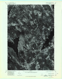 1975 Pittsfield NW1980 Print · USGSSomerset County's lake-strewn woods and small villages are captured from above in the mid-1970s. Genealogists and local historians can trace the rural layouts of St Albans and Hartland alongside landmarks like Great Moose Lake.
 - 1975 Map of Skowhegan NE, 1980 Print
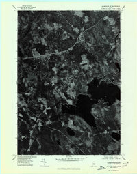 1975 Skowhegan NE1980 Print · USGSSomerset County, Maine, is captured in this mid-seventies orthophotograph showing the rural transition between forest and farmland. Genealogists and local historians can trace the clearings around Harmony and Mainstream or study the shoreline of Moose Pond.
 - 1975 Map of Guilford SW, 1980 Print
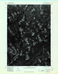 1975 Guilford SW1980 Print · USGSCentral Maine's wooded landscape is documented in the mid-1970s through this detailed aerial survey. Researchers can trace the rural layouts of Cambridge and Pingree Center alongside the natural courses of the Sebasticook and Main Stream.
 - 1975 Map of Kingsbury SE, 1980 Print
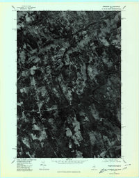 1975 Kingsbury SE1980 Print · USGSThe rural crossroads of Piscataquis County are seen here in the mid-seventies through detailed orthophoto imagery. Genealogists and local historians can trace the precise boundaries and farmsteads near Hunt Corner, Huff Corner, and Hardin Corner.
 - 1982 Map of Hartland, 1983 Print
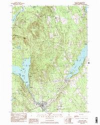 1982 Hartland1983 Print · USGSIn the early eighties, this Somerset County landscape was a tapestry of riverfront villages and wooded heights. Genealogists and local historians can trace family-named sites like Wing Cem or the Courser Memorial Sch near the shores of Indian Pond.
 - 1984 Map of Cambridge
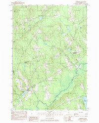 1984 Cambridge1984 Print · USGSMaine's interior border between Somerset and Piscataquis counties is captured here in the early 1980s, showcasing a landscape of timber and small-town resilience. Genealogy researchers can trace local family lineages through Mt Pleasant Cem and Tyler Cem, or locate old homesteads near Pingree Center and Cambridge.
 - 1985 Map of Skowhegan, 1986 Print
 1985 Skowhegan1986 Print · USGSCentral Maine in the mid-eighties shows a landscape of river-driven industry and rural crossroads. Genealogists can trace family names and farmsteads near Lake George or along the Maine Central Railroad through Pittsfield and Burnham.2 unique versions available
 - 1986 Map of Dover-Foxcroft
 1986 Dover-Foxcroft1986 Print · USGSPiscataquis County at the edge of the great Maine woods is documented here in the mid-1980s, centered on the river-and-rail hubs of the interior. Trace the industrial footprints of Dover South Mills, the rail yards at Brownville Junction, or the historic Katahdin Iron Works.
Showing maps 1-25 of 48
Top cities near Harmony
- Skowhegan historical maps
- Madison historical maps
- Pittsfield historical maps
- Dexter historical maps
- Norridgewock historical maps
- Corinna historical maps
See more
Top neighborhoods of Harmony
Frequently asked questions
- What are the different types of historical maps available for Harmony?
- What is the oldest map of Harmony?
- Where can I purchase historical maps of Harmony for my home or office?
- Where can I download high-res historical maps of Harmony?
- Are there historical topographic maps available for Harmony?
- Is there historical aerial imagery available for Harmony?
- Where are historical maps of Harmony sourced from?