1990s Maps of Jackman, Maine
Explore 3 historic maps of Jackman from the 1990s. These maps offer a rare glimpse into what life looked like during the 1990s — showing old roads, neighborhoods, homes, and landmarks that have changed or disappeared over time.
Whether you're researching your family's past, planning a metal detecting trip, or studying how Jackman's landscape evolved across the 1990s, these high-resolution maps are a powerful tool for exploring the history of this region.
- Focus on a specific era: All maps on this page are from the 1990s, giving you a focused view of this time period.
- See what’s changed: Compare century-old streets, trails, and buildings to today's modern landscape using overlays and satellite layers.
- Research with precision: Use these maps for genealogy, historical research, land use analysis, or educational projects.
- View, download, or print: Maps are fully viewable online in high resolution, and can be downloaded or printed for your own records.
Start exploring Jackman's history through authentic maps from the 1990s. This is your window into the past.
Jackman, ME maps
(3)- 1994 Map of Megantic
 1994 Megantic1994 Print · USGSUpper Somerset County during the early 1990s shows a landscape of remote timber outposts and the Canadian Pacific railroad. Genealogists and historians can trace the corridor through Jackman and Dennistown or locate old rail points like Skinner and Lowelltown.
 - 1997 Map of Jackman, 1999 Print
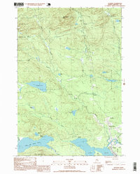 1997 Jackman1999 Print · USGSThe North Woods of Somerset County appear in the late nineties as a hub of rail and river activity. Researchers can trace the Canadian Pacific line through Jackman or locate remote sites like Foxs Camp and the Sky Lodge Landing Strip.
 - 1997 Map of Attean Pond, 1999 Print
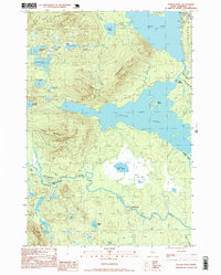 1997 Attean Pond1999 Print · USGSSomerset County’s northern woods and waterways appear here in the late twentieth century, centered on the village of Jackman. Local researchers can trace the portage and water routes between Attean Pond and Attean Landing or locate Holeb Falls on the river.
End of results
Showing maps 1-3 of 3
Top cities near Jackman
Top neighborhoods of Jackman
Frequently asked questions
- What are the different types of historical maps available for Jackman?
- What is the oldest map of Jackman?
- Where can I purchase historical maps of Jackman for my home or office?
- Where can I download high-res historical maps of Jackman?
- Are there historical topographic maps available for Jackman?
- Is there historical aerial imagery available for Jackman?
- Where are historical maps of Jackman sourced from?