Old Maps of Somerset Junction, Misery Gore for Academic Research
Study the evolution of Somerset Junction with 16 high-resolution historic maps. Whether you're teaching, researching, or modeling changes in land use, these maps provide essential visual documentation of urban, environmental, and geographic change.
- Analyze long-term change: Track patterns in development, transportation, and natural features.
- Ideal for environmental or urban studies: Support academic projects with primary historical map data.
- Use in the classroom or lab: Educators and researchers rely on these maps to bring historical context to life.
These maps are a powerful tool for teaching, research, and visualizing how Somerset Junction has changed over the decades.
Somerset Junction, Misery Gore maps
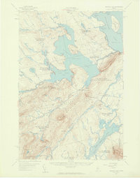
(16)- 1921 Map of Brassua Lake
 1921 Brassua Lake1921 Print · USGSThe North Maine Woods come alive in the 1920s at the intersection of the Canadian Pacific and Maine Central railroads. Genealogists and historians can trace logging-era life at Somerset Junction, Blaine School, and numerous seasonal sites like Depot Camp.3 unique versions available
 - 1923 Map of Brassua Lake
 1923 Brassua Lake1923 Print · USGSRailroads and river routes intersect in the Maine north woods at the start of the 1920s. Genealogists and historians can trace the junction of the Canadian Pacific at Somerset Junction Tarratine PO and locate remote outposts like Blaine School and Cornish Farm.4 unique versions available
 - 1944 Map of Brassua Lake
 1944 Brassua Lake1944 Print · USGSCentral Maine was a landscape of remote sporting camps and logging rail lines in the mid-1940s. Genealogists and historians can trace old homesteads and landmarks like Somerset Junction, Blaine Sch, and Cornish Farm.
 - 1954 Map of Millinocket, 1968 Print
 1954 Millinocket1968 Print · USGSMaine's North Woods and the Penobscot Valley are captured here during the mid-century era of logging and rail dominance. You can trace the path of the Bangor and Aroostook Railroad through timber towns like Millinocket, Mattawamkeag, and Silver Ridge.3 unique versions available
 - 1957 Map of Brassua Lake, 1959 Print
 1957 Brassua Lake1959 Print · USGSThe northern Maine woods around Rockwood are captured here during the late 1950s, a time of transition for the region's rail and river systems. Genealogists and historians can locate family-named clearings like Milliken Farm, local institutions such as Blaine Sch, and the winding path of the Canadian Pacific Railroad.5 unique versions available
 - 1958 Map of Millinocket
 1958 Millinocket1958 Print · USGSMaine's North Woods and the Penobscot river valley are captured here in the mid-1950s, showing a landscape of timber, rail, and wild waters. Researchers can trace the legacy of the Canadian Pacific railroad and find historic settlements like Millinocket, Sherman Station, and Mattawamkeag.
 - 1960 Map of Millinocket
 1960 Millinocket1960 Print · USGSThe Maine North Woods and Penobscot River valley are captured at mid-century during the height of the paper milling era. Researchers can trace the Appalachian Trail near Mount Katardin or locate family roots in towns like Dover-Foxcroft and Milo.3 unique versions available
 - 1977 Map of Indian Pond North, 1981 Print
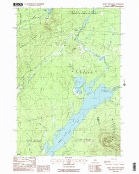
 1977 Indian Pond North1981 Print · USGSSomerset County, Maine, is captured in the late 1970s as a landscape of timber and wild water. Researchers can trace the rail and river history of Tarratine and Somerset Junction or locate the headwaters of the Kennebec River.
 - 1985 Map of Moosehead Lake, 1986 Print
 1985 Moosehead Lake1986 Print · USGSThe Maine North Woods in the 1980s remain a landscape of vast timberlands, railroads, and the sprawling waters of the state's largest lake. Researchers can trace the Canadian Pacific line through Rockwood or locate historical townships from Seboomook to Kokadjo.
 - 1988 Map of Indian Pond North
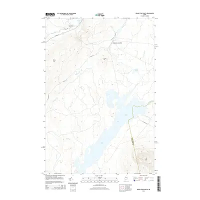
 1988 Indian Pond North1988 Print · USGSSomerset County in the late eighties was a landscape of timber-townships and essential riverways. Genealogists and historians can trace the rail history at Somerset Junction, locate the small settlement at Tarratine, and follow the OLD RAILROAD GRADE through MISERY GORE.2 unique versions available
 - 1994 Map of Moosehead Lake
 1994 Moosehead Lake1994 Print · USGSThe Maine North Woods at the end of the twentieth century remains a landscape of vast timberlands and remote outposts. Researchers can trace the Appalachian National Scenic Trail and locate historic water controls like Chesuncook Dam and Ripogenus Dam.
 - 2011 Map of Indian Pond North, 2011 Print
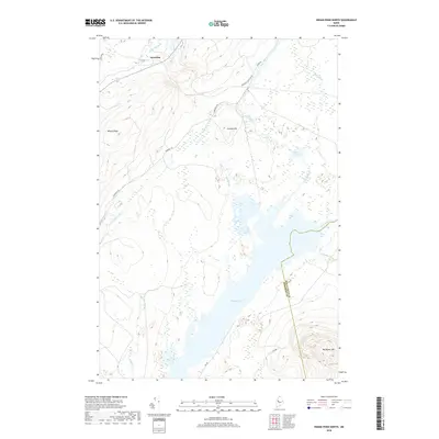
 2011 Indian Pond North2011 Print · USGSCovers Somerset Junction, including Misery Gore, Sapling Township, and other nearby areas
 - 2014 Map of Indian Pond North, 2014 Print
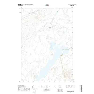
 2014 Indian Pond North2014 Print · USGSCovers Somerset Junction, including Misery Gore, Sapling Township, and other nearby areas
 - 2018 Map of Indian Pond North, 2018 Print
 2018 Indian Pond North2018 Print · USGSCovers Somerset Junction, including Misery Gore, Sapling Township, and other nearby areas
 - 2021 Map of Indian Pond North, 2021 Print
 2021 Indian Pond North2021 Print · USGSCovers Somerset Junction, including Misery Gore, Sapling Township, and other nearby areas
 - 2024 Map of Indian Pond North, 2024 Print
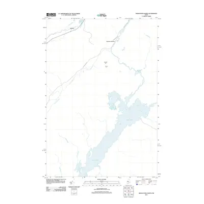
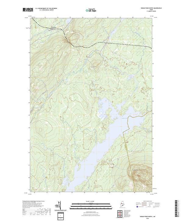 2024 Indian Pond North2024 Print · USGSThe northern reaches of Somerset County are shown in contemporary detail, where the settlement of Tarratine meets the vast waters of Indian Pond. Modern researchers can trace the routes of Somerset Rd and Its 88 through landmarks like Big Moose Mtn and Misery Ridge.
End of results
Showing maps 1-16 of 16
Top cities near Somerset Junction
- Greenville historical maps
- Shirley historical maps
- Beaver Cove historical maps
- West Forks historical maps
Frequently asked questions
- What are the different types of historical maps available for Somerset Junction?
- What is the oldest map of Somerset Junction?
- Where can I purchase historical maps of Somerset Junction for my home or office?
- Where can I download high-res historical maps of Somerset Junction?
- Are there historical topographic maps available for Somerset Junction?
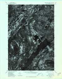
- Is there historical aerial imagery available for Somerset Junction?
- Where are historical maps of Somerset Junction sourced from?