Old Maps of Parlin Pond Township, Maine
Explore 23 old maps of Parlin Pond Township, spanning from 1922 to today. These high-resolution historic maps reveal how streets, neighborhoods, landmarks, and natural features evolved over time — perfect for genealogy, metal detecting, research, and local history exploration.
What you can do with these maps:
- See how Parlin Pond Township changed over time: Compare historical maps to modern-day views to trace roads, homesites, rail lines & more.
- View detailed metadata: Each map includes creators, publishers, year, scale, and archive source.
- Overlay maps with satellite & LiDAR: Visualize the past alongside modern tools to explore terrain & human change.
- Trusted historical sources: Maps sourced from the USGS, Library of Congress, and other archives.
- Access maps your way: View online, download high-res files, or order prints for personal or research use.
Start exploring old maps of Parlin Pond Township to uncover forgotten places, hidden landmarks, and the deep history beneath your feet.
Parlin Pond Township, ME maps
(23)- 1922 Map of Long Pond, 1955 Print
 1922 Long Pond1955 Print · USGSThe Maine north woods in the early twenties reveals a landscape defined by the Canadian Pacific rail line and the timber industry. Genealogists and historians can trace family-named sites like Fogg Farm, Mackamp, and Jackman Mill.5 unique versions available
 - 1924 Map of Long Pond
 1924 Long Pond1924 Print · USGSSomerset County’s timber and rail landscape is captured here in the early twenties as the logging and sporting industries thrived. Trace the Canadian Pacific rail line through Jackman Station to remote outposts like Mackamp and the Whipple Farm.5 unique versions available
 - 1944 Map of Long Pond
 1944 Long Pond1944 Print · USGSSomerset County's timber and rail corridor is captured here during the mid-forties as the north woods economy thrived. Genealogists and historians can trace family locations at Whipple Farm or follow the Canadian Pacific line to Jackman Station and Mackamp.
 - 1949 Map of Jackman
 1949 Jackman1949 Print · USGSThe Quebec and Maine borderlands are shown in great detail during the late 1940s, highlighting the industrial and natural geography of the region. Trace old rail lines like the Canadian Pacific and locate settlements from Sherbrooke to Scotstown.2 unique versions available
 - 1963 Map of Jackman
 1963 Jackman1963 Print · USGSThe international borderlands of Maine and Quebec come alive in the mid-twentieth century, showing a landscape of timber towns and rail connections. Genealogists and historians can trace the paths of the Canadian Pacific Railway through Jackman or locate families in Sherbrooke and Megantic.
 - 1966 Map of Sherbrooke
 1966 Sherbrooke1966 Print · USGSThe borderlands of Quebec and Maine come alive in the mid-1960s, documenting the industrial towns and deep woods of the Northeast. Genealogists can trace family lines through Sherbrooke and Coaticook, or locate remote logging outposts along the Moose River and Flagstaff Lake.
 - 1976 Map of Sherbrooke
 1976 Sherbrooke1976 Print · USGSThe northern Maine woods and Quebec’s Eastern Townships meet in this mid-century survey of the rugged international borderlands. Genealogists and historians can trace rail-and-river connections through Thetford Mines, follow the Dead River to Flagstaff Lake, or locate small border crossings at Stanhope and Beecher Falls.2 unique versions available
 - 1977 Map of Catheart Mountain, 1983 Print
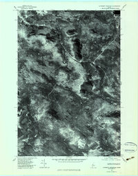 1977 Catheart Mountain1983 Print · USGSSomerset County in the late seventies is captured here in sharp aerial detail, showing a landscape defined by timber and water. Researchers can trace remote logging access roads and shoreline features near Attean Pond, Jackman Station, and Catheart Mountain.
 - 1979 Map of Long Pond, 1983 Print
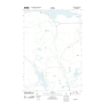
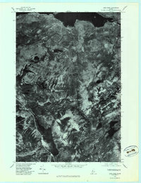 1979 Long Pond1983 Print · USGSThe deep woods of Somerset County are seen from above in the late seventies, documenting the remote lake country of northern Maine. Researchers can trace the wild shorelines of Lake Parlin and Long Pond or locate the small clearing at Mackamp.
 - 1986 Map of Megantic
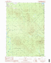
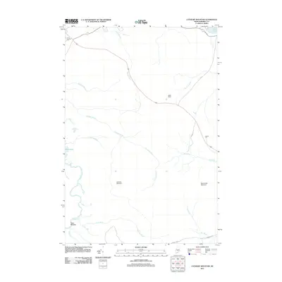
 1986 Megantic1986 Print · USGSSettlement and industry along the international border define this mid-1980s survey of the Maine north woods. Genealogists and historians can trace the Canadian Pacific rail line through Jackman Station, Lowelltown, and the Jackman Mill.
 - 1989 Map of Catheart Mountain
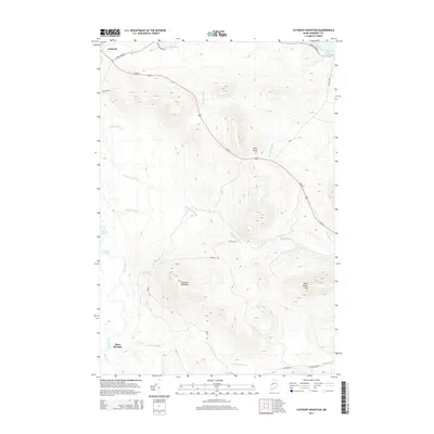
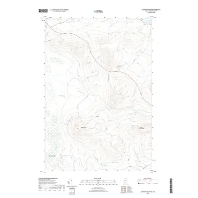
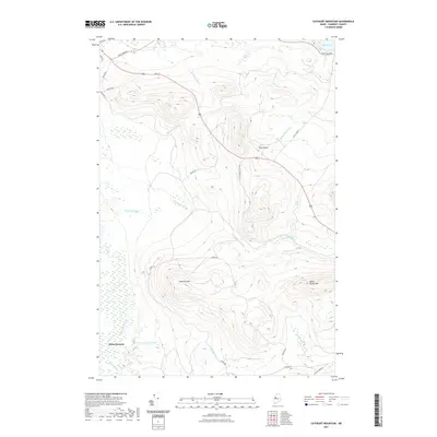
 1989 Catheart Mountain1989 Print · USGSJackman and the surrounding Somerset County wilderness are documented here in the late eighties as the region balanced timber interests and outdoor recreation. Researchers can trace the Moose River corridor from Attean Falls past Jackman Field and into the shadow of Catheart Mountain.
 - 1989 Map of Long Pond
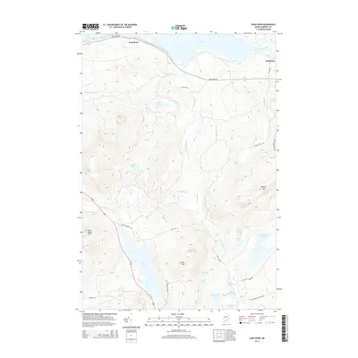
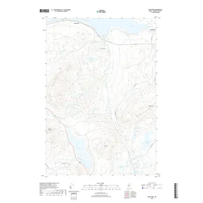
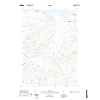
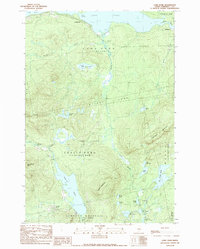 1989 Long Pond1989 Print · USGSThe Maine North Woods are captured here in the late eighties, featuring the remote settlement of Mackamp and the expansive waters of Long Pond. Researchers can trace old logging routes and survey boundaries like Misery Gore or locate isolated landmarks such as Parlin Mountain and Fernald Pond.
 - 1994 Map of Megantic
 1994 Megantic1994 Print · USGSUpper Somerset County during the early 1990s shows a landscape of remote timber outposts and the Canadian Pacific railroad. Genealogists and historians can trace the corridor through Jackman and Dennistown or locate old rail points like Skinner and Lowelltown.
 - 2011 Map of Long Pond, 2011 Print
 2011 Long Pond2011 Print · USGSCovers Parlin Pond Township, including Jackman, Misery Gore, and other nearby areas
 - 2011 Map of Catheart Mountain, 2011 Print
 2011 Catheart Mountain2011 Print · USGSCovers Parlin Pond Township, including Jackman, Misery Gore, and other nearby areas
 - 2014 Map of Long Pond, 2014 Print
 2014 Long Pond2014 Print · USGSCovers Parlin Pond Township, including Jackman, Misery Gore, and other nearby areas
 - 2014 Map of Catheart Mountain, 2014 Print
 2014 Catheart Mountain2014 Print · USGSCovers Parlin Pond Township, including Jackman, Misery Gore, and other nearby areas
 - 2018 Map of Long Pond, 2018 Print
 2018 Long Pond2018 Print · USGSCovers Parlin Pond Township, including Jackman, Misery Gore, and other nearby areas
 - 2018 Map of Catheart Mountain, 2018 Print
 2018 Catheart Mountain2018 Print · USGSCovers Parlin Pond Township, including Jackman, Misery Gore, and other nearby areas
 - 2021 Map of Catheart Mountain, 2021 Print
 2021 Catheart Mountain2021 Print · USGSCovers Parlin Pond Township, including Jackman, Misery Gore, and other nearby areas
 - 2021 Map of Long Pond, 2021 Print
 2021 Long Pond2021 Print · USGSCovers Parlin Pond Township, including Jackman, Misery Gore, and other nearby areas
 - 2024 Map of Catheart Mountain, 2024 Print
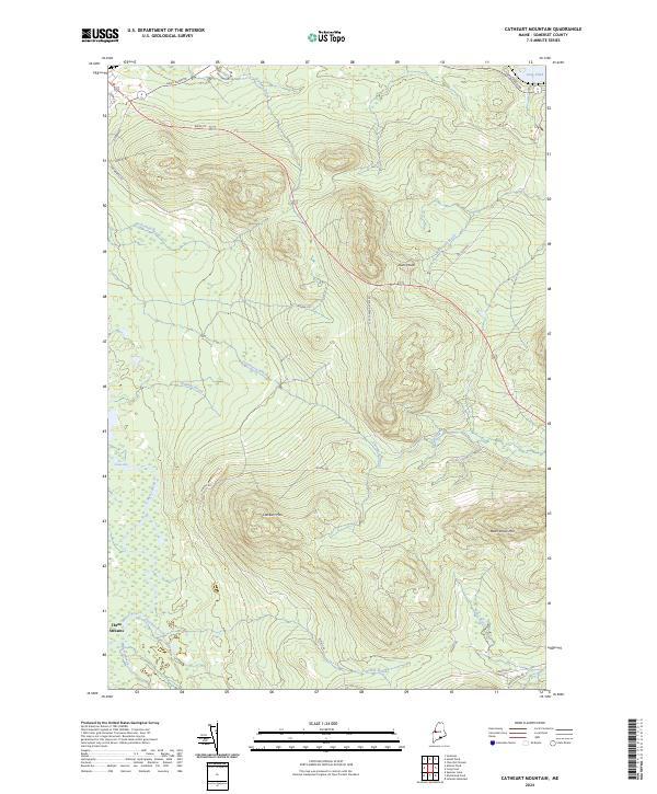 2024 Catheart Mountain2024 Print · USGSUpper Somerset County in the contemporary era reveals a landscape shaped by the timber industry and river systems. Researchers can trace the legacy of land use through industrial markers like the Scott Paper Access Rd and the remote settlement at Three Streams.
 - 2024 Map of Long Pond, 2024 Print
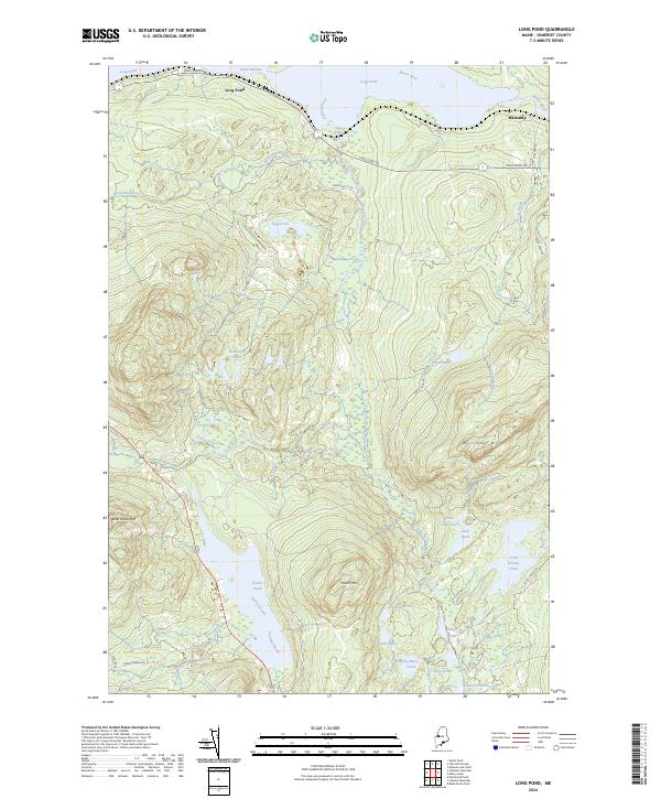 2024 Long Pond2024 Print · USGSSomerset County's north woods are captured here in the early twenty-first century, showing a landscape defined by timber heritage and high-country waters. Researchers can trace the layout of Mackamp or locate remote landmarks like Bean Brook Mtn and Parlin Pond.
End of results
Showing maps 1-23 of 23
Top cities near Parlin Pond Township
- Jackman historical maps
- Moose River historical maps
- Dennistown Plantation historical maps
- West Forks historical maps
- The Forks historical maps
Frequently asked questions
- What are the different types of historical maps available for Parlin Pond Township?
- What is the oldest map of Parlin Pond Township?
- Where can I purchase historical maps of Parlin Pond Township for my home or office?
- Where can I download high-res historical maps of Parlin Pond Township?
- Are there historical topographic maps available for Parlin Pond Township?
- Is there historical aerial imagery available for Parlin Pond Township?
- Where are historical maps of Parlin Pond Township sourced from?