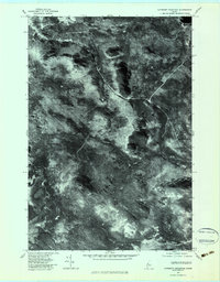
1977 Map of Catheart Mountain
USGS Topo · Published 1983About this map
Jackman Station serves as the northern anchor for this orthophotoquad, which captures the Somerset County landscape as it appeared in the late 1970s. The imagery highlights a rugged wilderness dominated by heavy timber and water, where the Moose River and Thompson Brook drain into the expansive Attean Pond. Unlike standard topographic maps, this aerial perspective reveals the dense vegetation patterns surrounding the elevations of Catheart Mountain and Owls Head, offering a clear view of the logging roads and clearings that defined the local economy during this era.
Find a feature on this map
10 named features on this map. Tap any name to fly to it.
Don’t see what you’re looking for? This feature index may not catch every label — zoom into the map to look around manually.
Map Details
Editions of this 1977 Catheart Mountain Map
This is the sole edition of this map. No revisions or reprints were ever made.
Other maps of this area

1922 · Long Pond
USGS Topo · 1:62,500

1923 · Attean
USGS Topo · 1:62,500

1924 · Long Pond
USGS Topo · 1:62,500

1925 · Pierce Pond
USGS Topo · 1:48,000

1925 · Attean
USGS Topo · 1:62,500

1927 · Pierce Pond
USGS Topo · 1:62,500

1928 · Spencer
USGS Topo · 1:48,000

1932 · Spencer
USGS Topo · 1:62,500

1944 · Long Pond
USGS Topo · 1:62,500

1944 · Pierce Pond
USGS Topo · 1:62,500
Featured Places
- Jackman, ME
- Misery Gore, ME
- Attean Township, ME
- Upper Enchanted Township, ME
- Johnson Mountain Township, ME