
1944 Map of Long Pond
USGS Topo · Published 1944About this map
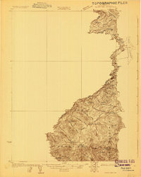
The Canadian Pacific railroad cuts a vital corridor through the Somerset County wilderness, connecting remote stations like Jackman Station and Mackamp. During this mid-century period, the landscape is defined by the Moose River and the expansive Long Pond, where industry and recreation meet. Local enterprise is visible at Jackman Mill, while numerous seasonal outposts such as Hughey Camp, Churchill Camp, and the Tourist Camp reflect the area's role in Maine's timber and sporting traditions. Beyond the tracks, family holdings like Whipple Farm and Fogg Farm represent small-scale agriculture established amid significant peaks, including Bald Mountain and Parlin Mt. The presence of Jackman Field and various landings along the shores of Lake Parlin suggests a transition toward aerial and road-based access in this interior region.
Find a feature on this map
63 named features on this map. Tap any name to fly to it.
Don’t see what you’re looking for? This feature index may not catch every label — zoom into the map to look around manually.
Map Details
Editions of this 1944 Long Pond Map
This is the sole edition of this map. No revisions or reprints were ever made.
Other maps of this area

1905 · The Forks
USGS Topo · 1:62,500

1907 · The Forks
USGS Topo · 1:62,500

1921 · Brassua Lake
USGS Topo · 1:62,500

1922 · Long Pond
USGS Topo · 1:62,500

1923 · Brassua Lake
USGS Topo · 1:62,500

1923 · Attean
USGS Topo · 1:62,500

1924 · Long Pond
USGS Topo · 1:62,500

1925 · Pierce Pond
USGS Topo · 1:48,000

1925 · Attean
USGS Topo · 1:62,500
1927 · Sandy Bay
USGS Topo · 1:48,000