Old Maps of T10 R16 WELS, Maine for Hiking & Exploration
Hike through history with 36 historic maps of T10 R16 WELS. Explore old trails, ghost towns, and forgotten backroads — perfect for outdoor adventurers and local explorers.
- Rediscover forgotten places: Map out old mining camps, roads, and footpaths that no longer exist on modern maps.
- Layer with modern tools: Combine with LiDAR or satellite views to plan hikes through historical terrain.
- Made for exploration: Popular among hikers, overlanders, and local history lovers.
Use these maps to find adventure and explore the hidden past of T10 R16 WELS.
T10 R16 WELS, ME maps
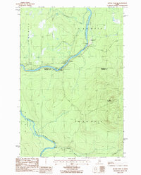
(36)- 1954 Map of Baker Lake, 1955 Print
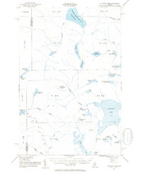
 1954 Baker Lake1955 Print · USGSThe Maine North Woods in the early fifties are shown here as a remote timberland network along the St John River. You can trace the path of the Telephone Trail and locate specific backcountry water bodies like Baker Lake and St Francis Lake.
 - 1954 Map of Allagash Lake, 1955 Print
 1954 Allagash Lake1955 Print · USGSNorthern Maine's remote timberlands are captured here in the mid-fifties, before modern roads reached these deep woods. Trace the wilderness waterways from Allagash Lake to the Allagash Lookout Tower and the remote St Francis Lake.2 unique versions available
 - 1954 Map of Presque Isle, 1968 Print
 1954 Presque Isle1968 Print · USGSNorth Woods logging and rail history come alive in this mid-century survey of the Maine-Quebec borderlands. Genealogists and historians can trace the Bangor and Aroostook railroad through timber hubs like Ashland, Smyrna Mills, and Presque Isle.2 unique versions available
 - 1955 Map of Beaver Pond, 1956 Print
 1955 Beaver Pond1956 Print · USGSThe Maine-Quebec borderlands are captured in the mid-fifties, showing a landscape of timber townships and river headwaters. Trace the remote Customs Office on the Daaquam River and the wild drainages of Sugarloaf Mountain.3 unique versions available
 - 1955 Map of Clayton Lake, 1956 Print
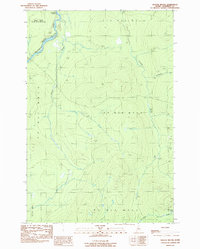
 1955 Clayton Lake1956 Print · USGSThe North Maine Woods in the mid-1950s remained a remote timberland shaped by the St John River and expansive lakes. Researchers can locate specific backcountry outposts like Ninemile Bridge, Gannett Camp, and the Game Warden Camp along the winding logging roads.2 unique versions available
 - 1958 Map of Presque Isle
 1958 Presque Isle1958 Print · USGSThe Aroostook timber and potato country is captured here during the late fifties, showing the vital rail-to-river network of Northern Maine. Genealogists and historians can trace the Bangor & Aroostook RR through Mapleton and Ashland, or locate remote sites like Chamberlain Farm and Seven Islands.
 - 1960 Map of Presque Isle
 1960 Presque Isle1960 Print · USGSNorthern Maine during the mid-century was a land of timber, rails, and strategic airfields. Genealogists and historians can trace the growth of Presque Isle and Ashland or explore the remote northern reaches of Baxter State Park and Presque Isle AFB.3 unique versions available
 - 1961 Map of Allagash Lake, 1964 Print
 1961 Allagash Lake1964 Print · USGSThe Maine north woods in the early sixties remain a vast network of timberlands and interconnected waterways. Researchers can trace remote logging infrastructure and forestry outposts like the Lookout Tower on Allagash Mtn and the Forest Service Camp near Allagash Lake.3 unique versions available
 - 1962 Map of Baker Lake, 1964 Print
 1962 Baker Lake1964 Print · USGSNorth Maine Woods townships were largely defined by timber and water during the early sixties. Researchers can trace remote logging infrastructure and river systems like the Baker Branch St John River, Baker Lake, and the Forest Service Camp.2 unique versions available
 - 1986 Map of Beaver Pond SE
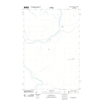
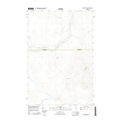
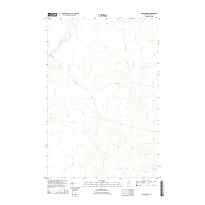
 1986 Beaver Pond SE1986 Print · USGSThe northern Maine wilderness of the 1980s is captured here, centered on the confluence of the St John River and its Southwest Branch. Researchers can trace the era's timber and transit network through the Red Pine Grove Landing Strip and remote outposts like Knowles Campsite.
 - 1986 Map of Chamberlain Lake
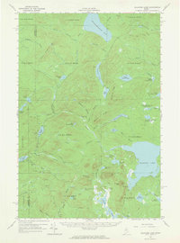
 1986 Chamberlain Lake1986 Print · USGSThe Maine North Woods in the mid-eighties appear here as a land of protected wilderness and logging heritage, centered on the Allagash Wilderness Waterway. Researchers can trace the historic Tramway at Chamberlain Lake and locate old outposts like Churchill Depot.
 - 1986 Map of Fool Brook, 1987 Print
 1986 Fool Brook1987 Print · USGSThe northern Maine woods at the intersection of Somerset and Piscataquis counties are captured here in the mid-eighties. Researchers can trace the logging infrastructure and water network around Ross Lake, including Gannett Camp and Fool Brook.
 - 1989 Map of Doucie Brook
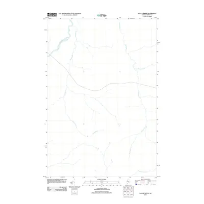
 1989 Doucie Brook1989 Print · USGSThis late-century survey captures the Maine North Woods at a time when the region was primarily defined by timber management and remote waterways. Researchers can trace primitive roads and key drainage systems like Knowles Brook, Desolation Pond, and the Doucie Brook Campsite.
 - 1989 Map of Allagash Pond
 1989 Allagash Pond1989 Print · USGSThe Maine North Woods in the late 1980s reveal a wilderness of interconnected waterways and timber ridges at the Somerset and Piscataquis county line. Trace the remote reaches of Chemquasabamticook Lake and the headwaters of Allagash Pond.
 - 1993 Map of Clayton Lake, 1994 Print
 1993 Clayton Lake1994 Print · USGSThe North Woods along the Maine and Quebec border remained a vast wilderness of timber and water in the early nineties. Researchers can trace historic river crossings and remote outposts like Ninemile Bridge, Saint-Pamphile, and the Harvey Farm.
 - 1994 Map of Chamberlain Lake
 1994 Chamberlain Lake1994 Print · USGSThe North Maine Woods in the early nineties remained a network of logging outposts and protected waterways. You can trace the historic logging infrastructure at Churchill Depot, the portage at Tramway, and remote landings such as Telos Landing.
 - 2011 Map of Doucie Brook, 2011 Print
 2011 Doucie Brook2011 Print · USGSCovers T10 R16 WELS, including T9 R17 WELS, Big Ten Township, and other nearby areas
 - 2011 Map of Beaver Pond SE, 2011 Print
 2011 Beaver Pond SE2011 Print · USGSCovers T10 R16 WELS, including Big Ten Township, Powers Gore, and other nearby areas
 - 2011 Map of Allagash Pond, 2011 Print
 2011 Allagash Pond2011 Print · USGSCovers T10 R16 WELS, including T9 R15 WELS, T8 R15 WELS, and other nearby areas
 - 2011 Map of Fool Brook, 2011 Print
 2011 Fool Brook2011 Print · USGSCovers T10 R16 WELS, including T10 R15 WELS, T11 R15 WELS, and other nearby areas
 - 2014 Map of Allagash Pond, 2014 Print
 2014 Allagash Pond2014 Print · USGSCovers T10 R16 WELS, including T9 R15 WELS, T8 R15 WELS, and other nearby areas
 - 2014 Map of Beaver Pond SE, 2014 Print
 2014 Beaver Pond SE2014 Print · USGSCovers T10 R16 WELS, including Big Ten Township, Powers Gore, and other nearby areas
 - 2014 Map of Fool Brook, 2014 Print
 2014 Fool Brook2014 Print · USGSCovers T10 R16 WELS, including T10 R15 WELS, T11 R15 WELS, and other nearby areas
 - 2014 Map of Doucie Brook, 2014 Print
 2014 Doucie Brook2014 Print · USGSCovers T10 R16 WELS, including T9 R17 WELS, Big Ten Township, and other nearby areas
 - 2018 Map of Allagash Pond, 2018 Print
 2018 Allagash Pond2018 Print · USGSCovers T10 R16 WELS, including T9 R15 WELS, T8 R15 WELS, and other nearby areas
Showing maps 1-25 of 36
Frequently asked questions
- What are the different types of historical maps available for T10 R16 WELS?
- What is the oldest map of T10 R16 WELS?
- Where can I purchase historical maps of T10 R16 WELS for my home or office?
- Where can I download high-res historical maps of T10 R16 WELS?
- Are there historical topographic maps available for T10 R16 WELS?
- Is there historical aerial imagery available for T10 R16 WELS?
- Where are historical maps of T10 R16 WELS sourced from?