Old Maps of Thorndike Township, Maine for Academic Research
Study the evolution of Thorndike Township with 38 high-resolution historic maps. Whether you're teaching, researching, or modeling changes in land use, these maps provide essential visual documentation of urban, environmental, and geographic change.
- Analyze long-term change: Track patterns in development, transportation, and natural features.
- Ideal for environmental or urban studies: Support academic projects with primary historical map data.
- Use in the classroom or lab: Educators and researchers rely on these maps to bring historical context to life.
These maps are a powerful tool for teaching, research, and visualizing how Thorndike Township has changed over the decades.
Thorndike Township, ME maps
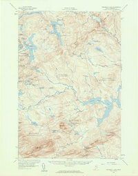
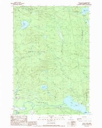
(38)- 1922 Map of Long Pond, 1955 Print
 1922 Long Pond1955 Print · USGSThe Maine north woods in the early twenties reveals a landscape defined by the Canadian Pacific rail line and the timber industry. Genealogists and historians can trace family-named sites like Fogg Farm, Mackamp, and Jackman Mill.5 unique versions available
 - 1924 Map of Long Pond
 1924 Long Pond1924 Print · USGSSomerset County’s timber and rail landscape is captured here in the early twenties as the logging and sporting industries thrived. Trace the Canadian Pacific rail line through Jackman Station to remote outposts like Mackamp and the Whipple Farm.5 unique versions available
 - 1944 Map of Long Pond
 1944 Long Pond1944 Print · USGSSomerset County's timber and rail corridor is captured here during the mid-forties as the north woods economy thrived. Genealogists and historians can trace family locations at Whipple Farm or follow the Canadian Pacific line to Jackman Station and Mackamp.
 - 1949 Map of Jackman
 1949 Jackman1949 Print · USGSThe Quebec and Maine borderlands are shown in great detail during the late 1940s, highlighting the industrial and natural geography of the region. Trace old rail lines like the Canadian Pacific and locate settlements from Sherbrooke to Scotstown.2 unique versions available
 - 1956 Map of Penobscot Lake, 1960 Print
 1956 Penobscot Lake1960 Print · USGSThe Maine-Quebec borderlands in the mid-1950s reveal a landscape of timber townships and remote waterways. Trace the Bald Mtn Trail to the Lookout Tower or explore the vast Penobscot Lake and the North Branch Penobscot River.4 unique versions available
 - 1963 Map of Jackman
 1963 Jackman1963 Print · USGSThe international borderlands of Maine and Quebec come alive in the mid-twentieth century, showing a landscape of timber towns and rail connections. Genealogists and historians can trace the paths of the Canadian Pacific Railway through Jackman or locate families in Sherbrooke and Megantic.
 - 1966 Map of Sherbrooke
 1966 Sherbrooke1966 Print · USGSThe borderlands of Quebec and Maine come alive in the mid-1960s, documenting the industrial towns and deep woods of the Northeast. Genealogists can trace family lines through Sherbrooke and Coaticook, or locate remote logging outposts along the Moose River and Flagstaff Lake.
 - 1976 Map of Sherbrooke
 1976 Sherbrooke1976 Print · USGSThe northern Maine woods and Quebec’s Eastern Townships meet in this mid-century survey of the rugged international borderlands. Genealogists and historians can trace rail-and-river connections through Thetford Mines, follow the Dead River to Flagstaff Lake, or locate small border crossings at Stanhope and Beecher Falls.2 unique versions available
 - 1977 Map of Heald Pond, 1983 Print
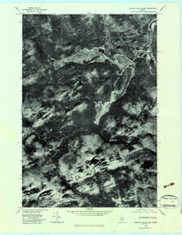
 1977 Heald Pond1983 Print · USGSThe Maine woods and their industrial timber roots are visible in this late 1970s aerial survey of Somerset County. Researchers can trace the water-based economy of the day through the Jackman Mill and the vast reaches of Long Pond and the Moose River.
 - 1977 Map of Boundary Bald Mountain, 1983 Print
 1977 Boundary Bald Mountain1983 Print · USGSThe Maine wilderness near the Canadian border is captured here in the late seventies, showing the dense timberlands of Somerset County. Outdoorsmen and historians can trace the headwaters of the South Branch Penobscot River and landmarks like Jones Pond and Boundary Bald Mountain.
 - 1979 Map of Churchill Stream, 1983 Print
 1979 Churchill Stream1983 Print · USGSSomerset County's dense timberlands and waterways are captured in detail at the close of the seventies. Researchers can trace the precise flow of Churchill Stream and the northern reaches of Long Pond across this aerial orthophoto.
 - 1979 Map of Canada Falls Lake, 1983 Print
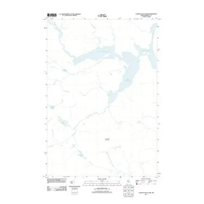
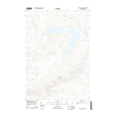
 1979 Canada Falls Lake1983 Print · USGSSomerset County, Maine, is captured in this late 1970s orthophotoquad showing the northern wilderness at a transition point in modern land management. Trace the winding shoreline of Canada Falls Lake and the intricate bends of the South Branch Penobscot River.
 - 1986 Map of Megantic
 1986 Megantic1986 Print · USGSSettlement and industry along the international border define this mid-1980s survey of the Maine north woods. Genealogists and historians can trace the Canadian Pacific rail line through Jackman Station, Lowelltown, and the Jackman Mill.
 - 1989 Map of Canada Falls Lake
 1989 Canada Falls Lake1989 Print · USGSSomerset County's timberlands and waterways are captured in the late eighties, documenting a remote region of northern Maine. Researchers can trace the drainage of the South Branch Penobscot River and locate landmarks like Ironbound Mountain and Canada Falls Lake.
 - 1989 Map of Churchill Stream
 1989 Churchill Stream1989 Print · USGSSomerset County, Maine, was a landscape of remote timberlands and expansive bogs in the late eighties. Researchers can trace the hydrography of the northern woods through features like Twelvemile Bog, the winding Churchill Stream, and numerous isolated waters including Luther Pond.
 - 1989 Map of Boundary Bald Mountain
 1989 Boundary Bald Mountain1989 Print · USGSThe Maine wilderness near the Canadian border comes into focus in the late eighties, documenting the remote townships of Somerset County. Researchers can trace the waters of the South Branch Penobscot River and locate landmarks like Moose Mtn and Jones Pond.2 unique versions available
 - 1989 Map of Heald Pond
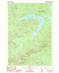
 1989 Heald Pond1989 Print · USGSSomerset County's remote timber and water systems are captured here in the late eighties, showing a landscape defined by the Moose River and its glacial ponds. Researchers can find old landmarks like Whipple Farm, the settlement of Blair, and several remote Gravel Pits.
 - 1994 Map of Megantic
 1994 Megantic1994 Print · USGSUpper Somerset County during the early 1990s shows a landscape of remote timber outposts and the Canadian Pacific railroad. Genealogists and historians can trace the corridor through Jackman and Dennistown or locate old rail points like Skinner and Lowelltown.
 - 2011 Map of Churchill Stream, 2011 Print
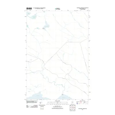 2011 Churchill Stream2011 Print · USGSCovers Thorndike Township, including Brassua Township, Rockwood Strip T2 R1 NBKP, and other nearby areas
 - 2011 Map of Heald Pond, 2011 Print
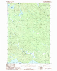
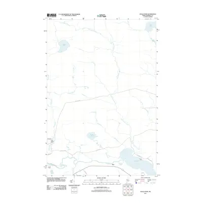 2011 Heald Pond2011 Print · USGSCovers Thorndike Township, including Jackman, Moose River, and other nearby areas
 - 2011 Map of Boundary Bald Mountain, 2011 Print
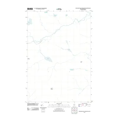 2011 Boundary Bald Mountain2011 Print · USGSCovers Thorndike Township, including Moose River, Alder Brook Township, and other nearby areas
 - 2011 Map of Canada Falls Lake, 2011 Print
 2011 Canada Falls Lake2011 Print · USGSCovers Thorndike Township, including Alder Brook Township, Pittston Academy Grant, and other nearby areas
 - 2014 Map of Churchill Stream, 2014 Print
 2014 Churchill Stream2014 Print · USGSCovers Thorndike Township, including Brassua Township, Rockwood Strip T2 R1 NBKP, and other nearby areas
 - 2014 Map of Canada Falls Lake, 2014 Print
 2014 Canada Falls Lake2014 Print · USGSCovers Thorndike Township, including Alder Brook Township, Pittston Academy Grant, and other nearby areas
 - 2014 Map of Heald Pond, 2014 Print
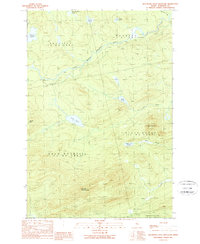
 2014 Heald Pond2014 Print · USGSCovers Thorndike Township, including Jackman, Moose River, and other nearby areas
Showing maps 1-25 of 38
Top cities near Thorndike Township
Frequently asked questions
- What are the different types of historical maps available for Thorndike Township?
- What is the oldest map of Thorndike Township?
- Where can I purchase historical maps of Thorndike Township for my home or office?
- Where can I download high-res historical maps of Thorndike Township?
- Are there historical topographic maps available for Thorndike Township?
- Is there historical aerial imagery available for Thorndike Township?
- Where are historical maps of Thorndike Township sourced from?