Old Maps of Montville, Maine
Explore 24 old maps of Montville, spanning from 1915 to today. These high-resolution historic maps reveal how streets, neighborhoods, landmarks, and natural features evolved over time — perfect for genealogy, metal detecting, research, and local history exploration.
What you can do with these maps:
- See how Montville changed over time: Compare historical maps to modern-day views to trace roads, homesites, rail lines & more.
- View detailed metadata: Each map includes creators, publishers, year, scale, and archive source.
- Overlay maps with satellite & LiDAR: Visualize the past alongside modern tools to explore terrain & human change.
- Trusted historical sources: Maps sourced from the USGS, Library of Congress, and other archives.
- Access maps your way: View online, download high-res files, or order prints for personal or research use.
Start exploring old maps of Montville to uncover forgotten places, hidden landmarks, and the deep history beneath your feet.
Montville, ME maps
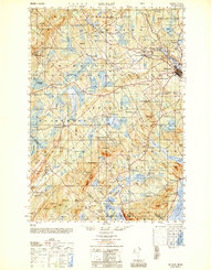
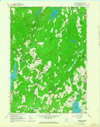
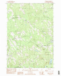
(24)- 1915 Map of Belfast, 1962 Print
 1915 Belfast1962 Print · USGSCovers Montville, including Belfast, Camden, and other nearby areas
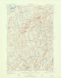
 - 1916 Map of Liberty
 1916 Liberty1916 Print · USGSCovers Montville, including China, Jefferson, and other nearby areas6 unique versions available
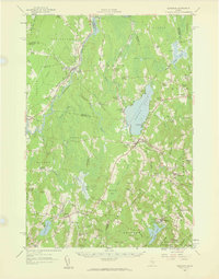
 - 1917 Map of Belfast
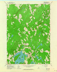
 1917 Belfast1917 Print · USGSCovers Montville, including Belfast, Camden, and other nearby areas6 unique versions available
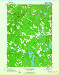
 - 1926 Map of Burnham
 1926 Burnham1926 Print · USGSCovers Montville, including Winslow, Pittsfield, and other nearby areas3 unique versions available
 - 1932 Map of Brooks
 1932 Brooks1932 Print · USGSCovers Montville, including Winterport, Carmel, and other nearby areas3 unique versions available
 - 1941 Map of Belfast
 1941 Belfast1941 Print · USGSCovers Montville, including Belfast, Camden, and other nearby areas
 - 1942 Map of Liberty
 1942 Liberty1942 Print · USGSCovers Montville, including China, Jefferson, and other nearby areas
 - 1948 Map of Bangor
 1948 Bangor1948 Print · USGSCovers Montville, including Bangor, Augusta, and other nearby areas
 - 1950 Map of Belfast
 1950 Belfast1950 Print · USGSCovers Montville, including Belfast, Camden, and other nearby areas
 - 1950 Map of Liberty
 1950 Liberty1950 Print · USGSCovers Montville, including China, Jefferson, and other nearby areas
 - 1955 Map of Brooks, 1957 Print
 1955 Brooks1957 Print · USGSCovers Montville, including Winterport, Carmel, and other nearby areas4 unique versions available
 - 1956 Map of Bangor, 1966 Print
 1956 Bangor1966 Print · USGSCovers Montville, including Bangor, Augusta, and other nearby areas3 unique versions available
 - 1957 Map of Burnham, 1959 Print
 1957 Burnham1959 Print · USGSCovers Montville, including Winslow, Pittsfield, and other nearby areas2 unique versions available
 - 1960 Map of Bangor
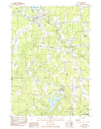
 1960 Bangor1960 Print · USGSCovers Montville, including Bangor, Augusta, and other nearby areas
 - 1960 Map of Morrill, 1962 Print
 1960 Morrill1962 Print · USGSCovers Montville, including Searsmont, Brooks, and other nearby areas4 unique versions available
 - 1961 Map of Bangor
 1961 Bangor1961 Print · USGSCovers Montville, including Bangor, Augusta, and other nearby areas
 - 1961 Map of Washington, 1964 Print
 1961 Washington1964 Print · USGSCovers Montville, including Union, Washington, and other nearby areas3 unique versions available
 - 1961 Map of Liberty, 1964 Print
 1961 Liberty1964 Print · USGSCovers Montville, including Palermo, Searsmont, and other nearby areas4 unique versions available
 - 1975 Map of Burnham SE, 1980 Print
 1975 Burnham SE1980 Print · USGSCovers Montville, including Unity, Albion, and other nearby areas
 - 1975 Map of Brooks SW, 1980 Print
 1975 Brooks SW1980 Print · USGSCovers Montville, including Brooks, Knox, and other nearby areas
 - 1982 Map of Unity, 1983 Print
 1982 Unity1983 Print · USGSCovers Montville, including Unity, Albion, and other nearby areas
 - 1982 Map of Brooks West, 1983 Print
 1982 Brooks West1983 Print · USGSCovers Montville, including Brooks, Knox, and other nearby areas
 - 1984 Map of Augusta
 1984 Augusta1984 Print · USGSCovers Montville, including Augusta, Topsham, and other nearby areas
 - 1985 Map of Skowhegan, 1986 Print
 1985 Skowhegan1986 Print · USGSCovers Montville, including Waterville, Winslow, and other nearby areas2 unique versions available
End of results
Showing maps 1-24 of 24
Top cities near Montville
- Winslow historical maps
- Belfast historical maps
- China historical maps
- Camden historical maps
- Rockport historical maps
- Clinton historical maps
See more
Top neighborhoods of Montville
- Beans Corner historical maps
- Center Montville historical maps
- Connors Corner historical maps
- Gregorys Corner historical maps
- Halldale historical maps
- McFarlands Corner historical maps
See more
Frequently asked questions
- What are the different types of historical maps available for Montville?
- What is the oldest map of Montville?
- Where can I purchase historical maps of Montville for my home or office?
- Where can I download high-res historical maps of Montville?
- Are there historical topographic maps available for Montville?
- Is there historical aerial imagery available for Montville?
- Where are historical maps of Montville sourced from?