Old Maps of Meddybemps, Maine for Academic Research
Study the evolution of Meddybemps with 31 high-resolution historic maps. Whether you're teaching, researching, or modeling changes in land use, these maps provide essential visual documentation of urban, environmental, and geographic change.
- Analyze long-term change: Track patterns in development, transportation, and natural features.
- Ideal for environmental or urban studies: Support academic projects with primary historical map data.
- Use in the classroom or lab: Educators and researchers rely on these maps to bring historical context to life.
These maps are a powerful tool for teaching, research, and visualizing how Meddybemps has changed over the decades.
Meddybemps, ME maps
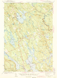
(31)- 1929 Map of Calais
 1929 Calais1929 Print · USGSThe international border along the St. Croix River comes alive in the late 1920s, showing a landscape defined by rail lines and river industry. Genealogists and historians can trace the foundations of local life at Grove PO, Damon Sch, and the riverside works at Milltown.4 unique versions available
 - 1932 Map of Calais
 1932 Calais1932 Print · USGSCoastal Washington County at the start of the 1930s is defined by the international river border and the busy corridors of the Maine Central RR. Genealogists and local historians can locate old rural schoolhouses like Damon Sch or trace the timber-and-rail industry through Woodland Junc and Young Siding.4 unique versions available
 - 1941 Map of Gardner Lake, 1958 Print
 1941 Gardner Lake1958 Print · USGSWashington County during the early 1940s was a landscape of remote timberlands and tight-knit settlements along the Maine Central line. Genealogists and historians can locate rural schoolhouses like Gardner Lake Sch and vanished local hubs such as Chase Mills and Halls Mills.3 unique versions available
 - 1943 Map of Gardner Lake
 1943 Gardner Lake1943 Print · USGSWashington County's lake-country comes alive in this early 1940s survey, showing a landscape of remote mills and scattered schoolhouses. Researchers can trace family sites near Marion or locate old landmarks like the Gardner Lake Sch and the firetower on Cooper Hill.3 unique versions available
 - 1957 Map of Fredericton, 1981 Print
 1957 Fredericton1981 Print · USGSThe New Brunswick and Maine borderlands come into focus in the mid-fifties, dominated by the Saint John River and massive military tracts. Genealogists can locate riverfront hamlets like Maugerville or inland sites like Scotch Settlement along the Canadian Pacific rail line.
 - 1961 Map of Eastport
 1961 Eastport1961 Print · USGSThe maritime borderlands of Maine and New Brunswick are captured here in the early sixties, showing a world defined by the Bay of Fundy. Researchers can trace the Maine Central Railroad to Machiasport or explore remote island villages like Grand Harbour and Welchpool.
 - 1963 Map of Fredericton
 1963 Fredericton1963 Print · USGSThe Saint John River valley and the Maine-New Brunswick border are captured here during the early sixties. Researchers can trace the Canadian Pacific rail lines through rural settlements like Jewetts Mills, Mckeens Corner, and Scotch Settlement.
 - 1969 Map of Eastport
 1969 Eastport1969 Print · USGSThe maritime borderlands of Washington County and New Brunswick appear in detail during the late sixties. Researchers can trace historic rail lines like the Maine Central Railroad and explore coastal settlements from Machias to St. Andrews.
 - 1976 Map of Eastport
 1976 Eastport1976 Print · USGSThe maritime borderlands of Maine and Nova Scotia come alive in this mid-seventies survey of the Downeast coast. Genealogists and historians can trace the shoreline settlements of Eastport, Lubec, and Machias, or cross the channel to find Acadian villages like Church Point and Meteghan Centre.
 - 1985 Map of Machias, 1986 Print
 1985 Machias1986 Print · USGSThe Downeast coast of Maine in the 1980s reveals a landscape of deep-water bays, tidal rivers, and isolated timberlands. Researchers can trace the Maine Central rail line and locate coastal landmarks from Leighton Point to the U.S. Naval Radio Station.
 - 1986 Map of Calais
 1986 Calais1986 Print · USGSCoastal and interior Washington County are captured here in the mid-1980s, where the international border follows the winding St Croix River. Genealogists and historians can trace the rail lines of the Maine Central and find landmarks like Red Beach and Princeton Airport.
 - 1987 Map of Meddybemps Lake West
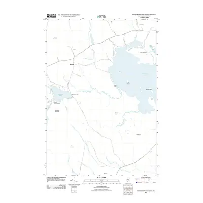
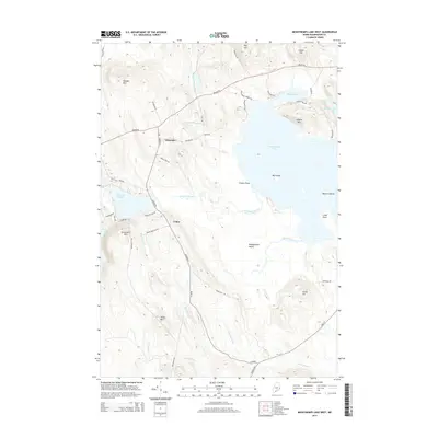
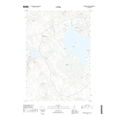
 1987 Meddybemps Lake West1987 Print · USGSWashington County at the start of the 1980s reveals a quiet landscape of interior lakes and isolated settlements. Researchers can locate family landmarks like Howe and Cedar, or trace old routes passing by Kendall Mtn and Meddybemps Lake.
 - 1987 Map of Lake Cathance, 1988 Print
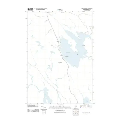
 1987 Lake Cathance1988 Print · USGSThe interior lakes and timberlands of Washington County are captured here in the late eighties. Researchers can trace land divisions across Cooper and No 14 Plt or locate family landmarks like Conner Hill and Provost Island.
 - 1987 Map of Meddybemps Lake East, 1988 Print
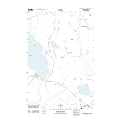
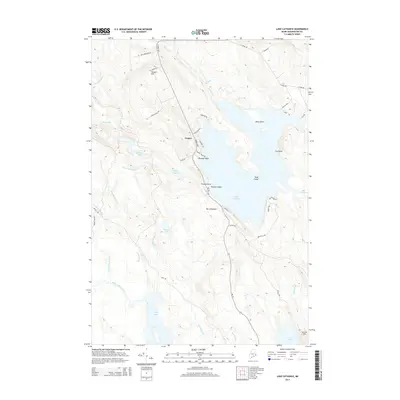
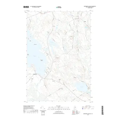
 1987 Meddybemps Lake East1988 Print · USGSMeddybemps and the surrounding Maine lake country are documented here in the late twentieth century. Genealogists and local historians can trace family locations near Meddybemps village and Blanchard Corner or locate the lakeside Cem.
 - 1994 Map of Calais
 1994 Calais1994 Print · USGSEastern Maine's river and lake country comes into focus in the 1990s, centered on the international border at Calais and the vast Passamaquoddy Indian Reservation. Researchers can trace the water-linked settlements of Grand Lake Stream, the airfield at Princeton Airport, and the industrial heritage of Woodland.
 - 1994 Map of Machias
 1994 Machias1994 Print · USGSThe Downeast coast of Maine in the 1990s is captured here, from the Narraguagus River to the Canadian border. Genealogists and historians can trace coastal settlements like Jonesboro and Addison or locate the U.S. Naval Radio Station and Moosehorn National Wildlife Refuge.
 - 2011 Map of Meddybemps Lake West, 2011 Print
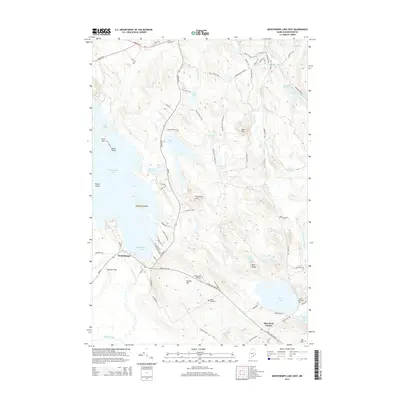
 2011 Meddybemps Lake West2011 Print · USGSCovers Meddybemps, including Baileyville, Alexander, and other nearby areas
 - 2011 Map of Meddybemps Lake East, 2011 Print
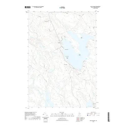
 2011 Meddybemps Lake East2011 Print · USGSCovers Meddybemps, including Calais, Baileyville, and other nearby areas
 - 2011 Map of Lake Cathance, 2011 Print
 2011 Lake Cathance2011 Print · USGSCovers Meddybemps, including Cooper, Berry Township, and other nearby areas
 - 2014 Map of Lake Cathance, 2014 Print
 2014 Lake Cathance2014 Print · USGSCovers Meddybemps, including Cooper, Berry Township, and other nearby areas
 - 2014 Map of Meddybemps Lake West, 2014 Print
 2014 Meddybemps Lake West2014 Print · USGSCovers Meddybemps, including Baileyville, Alexander, and other nearby areas
 - 2014 Map of Meddybemps Lake East, 2014 Print
 2014 Meddybemps Lake East2014 Print · USGSCovers Meddybemps, including Calais, Baileyville, and other nearby areas
 - 2018 Map of Lake Cathance, 2018 Print
 2018 Lake Cathance2018 Print · USGSCovers Meddybemps, including Cooper, Berry Township, and other nearby areas
 - 2018 Map of Meddybemps Lake West, 2018 Print
 2018 Meddybemps Lake West2018 Print · USGSCovers Meddybemps, including Baileyville, Alexander, and other nearby areas
 - 2018 Map of Meddybemps Lake East, 2018 Print
 2018 Meddybemps Lake East2018 Print · USGSCovers Meddybemps, including Calais, Baileyville, and other nearby areas
Showing maps 1-25 of 31
Top cities near Meddybemps
- Calais historical maps
- East Machias historical maps
- Baileyville historical maps
- Perry historical maps
- Princeton historical maps
- Pembroke historical maps
See more
Frequently asked questions
- What are the different types of historical maps available for Meddybemps?
- What is the oldest map of Meddybemps?
- Where can I purchase historical maps of Meddybemps for my home or office?
- Where can I download high-res historical maps of Meddybemps?
- Are there historical topographic maps available for Meddybemps?
- Is there historical aerial imagery available for Meddybemps?
- Where are historical maps of Meddybemps sourced from?