1900s (20th Century) Maps of Princeton, Maine
Explore 17 historic maps of Princeton from the 1900s (20th Century). These maps offer a rare glimpse into what life looked like during the 1900s — showing old roads, neighborhoods, homes, and landmarks that have changed or disappeared over time.
Whether you're researching your family's past, planning a metal detecting trip, or studying how Princeton's landscape evolved across the 1900s, these high-resolution maps are a powerful tool for exploring the history of this region.
- Focus on a specific era: All maps on this page are from the 1900s, giving you a focused view of this time period.
- See what’s changed: Compare century-old streets, trails, and buildings to today's modern landscape using overlays and satellite layers.
- Research with precision: Use these maps for genealogy, historical research, land use analysis, or educational projects.
- View, download, or print: Maps are fully viewable online in high resolution, and can be downloaded or printed for your own records.
Start exploring Princeton's history through authentic maps from the 1900s. This is your window into the past.
Princeton, ME maps
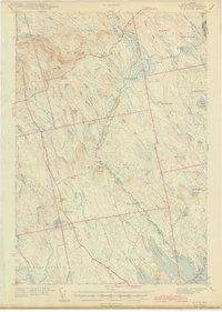
(17)- 1929 Map of Calais
 1929 Calais1929 Print · USGSCovers Princeton, including Saint Stephen, Calais, and other nearby areas4 unique versions available
 - 1932 Map of Calais
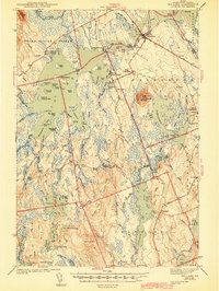
 1932 Calais1932 Print · USGSCovers Princeton, including Saint Stephen, Calais, and other nearby areas4 unique versions available
 - 1940 Map of Waite, 1959 Print
 1940 Waite1959 Print · USGSCovers Princeton, including Baileyville, Topsfield, and other nearby areas3 unique versions available
 - 1941 Map of Big Lake, 1960 Print
 1941 Big Lake1960 Print · USGSCovers Princeton, including Baileyville, Indian Township / Motahkomikuk, and other nearby areas
 - 1942 Map of Waite
 1942 Waite1942 Print · USGSCovers Princeton, including Baileyville, Topsfield, and other nearby areas2 unique versions available
 - 1943 Map of Big Lake
 1943 Big Lake1943 Print · USGSCovers Princeton, including Baileyville, Indian Township / Motahkomikuk, and other nearby areas4 unique versions available
 - 1952 Map of Big Lake
 1952 Big Lake1952 Print · USGSCovers Princeton, including Baileyville, Indian Township / Motahkomikuk, and other nearby areas
 - 1957 Map of Fredericton, 1981 Print
 1957 Fredericton1981 Print · USGSCovers Princeton, including Saint John, Fredericton, and other nearby areas
 - 1963 Map of Fredericton
 1963 Fredericton1963 Print · USGSCovers Princeton, including Saint John, Fredericton, and other nearby areas
 - 1963 Map of Big Lake, 1966 Print
 1963 Big Lake1966 Print · USGSCovers Princeton, including Baileyville, Indian Township / Motahkomikuk, and other nearby areas4 unique versions available
 - 1986 Map of Calais
 1986 Calais1986 Print · USGSCovers Princeton, including Saint Stephen, Calais, and other nearby areas
 - 1987 Map of Woodland
 1987 Woodland1987 Print · USGSCovers Princeton, including Baileyville, Alexander, and other nearby areas
 - 1988 Map of Tomah Ridge
 1988 Tomah Ridge1988 Print · USGSCovers Princeton, including Baileyville, Waite, and other nearby areas
 - 1990 Map of Big Lake
 1990 Big Lake1990 Print · USGSCovers Princeton, including Indian Township / Motahkomikuk, Grand Lake Stream, and other nearby areas
 - 1990 Map of Princeton
 1990 Princeton1990 Print · USGSCovers Princeton, including Baileyville, Alexander, and other nearby areas
 - 1990 Map of Crawford Lake
 1990 Crawford Lake1990 Print · USGSCovers Princeton, including Alexander, Cooper, and other nearby areas
 - 1994 Map of Calais
 1994 Calais1994 Print · USGSCovers Princeton, including Saint Stephen, Calais, and other nearby areas
End of results
Showing maps 1-17 of 17
Top cities near Princeton
- Baileyville historical maps
- Indian Township / Motahkomikuk historical maps
- Alexander historical maps
- Charlotte historical maps
- Baring Plantation historical maps
- Topsfield historical maps
See more
Top neighborhoods of Princeton
Frequently asked questions
- What are the different types of historical maps available for Princeton?
- What is the oldest map of Princeton?
- Where can I purchase historical maps of Princeton for my home or office?
- Where can I download high-res historical maps of Princeton?
- Are there historical topographic maps available for Princeton?
- Is there historical aerial imagery available for Princeton?
- Where are historical maps of Princeton sourced from?