1940s Maps of T37 MD BPP, Maine
Explore 8 historic maps of T37 MD BPP from the 1940s. These maps offer a rare glimpse into what life looked like during the 1940s — showing old roads, neighborhoods, homes, and landmarks that have changed or disappeared over time.
Whether you're researching your family's past, planning a metal detecting trip, or studying how T37 MD BPP's landscape evolved across the 1940s, these high-resolution maps are a powerful tool for exploring the history of this region.
- Focus on a specific era: All maps on this page are from the 1940s, giving you a focused view of this time period.
- See what’s changed: Compare century-old streets, trails, and buildings to today's modern landscape using overlays and satellite layers.
- Research with precision: Use these maps for genealogy, historical research, land use analysis, or educational projects.
- View, download, or print: Maps are fully viewable online in high resolution, and can be downloaded or printed for your own records.
Start exploring T37 MD BPP's history through authentic maps from the 1940s. This is your window into the past.
T37 MD BPP, ME maps
(8)- 1941 Map of Wesley, 1956 Print
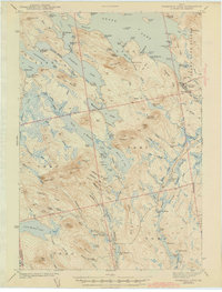
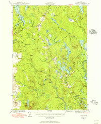 1941 Wesley1956 Print · USGSWashington County’s interior woods and riverways appear here as they were surveyed just before the war. You can trace the path of the Air Line road and locate landmarks like the Lower Wesley Sch, Joe Hanscom Heath, and Smith Landing.3 unique versions available
 - 1941 Map of Tug Mountain, 1958 Print
 1941 Tug Mountain1958 Print · USGSWashington County during the early 1940s was a landscape of timber and remote sporting camps. You can trace early backcountry retreats like Worcester Lodge and Hartford Camp or follow the route of the historic Air Line Road past Tug Mountain.2 unique versions available
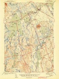
 - 1941 Map of Big Lake, 1960 Print
 1941 Big Lake1960 Print · USGSThe Washington County lakeside communities of Princeton and South Princeton appear in this early 1940s survey. Researchers can trace historic landmarks like the Dixie School, Red Beach Landing, and the Fire Tower atop Pocamoonsine Mountain.
 - 1941 Map of Wabassus Lake, 1962 Print
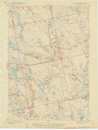
 1941 Wabassus Lake1962 Print · USGSThe Downeast timberlands of Washington County were a labyrinth of logging camps and glacial lakes just before the mid-century. Researchers can trace the water-and-woods economy through Farm Cove Dam, the Dennison Portage, and the village of Grand Lake Stream.
 - 1943 Map of Big Lake
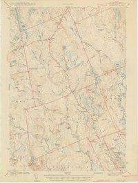
 1943 Big Lake1943 Print · USGSIn the early 1940s, this portion of Washington County was a mosaic of interconnected waterways and timberlands. Researchers can trace old rail routes along the Maine Central, locate the Dixie School, or explore family landmarks like Yates Point and Jameson Cove.4 unique versions available
 - 1943 Map of Tug Mountain
 1943 Tug Mountain1943 Print · USGSThe Maine woods in the early 1940s reveal a network of logging dams and remote seasonal camps. Genealogists and historians can trace family-named sites like Worcester Lodge, Hartford Camp, and Ben Tucker Mtn along the Machias River.2 unique versions available
 - 1943 Map of Wesley
 1943 Wesley1943 Print · USGSWashington County during the early 1940s was defined by its timberlands and the winding Machias River. Genealogists and local historians can trace family locations and rural landmarks like Mattimo Place, the Northfield Sch, and the hilltop Firetower.2 unique versions available
 - 1943 Map of Wabassus Lake
 1943 Wabassus Lake1943 Print · USGSThe Maine wilderness of Washington County comes alive in the 1940s through its intricate network of lakes, logging camps, and traditional portages. Local historians can trace the foundations of Grand Lake Stream or locate remote sites like The Birches and Holland Camp.3 unique versions available
End of results
Showing maps 1-8 of 8
Top cities near T37 MD BPP
- Princeton historical maps
- Indian Township / Motahkomikuk historical maps
- Northfield historical maps
- Grand Lake Stream historical maps
- Wesley historical maps
- Lakeville historical maps
See more
Frequently asked questions
- What are the different types of historical maps available for T37 MD BPP?
- What is the oldest map of T37 MD BPP?
- Where can I purchase historical maps of T37 MD BPP for my home or office?
- Where can I download high-res historical maps of T37 MD BPP?
- Are there historical topographic maps available for T37 MD BPP?
- Is there historical aerial imagery available for T37 MD BPP?
- Where are historical maps of T37 MD BPP sourced from?