2020s Maps of T8 R3 NBPP, Maine
Explore 12 historic maps of T8 R3 NBPP from the 2020s. These maps offer a rare glimpse into what life looked like during the 2020s — showing old roads, neighborhoods, homes, and landmarks that have changed or disappeared over time.
Whether you're researching your family's past, planning a metal detecting trip, or studying how T8 R3 NBPP's landscape evolved across the 2020s, these high-resolution maps are a powerful tool for exploring the history of this region.
- Focus on a specific era: All maps on this page are from the 2020s, giving you a focused view of this time period.
- See what’s changed: Compare century-old streets, trails, and buildings to today's modern landscape using overlays and satellite layers.
- Research with precision: Use these maps for genealogy, historical research, land use analysis, or educational projects.
- View, download, or print: Maps are fully viewable online in high resolution, and can be downloaded or printed for your own records.
Start exploring T8 R3 NBPP's history through authentic maps from the 2020s. This is your window into the past.
T8 R3 NBPP, ME maps
(12)- 2021 Map of Brookton, 2021 Print
 2021 Brookton2021 Print · USGSCovers T8 R3 NBPP, including Danforth, Topsfield, and other nearby areas
 - 2021 Map of Farrow Mountain, 2021 Print
 2021 Farrow Mountain2021 Print · USGSCovers T8 R3 NBPP, including Topsfield, Talmadge, and other nearby areas
 - 2021 Map of Stetson Mountain, 2021 Print
 2021 Stetson Mountain2021 Print · USGSCovers T8 R3 NBPP, including Danforth, T8 R4 NBPP, and other nearby areas
 - 2021 Map of Dill Hill, 2021 Print
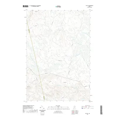 2021 Dill Hill2021 Print · USGSCovers T8 R3 NBPP, including Prentiss Township, Carroll Plantation, and other nearby areas
 - 2021 Map of Potter Hill, 2021 Print
 2021 Potter Hill2021 Print · USGSCovers T8 R3 NBPP, including Prentiss Township, Drew Plantation, and other nearby areas
 - 2021 Map of Bowers Mountain, 2021 Print
 2021 Bowers Mountain2021 Print · USGSCovers T8 R3 NBPP, including Springfield, Prentiss Township, and other nearby areas
 - 2024 Map of Stetson Mountain, 2024 Print
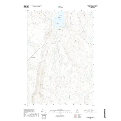
 2024 Stetson Mountain2024 Print · USGSThe Washington County wilderness is documented here in the early twenty-first century, showing a landscape defined by water and ridge. Trace the remote shorelines of Upper Hot Brook Lake or follow the elevations of Stetson Mtn and Deadman Ridge.
 - 2024 Map of Bowers Mountain, 2024 Print
 2024 Bowers Mountain2024 Print · USGSThe wooded highlands of eastern Maine are captured here at the Penobscot and Washington county line. Local historians can trace the network of old roads connecting settlements like Prentiss and Carroll or locate family-named landmarks such as Gates Hill and Sam Rowe Ridge.
 - 2024 Map of Potter Hill, 2024 Print
 2024 Potter Hill2024 Print · USGSThe Penobscot and Washington County borderlands are captured here in the early twenty-first century as they flank the Mattawamkeag River. Researchers can locate local burial sites like Drew Cem and Belding Cem tucked between Potter Hill and the river valley.
 - 2024 Map of Farrow Mountain, 2024 Print
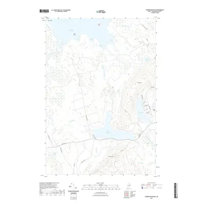
 2024 Farrow Mountain2024 Print · USGSThis part of Washington County is defined by its massive glacial lakes and peaks in the current era. Researchers can trace the rugged topography of Farrow Mtn, the drainage of Baskahegan Stream, and the reach of Farrow Lake.
 - 2024 Map of Dill Hill, 2024 Print
 2024 Dill Hill2024 Print · USGSRemote Maine timberlands and sprawling wetlands come into focus at the intersection of Washington and Penobscot counties. Trace the winding path of Baskahegan Stream through Big Bog or locate high-ground landmarks like Stetson Mtn and Dill Hill.
 - 2024 Map of Brookton, 2024 Print
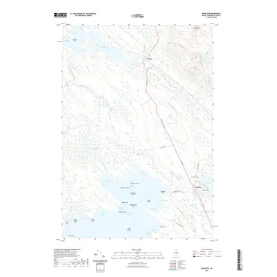
 2024 Brookton2024 Print · USGSNorthern Washington County is mapped here in the early twenty-first century, showcasing the expansive waters of Baskahegan Lake. Researchers can locate family sites in Brookton or Eaton and trace the winding paths of Baskahegan Stream and Witcher Brook.
End of results
Showing maps 1-12 of 12
Top cities near T8 R3 NBPP
- Danforth historical maps
- Springfield historical maps
- Weston historical maps
- Prentiss Township historical maps
- Topsfield historical maps
- Kingman Township historical maps
See more
Frequently asked questions
- What are the different types of historical maps available for T8 R3 NBPP?
- What is the oldest map of T8 R3 NBPP?
- Where can I purchase historical maps of T8 R3 NBPP for my home or office?
- Where can I download high-res historical maps of T8 R3 NBPP?
- Are there historical topographic maps available for T8 R3 NBPP?
- Is there historical aerial imagery available for T8 R3 NBPP?
- Where are historical maps of T8 R3 NBPP sourced from?