Old Maps of Whiting, Maine for Hiking & Exploration
Hike through history with 44 historic maps of Whiting. Explore old trails, ghost towns, and forgotten backroads — perfect for outdoor adventurers and local explorers.
- Rediscover forgotten places: Map out old mining camps, roads, and footpaths that no longer exist on modern maps.
- Layer with modern tools: Combine with LiDAR or satellite views to plan hikes through historical terrain.
- Made for exploration: Popular among hikers, overlanders, and local history lovers.
Use these maps to find adventure and explore the hidden past of Whiting.
Whiting, ME maps
(44)- 1907 Map of Eastport
 1907 Eastport1907 Print · USGSCoastal Washington County is seen here at the height of its maritime and rail era, detailing the intricate shorelines between Eastport and Lubec. Researchers can trace the Washington County Railway through Ayers Junction or locate local landmarks like North Lubec Landing and the Burnt Cove School.
 - 1908 Map of Eastport
 1908 Eastport1908 Print · USGSMaine's easternmost coastline comes alive in the early twentieth century, showing the bustling island city of Eastport and the sardine-packing hub of Lubec. Genealogists can trace family footprints at rural schoolhouses like Crosby School or follow the Washington County Railway to Ayers Junction.4 unique versions available
 - 1917 Map of Cutler, 1965 Print
 1917 Cutler1965 Print · USGSCoastal Washington County is shown here during the late First World War era as a landscape of isolated fishing villages and rocky peninsulas. Genealogists and researchers can trace local landmarks like Moose River School, the village of Cutler, and family-named spots such as Harmon Heath.
 - 1918 Map of Machias
 1918 Machias1918 Print · USGSThe Downeast coast of Washington County comes alive in the years during the Great War, showing the maritime and rail infrastructure that drove the regional economy. Genealogists and historians can trace family-named landmarks and old coastal outposts like Dog Town, Fort O'Brien Point, and the Cross Island L S S.5 unique versions available
 - 1918 Map of Cutler
 1918 Cutler1918 Print · USGSThe Downeast coast of Washington County is captured here just after the Great War, showing a landscape defined by maritime industry and remote schools. Genealogists can trace early homesteads and community sites like School No 2, Moose River School, and the rocky outposts of Machias Seal I.5 unique versions available
 - 1941 Map of Machias, 1956 Print
 1941 Machias1956 Print · USGSThe rugged Washington County coastline at the start of the 1940s reveals a world defined by the Maine Central railroad and tidal waters. Genealogists and historians can trace family-named landmarks such as Hoyttown, Dog Town, and the defensive site at Fort O'Brien Point.3 unique versions available
 - 1941 Map of Gardner Lake, 1958 Print
 1941 Gardner Lake1958 Print · USGSWashington County during the early 1940s was a landscape of remote timberlands and tight-knit settlements along the Maine Central line. Genealogists and historians can locate rural schoolhouses like Gardner Lake Sch and vanished local hubs such as Chase Mills and Halls Mills.3 unique versions available
 - 1943 Map of Gardner Lake
 1943 Gardner Lake1943 Print · USGSWashington County's lake-country comes alive in this early 1940s survey, showing a landscape of remote mills and scattered schoolhouses. Researchers can trace family sites near Marion or locate old landmarks like the Gardner Lake Sch and the firetower on Cooper Hill.3 unique versions available
 - 1943 Map of Eastport, 1955 Print
 1943 Eastport1955 Print · USGSCoastal Washington County is defined here by its complex tidal bays and international border during the mid-forties. Genealogists and historians can trace the Maine Central Railroad through Dennysville Station or locate rural landmarks like the West Pembroke Ch and the Pleasant Point Indian Reservation.2 unique versions available
 - 1945 Map of Eastport
 1945 Eastport1945 Print · USGSThe rugged coast of Washington County is captured here at the end of the war, showcasing the maritime hubs of Eastport and Lubec. Genealogists can trace family names across Ayers Junction, locate rural landmarks like the Wilcox Sch, and explore the early bounds of the Moosehorn National Wildlife Refuge.2 unique versions available
 - 1949 Map of Whiting, 1952 Print
 1949 Whiting1952 Print · USGSCoastal Washington County is seen here just after the war, showcasing a landscape defined by the tidal reaches of Whiting Bay and the Orange River. Researchers can locate old community landmarks like the East Stream Sch, the Lookout Tower on Littles Mtn, and maritime Pier Ruins.3 unique versions available
 - 1949 Map of Cutler, 1968 Print
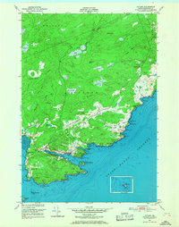 1949 Cutler1968 Print · USGSCoastal Washington County is shown here just after the war, detailing the maritime and rural life of the Downeast shore. Genealogists and historians can trace family-named landmarks like Dennison and Huntley alongside the Little River Lighthouse and Bay View Cem.2 unique versions available
 - 1949 Map of Machias Bay, 1974 Print
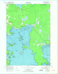 1949 Machias Bay1974 Print · USGSCoastal Washington County is captured here in the late 1940s, showing the intricate maritime landscape from Machias Bay to Cutler. Genealogists and historians can locate old landmarks like Holmes Bay Ch, Holmes Bay Sch, and the small settlement at Holway.2 unique versions available
 - 1951 Map of Cutler
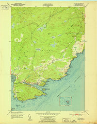 1951 Cutler1951 Print · USGSThe Downeast coast of Maine in the early 1950s reveals a maritime landscape centered on the sheltered harbor of Cutler. Researchers can trace the layout of early settlements and coastal landmarks, from the Little River Lighthouse to the Head of the River Ch and Little Machias Sch.2 unique versions available
 - 1951 Map of Machias Bay
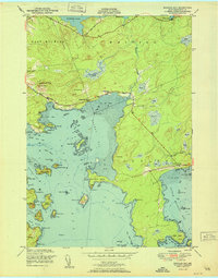 1951 Machias Bay1951 Print · USGSThe Maine coast in the early fifties shows a landscape of tidal flats and rocky points between Holmes Bay and Little Machias Bay. Genealogists and historians can locate the Holmes Bay Ch, the settlement at North Cutler, and family-named landmarks like Pettegrove Mtn.
 - 1953 Map of Cutler
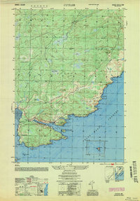 1953 Cutler1953 Print · USGSThe Washington County coast was a network of fishing harbors and small school districts in the early 1950s. Genealogists can trace family landmarks and burial sites like the Old Cutler Cem, Little Machias Sch, and the isolated Little River Lighthouse.
 - 1961 Map of Eastport
 1961 Eastport1961 Print · USGSThe maritime borderlands of Maine and New Brunswick are captured here in the early sixties, showing a world defined by the Bay of Fundy. Researchers can trace the Maine Central Railroad to Machiasport or explore remote island villages like Grand Harbour and Welchpool.
 - 1969 Map of Eastport
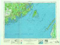 1969 Eastport1969 Print · USGSThe maritime borderlands of Washington County and New Brunswick appear in detail during the late sixties. Researchers can trace historic rail lines like the Maine Central Railroad and explore coastal settlements from Machias to St. Andrews.
 - 1976 Map of Eastport
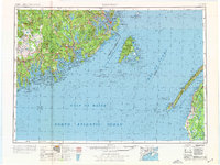 1976 Eastport1976 Print · USGSThe maritime borderlands of Maine and Nova Scotia come alive in this mid-seventies survey of the Downeast coast. Genealogists and historians can trace the shoreline settlements of Eastport, Lubec, and Machias, or cross the channel to find Acadian villages like Church Point and Meteghan Centre.
 - 1985 Map of Machias, 1986 Print
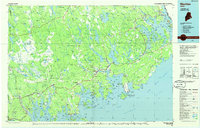 1985 Machias1986 Print · USGSThe Downeast coast of Maine in the 1980s reveals a landscape of deep-water bays, tidal rivers, and isolated timberlands. Researchers can trace the Maine Central rail line and locate coastal landmarks from Leighton Point to the U.S. Naval Radio Station.
 - 1987 Map of Long Lake, 1988 Print
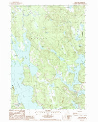 1987 Long Lake1988 Print · USGSCoastal Washington County is shown here in the late eighties, a land defined by intricate waterways and small mill settlements. Researchers can locate family landmarks at Chase Mills and Halls Mills, or trace the winding course of the East Machias River and Rocky Lake.
 - 1993 Map of Cutler, 1995 Print
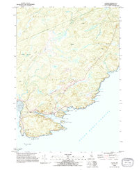 1993 Cutler1995 Print · USGSThe Washington County coastline in the early nineties reveals a landscape of protected harbors and rocky heads. Genealogists and maritime historians can locate the Old Cutler Cem, the Head of the River Ch, and the iconic Lighthouse on Little River Island.2 unique versions available
 - 1993 Map of Machias Bay, 1995 Print
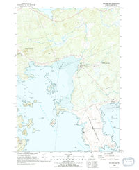 1993 Machias Bay1995 Print · USGSCoastal Washington County in the 1990s reveals a landscape shaped by military infrastructure and maritime conservation. Trace the restricted grounds of the U S Naval Communication Unit or explore the islands of the Cross Island National Wildlife Refuge and the harbor at North Cutler.2 unique versions available
 - 1994 Map of Machias
 1994 Machias1994 Print · USGSThe Downeast coast of Maine in the 1990s is captured here, from the Narraguagus River to the Canadian border. Genealogists and historians can trace coastal settlements like Jonesboro and Addison or locate the U.S. Naval Radio Station and Moosehorn National Wildlife Refuge.
 - 2011 Map of Whiting, 2011 Print
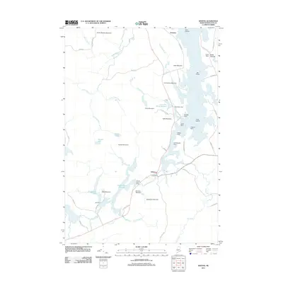 2011 Whiting2011 Print · USGSCoastal Washington County is mapped here in the early 21st century, showing the tidal reaches and inland waters near Whiting. Researchers can trace the local water infrastructure through Crane Dam, Orange River Dam, and the Crane Mill Brook Reservoir.
Showing maps 1-25 of 44
Top cities near Whiting
- Machias historical maps
- East Machias historical maps
- Eastport historical maps
- Jonesport historical maps
- Lubec historical maps
- Machiasport historical maps
See more
Top neighborhoods of Whiting
Frequently asked questions
- What are the different types of historical maps available for Whiting?
- What is the oldest map of Whiting?
- Where can I purchase historical maps of Whiting for my home or office?
- Where can I download high-res historical maps of Whiting?
- Are there historical topographic maps available for Whiting?
- Is there historical aerial imagery available for Whiting?
- Where are historical maps of Whiting sourced from?