Old Maps of Long Beach, York for Hiking & Exploration
Hike through history with 17 historic maps of Long Beach. Explore old trails, ghost towns, and forgotten backroads — perfect for outdoor adventurers and local explorers.
- Rediscover forgotten places: Map out old mining camps, roads, and footpaths that no longer exist on modern maps.
- Layer with modern tools: Combine with LiDAR or satellite views to plan hikes through historical terrain.
- Made for exploration: Popular among hikers, overlanders, and local history lovers.
Use these maps to find adventure and explore the hidden past of Long Beach.
Long Beach, York maps
(17)- 1893 Map of York
 1893 York1893 Print · USGSThe Maine and New Hampshire coastlines meet in the 1890s at a time of maritime industry and emerging seaside travel. Researchers can trace the development of York Village, the operations at the Navy Yard, and the early route of the York Beach and Railroad.5 unique versions available
 - 1920 Map of York
 1920 York1920 Print · USGSThe Maine and New Hampshire shoreline comes to life during the late 1910s, showing a region balanced between naval defense and coastal commerce. Genealogists and historians can locate old landmarks like the Lincoln School, the Coast Guard Sta, and the path of the Electric Railway.6 unique versions available
 - 1944 Map of York Beach
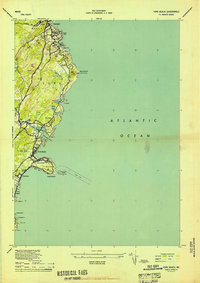 1944 York Beach1944 Print · USGSCoastal Maine at the height of the mid-century shows a landscape of rocky shores and growing seaside communities. Genealogists and local historians can trace family-named landmarks and old infrastructure like Perkins Cove, Cape Neddick LH, and the Old RR Grade.2 unique versions available
 - 1949 Map of Portland
 1949 Portland1949 Print · USGSCoastal Maine and the New Hampshire interior are shown in detail during the late forties, from the bustling harbors to the lakeside villages. Researchers can trace historical rail networks like the Boston & Maine RR and locate coastal defenses such as Fort Preble.3 unique versions available
 - 1956 Map of York Beach, 1958 Print
 1956 York Beach1958 Print · USGSThe York and Ogunquit coastlines are captured here in the mid-fifties, showing the classic Maine shoreline of summer colonies and working harbors. You can trace early settlement patterns near Concordville, locate the Cape Neddick Lighthouse, and follow the old Railroad Grade.3 unique versions available
 - 1956 Map of York, 1960 Print
 1956 York1960 Print · USGSThe Maine coastline in the mid-fifties shows a world of historic harbor defenses and growing seaside resorts. Genealogists can trace family names at Brixham Upper Corners, locate the First Parish Ch, and explore the shoreline from York Cliffs to Kittery.4 unique versions available
 - 1956 Map of Portland, 1963 Print
 1956 Portland1963 Print · USGSSouthern Maine and eastern New Hampshire are captured here in the mid-fifties, during a time of major highway expansion and military growth. You can trace the path of the Maine Turnpike and locate landmarks like the Portsmouth Naval Shipyard and Sebago Lake.4 unique versions available
 - 1959 Map of Portland
 1959 Portland1959 Print · USGSThe Maine and New Hampshire coastlines meet in this mid-century portrait of maritime commerce and inland rail networks. Researchers can trace the legacy of coastal defense at Fort Williams and follow the historic path of the Maine Central RR through the White Mountain National Forest.2 unique versions available
 - 1963 Map of Portland
 1963 Portland1963 Print · USGSCoastal Maine and New Hampshire thrived as maritime and industrial hubs during the mid-sixties, linked by a dense network of rail and river. Researchers can trace historic transit corridors like the Maine Central RR and locate key sites such as the Portsmouth Naval Shipyard or Pease Air Force Base.3 unique versions available
 - 1977 Map of York Beach, 1979 Print
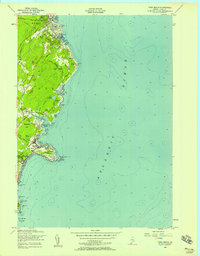
 1977 York Beach1979 Print · USGSCoastal Maine at the end of the seventies is captured in this detailed aerial study of the shoreline. Genealogists and local historians can trace property footprints and the layout of seaside communities in Ogunquit and York Beach.
 - 1985 Map of Kittery, 1986 Print
 1985 Kittery1986 Print · USGSThe Maine and New Hampshire borderlands are shown here in the mid-eighties, centered on the strategic Piscataqua River harbor. Genealogists and historians can trace the development of coastal towns like York or locate the sprawling Portsmouth Naval Shipyard and Pease Air Force Base.2 unique versions available
 - 1998 Map of York Beach, 1999 Print
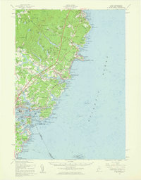
 1998 York Beach1999 Print · USGSThe Maine coast near York Beach and Ogunquit is captured here just before the millennium, showcasing a landscape defined by maritime heritage and summer retreats. Genealogists and local historians can trace family-named sites like Simpson Hill or locate the historic Cape Neddick Lighthouse.
 - 2011 Map of York Beach, 2011 Print
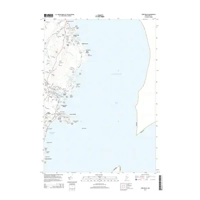
 2011 York Beach2011 Print · USGSCovers Long Beach, including York, Wells, and other nearby areas
 - 2014 Map of York Beach, 2014 Print
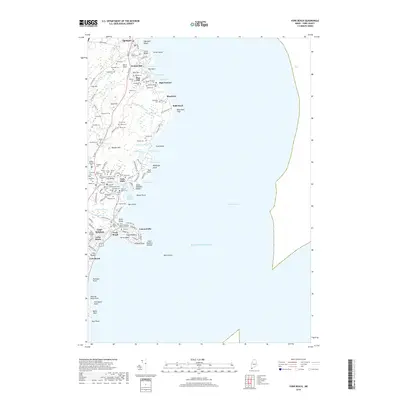
 2014 York Beach2014 Print · USGSCovers Long Beach, including York, Wells, and other nearby areas
 - 2018 Map of York Beach, 2018 Print
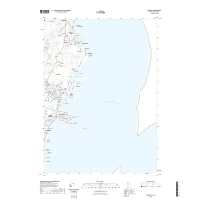
 2018 York Beach2018 Print · USGSCovers Long Beach, including York, Wells, and other nearby areas
 - 2021 Map of York Beach, 2021 Print
 2021 York Beach2021 Print · USGSCovers Long Beach, including York, Wells, and other nearby areas
 - 2024 Map of York Beach, 2024 Print
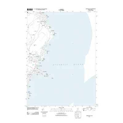
 2024 York Beach2024 Print · USGSMaine's southern coast is shown in modern detail as the villages of Ogunquit and York Beach continue to evolve. Genealogists can trace family burial sites like the Webber-Merrow Cem and Currier Cem near Cape Neddick Harbor.
End of results
Showing maps 1-17 of 17
Frequently asked questions
- What are the different types of historical maps available for Long Beach?
- What is the oldest map of Long Beach?
- Where can I purchase historical maps of Long Beach for my home or office?
- Where can I download high-res historical maps of Long Beach?
- Are there historical topographic maps available for Long Beach?
- Is there historical aerial imagery available for Long Beach?
- Where are historical maps of Long Beach sourced from?