Old Maps of North Deale, Maryland for Metal Detecting
Plan your next treasure hunt with 18 historic maps of North Deale. Find old homesites, ghost towns, trails, and gathering spots that may be lost to time — perfect for identifying promising metal detecting locations.
- Locate forgotten sites: Uncover places like long-lost settlements, abandoned rail lines, or gathering spots.
- Plan better hunts: Use map overlays combined with LiDAR or satellite views to narrow in on historically rich areas.
- Made for detectorists: Thousands of hobbyists use these maps to discover relics, coins, and hidden history.
Use these historic maps to boost your research and find new opportunities beneath the surface of North Deale.
North Deale, MD maps
(18)- 1892 Map of Owensville
 1892 Owensville1892 Print · USGSCoastal Anne Arundel County comes alive in the 1890s, showing a world of tidewater landings and proposed rail lines. Trace old property locations near Obligation (Butler Tav.) or the early waterfront hubs of West River (Galesville) and Tracy Landing.
 - 1895 Map of Owensville
 1895 Owensville1895 Print · USGSCoastal Anne Arundel County comes alive in this late nineteenth-century survey, from the winding Patuxent River to the shores of Herring Bay. Genealogists and local historians can trace the route of the Proposed Drum Point Railroad and find long-standing settlements like Obligation (Butler Tav.) and West River (Galesville).2 unique versions available
 - 1899 Map of Patuxent
 1899 Patuxent1899 Print · USGSSouthern Maryland in the late nineteenth century was a world of river wharves and emerging rail lines. Genealogists can trace family names across landings and settlements like Bladensburg, Upper Marlboro, and Piscataway Reform School before the landscape was modernised.3 unique versions available
 - 1905 Map of Owensville
 1905 Owensville1905 Print · USGSCoastal Maryland in the early twentieth century was a landscape of tide-water wharves and rural post offices. Genealogists can trace family connections through sites like Owensville West River PO, Hartges Wharf, and Mitchellville PO.5 unique versions available
 - 1906 Map of Patuxent
 1906 Patuxent1906 Print · USGSThe Tidewater region of Maryland and the outskirts of the District of Columbia are shown here at the turn of the century. Researchers can trace the early footprints of Maryland Agril. College, find riverfront infrastructure at Milltown Landing, and follow long-established routes like the Marlboro Turnpike.4 unique versions available
 - 1944 Map of West River
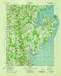 1944 West River1944 Print · USGSCoastal Anne Arundel County comes alive during the war years, showing a landscape of maritime industry and rural crossroads. Genealogists can trace family roots through Tracys Landing, the Franklin Ch and Cem, and schools like Nutwell Sch.
 - 1948 Map of Washington
 1948 Washington1948 Print · USGSThe Potomac and Chesapeake regions in the late 1940s reveal a landscape of expanding military reach and deep-rooted Tidewater settlements. Trace old rail corridors like the Richmond Fredericksburg & Potomac RR or locate landmarks like the Wakefield Washington Monument and St. Marys College.2 unique versions available
 - 1957 Map of Deale, 1959 Print
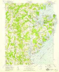 1957 Deale1959 Print · USGSCoastal Maryland at the dawn of the 1960s reveals a blend of historic river landings and new waterfront developments. Genealogists and local historians can locate legacy sites like St James Ch alongside seasonal destinations such as Camp Wabanna and Mimosa Cove.4 unique versions available
 - 1957 Map of Washington, 1966 Print
 1957 Washington1966 Print · USGSThe mid-Atlantic region during the mid-fifties and early sixties reveals a landscape of growing suburbs and vital military outposts. Researchers can trace historic river towns and shorelines from Alexandria to the Hooper Islands and St Clements Island.5 unique versions available
 - 1961 Map of Washington
 1961 Washington1961 Print · USGSThe mid-Atlantic region in the late fifties is presented in remarkable detail, from the Blue Ridge foothills to the Chesapeake Eastern Shore. Researchers can trace historic river landings and military sites like Mount Vernon, Fort Belvoir, and Point Lookout.2 unique versions available
 - 1983 Map of Washington East, 1984 Print
 1983 Washington East1984 Print · USGSThe Chesapeake Bay region in the early eighties shows the Maryland capital and its suburbs meeting the maritime traditions of the Eastern Shore. Researchers can trace land patterns from Andrews Air Force Base to waterfront settlements like Oxford and Chesapeake Beach.2 unique versions available
 - 1989 Map of Washington
 1989 Washington1989 Print · USGSThe Potomac River valley and Chesapeake Bay are shown in comprehensive detail during the late 1980s. Genealogists and historians can trace the transition from urban Alexandria to the rural Northern Neck, locating landmarks like Mount Vernon and Stratford Hall.
 - 1997 Map of Deale, 1999 Print
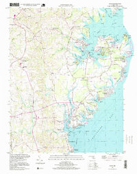 1997 Deale1999 Print · USGSThe western shore of the Chesapeake Bay comes alive in this late-century look at Maryland's tidal creeks and maritime communities. Genealogists and local historians can trace family locations through Galesville, Deale, and Shady Side, or find historic landmarks like West River Church and Deep Creek Airpark.
 - 2011 Map of Deale, 2011 Print
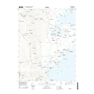
 2011 Deale2011 Print · USGSCovers North Deale, including Lothian, Almar Estates, and other nearby areas
 - 2014 Map of Deale, 2014 Print
 2014 Deale2014 Print · USGSCovers North Deale, including Lothian, Almar Estates, and other nearby areas
 - 2016 Map of Deale, 2016 Print
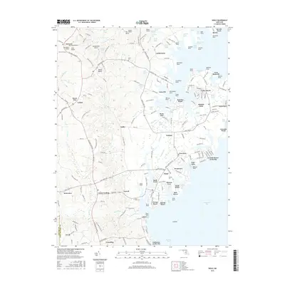 2016 Deale2016 Print · USGSCovers North Deale, including Lothian, Almar Estates, and other nearby areas
 - 2019 Map of Deale, 2019 Print
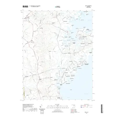 2019 Deale2019 Print · USGSCovers North Deale, including Lothian, Almar Estates, and other nearby areas
 - 2023 Map of Deale, 2023 Print
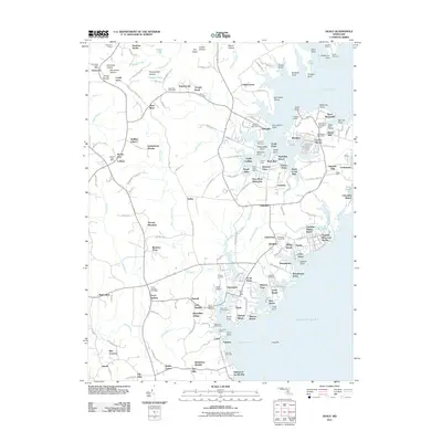
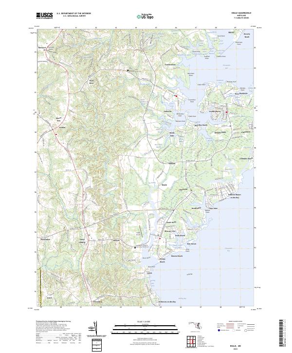 2023 Deale2023 Print · USGSCoastal Anne Arundel County comes into sharp focus in this recent study of its bayside settlements and marshy creeks. Researchers can trace the boundaries of family burial grounds at Chews Memorial United Methodist Church Cem and explore the waterfront grids of Columbia Beach and Deale.
End of results
Showing maps 1-18 of 18
Top cities near North Deale
- Bowie historical maps
- Annapolis historical maps
- Crofton historical maps
- Marlboro Village historical maps
- Edgewater historical maps
- Mayo historical maps
See more
Frequently asked questions
- What are the different types of historical maps available for North Deale?
- What is the oldest map of North Deale?
- Where can I purchase historical maps of North Deale for my home or office?
- Where can I download high-res historical maps of North Deale?
- Are there historical topographic maps available for North Deale?
- Is there historical aerial imagery available for North Deale?
- Where are historical maps of North Deale sourced from?