1950s Maps of Cherry Hill, Baltimore
Explore 8 historic maps of Cherry Hill from the 1950s. These maps offer a rare glimpse into what life looked like during the 1950s — showing old roads, neighborhoods, homes, and landmarks that have changed or disappeared over time.
Whether you're researching your family's past, planning a metal detecting trip, or studying how Cherry Hill's landscape evolved across the 1950s, these high-resolution maps are a powerful tool for exploring the history of this region.
- Focus on a specific era: All maps on this page are from the 1950s, giving you a focused view of this time period.
- See what’s changed: Compare century-old streets, trails, and buildings to today's modern landscape using overlays and satellite layers.
- Research with precision: Use these maps for genealogy, historical research, land use analysis, or educational projects.
- View, download, or print: Maps are fully viewable online in high resolution, and can be downloaded or printed for your own records.
Start exploring Cherry Hill's history through authentic maps from the 1950s. This is your window into the past.
Cherry Hill, Baltimore maps
(8)- 1950 Map of Relay
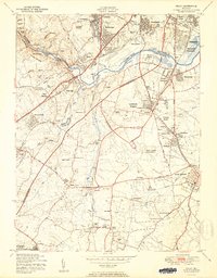 1950 Relay1950 Print · USGSMaryland's corridor between Baltimore and Anne Arundel County is captured here just as the post-war suburban and industrial expansion takes flight. Genealogists and local historians can trace the early layout of Friendship International Airport and find local landmarks like the Thomas Viaduct and All Saints Convent.2 unique versions available
 - 1953 Map of Baltimore West
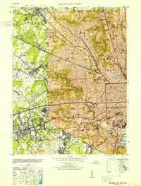 1953 Baltimore West1953 Print · USGSMid-century Baltimore and its western suburbs are caught in a moment of rapid postwar expansion and institutional growth. Genealogists and historians can trace family plots in Loudon Park Cemetery or locate landmarks like Pimlico Race Track and Curtis-Wright Airport.6 unique versions available
 - 1953 Map of Baltimore East
 1953 Baltimore East1953 Print · USGSMid-century Baltimore thrives as a center of industry and education, from the bustling inner harbor to the emerging eastern suburbs. Researchers can trace the legacy of major institutions like Johns Hopkins University, the sprawling Camp Holabird, and the historic Fort McHenry.5 unique versions available
 - 1954 Map of Baltimore
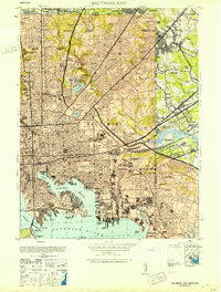
 1954 Baltimore1954 Print · USGSThe Mid-Atlantic region in the early fifties shows a landscape of growing suburban centers and heavy rail corridors. Trace mid-century transit networks and military landmarks from the Aberdeen Proving Ground to the Gettysburg National Military Park.
 - 1956 Map of Baltimore
 1956 Baltimore1956 Print · USGSMid-century Maryland and Pennsylvania are captured here during a period of massive suburban and military growth across the Chesapeake region. Genealogists and historians can trace the rail corridors of the Baltimore & Ohio RR and locate landmarks like Fort McHenry or the Aberdeen Proving Ground.
 - 1957 Map of Relay, 1960 Print
 1957 Relay1960 Print · USGSMaryland's corridor between Baltimore and the suburbs was rapidly evolving in the late fifties, shaped by major infrastructure and aviation. Genealogists can trace family roots through United Hebrew Cemetery, Severn Sch, and many small communities like Relay and Harmans.5 unique versions available
 - 1957 Map of Curtis Bay, 1960 Print
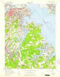 1957 Curtis Bay1960 Print · USGSThe industrial waterfront of South Baltimore and the emerging suburbs of Anne Arundel County are shown here during the late fifties growth spurt. Genealogists and local researchers can trace family roots through sites like Cedar Hill Cem, Harundale, and the Curtis Bay Army Ordnance Depot.2 unique versions available
 - 1957 Map of Baltimore, 1964 Print
 1957 Baltimore1964 Print · USGSMaryland and Southern Pennsylvania are shown during the mid-century expansion of the Baltimore-Washington corridor. Researchers can trace the extensive rail lines of the Baltimore & Ohio RR and locate sites like Fort Detrick and Gettysburg National Military Park.5 unique versions available
End of results
Showing maps 1-8 of 8
Frequently asked questions
- What are the different types of historical maps available for Cherry Hill?
- What is the oldest map of Cherry Hill?
- Where can I purchase historical maps of Cherry Hill for my home or office?
- Where can I download high-res historical maps of Cherry Hill?
- Are there historical topographic maps available for Cherry Hill?
- Is there historical aerial imagery available for Cherry Hill?
- Where are historical maps of Cherry Hill sourced from?