1950s Maps of Follywoods, Maryland
Explore 3 historic maps of Follywoods from the 1950s. These maps offer a rare glimpse into what life looked like during the 1950s — showing old roads, neighborhoods, homes, and landmarks that have changed or disappeared over time.
Whether you're researching your family's past, planning a metal detecting trip, or studying how Follywoods's landscape evolved across the 1950s, these high-resolution maps are a powerful tool for exploring the history of this region.
- Focus on a specific era: All maps on this page are from the 1950s, giving you a focused view of this time period.
- See what’s changed: Compare century-old streets, trails, and buildings to today's modern landscape using overlays and satellite layers.
- Research with precision: Use these maps for genealogy, historical research, land use analysis, or educational projects.
- View, download, or print: Maps are fully viewable online in high resolution, and can be downloaded or printed for your own records.
Start exploring Follywoods's history through authentic maps from the 1950s. This is your window into the past.
Follywoods, MD maps
(3)- 1950 Map of Leonardtown, 1964 Print
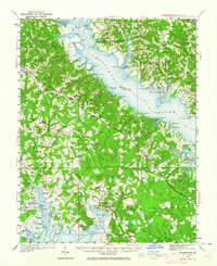 1950 Leonardtown1964 Print · USGSMid-century Southern Maryland comes alive on this peninsula bounded by the Patuxent and Potomac estuaries. Genealogists and historians can trace family-named points and rural infrastructure through landmarks like St Andrews Ch, Williams Wharf, and Broomes Island.
 - 1953 Map of Mechanicsville, 1956 Print
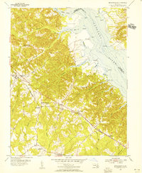 1953 Mechanicsville1956 Print · USGSSt. Mary's County in the early fifties shows a rural landscape defined by the Patuxent River and its tidal creeks. Genealogists and local historians can trace family-named points and early schools like Brent High Sch, St Joseph Sch, and the community of Mechanicsville.4 unique versions available
 - 1957 Map of Washington, 1966 Print
 1957 Washington1966 Print · USGSThe mid-Atlantic region during the mid-fifties and early sixties reveals a landscape of growing suburbs and vital military outposts. Researchers can trace historic river towns and shorelines from Alexandria to the Hooper Islands and St Clements Island.5 unique versions available
End of results
Showing maps 1-3 of 3
Top cities near Follywoods
- Lexington Park historical maps
- California historical maps
- Brandywine historical maps
- Chesapeake Ranch Estates historical maps
- Wildewood historical maps
- Chesapeake Beach historical maps
See more
Frequently asked questions
- What are the different types of historical maps available for Follywoods?
- What is the oldest map of Follywoods?
- Where can I purchase historical maps of Follywoods for my home or office?
- Where can I download high-res historical maps of Follywoods?
- Are there historical topographic maps available for Follywoods?
- Is there historical aerial imagery available for Follywoods?
- Where are historical maps of Follywoods sourced from?