Old Maps of Piney Run Estates, Maryland for Academic Research
Study the evolution of Piney Run Estates with 17 high-resolution historic maps. Whether you're teaching, researching, or modeling changes in land use, these maps provide essential visual documentation of urban, environmental, and geographic change.
- Analyze long-term change: Track patterns in development, transportation, and natural features.
- Ideal for environmental or urban studies: Support academic projects with primary historical map data.
- Use in the classroom or lab: Educators and researchers rely on these maps to bring historical context to life.
These maps are a powerful tool for teaching, research, and visualizing how Piney Run Estates has changed over the decades.
Piney Run Estates, MD maps
(17)- 1893 Map of Frederick
 1893 Frederick1893 Print · USGSMaryland's Piedmont region at the end of the nineteenth century reveals a landscape defined by the Potomac River and the rise of rail transit. Researchers can trace the path of the Chesapeake and Ohio Canal or locate local hubs like Poolesville and Buckeystown.
 - 1894 Map of Frederick
 1894 Frederick1894 Print · USGSMaryland's Piedmont region in the late nineteenth century was a complex network of river crossings and railway junctions. Researchers can trace the path of the Baltimore & Ohio R. R. past Sugar Loaf Mtn. and locate historic river sites like Nolands Ferry.5 unique versions available
 - 1909 Map of Mount Airy
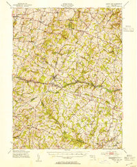
 1909 Mount Airy1909 Print · USGSCentral Maryland's Piedmont region is captured here during the height of the steam-rail era, centered on the strategic crossing at Mount Airy. Genealogists and historians can trace old property locations near Shipleys Mill, the winding Gary Turnpike, and rural settlements like Winfield and Libertytown.7 unique versions available
 - 1945 Map of Mount Airy, 1955 Print
 1945 Mount Airy1955 Print · USGSMid-century central Maryland is captured here as a landscape of rural villages and crossroads just before post-war expansion. Genealogists and historians can trace family locations through Mount Airy, Libertytown, and Damascus, or follow the Baltimore and Ohio rail line.2 unique versions available
 - 1948 Map of Baltimore
 1948 Baltimore1948 Print · USGSMaryland and Pennsylvania crossroads are captured in the late 1940s, showing a landscape defined by historic rail lines and major military installations. Genealogists can trace family connections in Gettysburg, Westminster, and near the U.S. Naval Academy in Annapolis.2 unique versions available
 - 1950 Map of Winfield
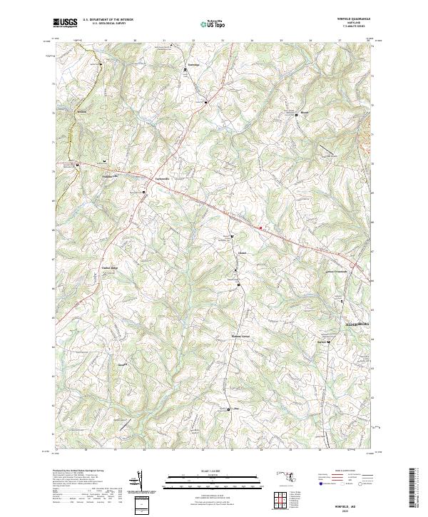
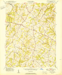 1950 Winfield1950 Print · USGSMid-century Carroll County life is centered here on the prominence of Parrs Ridge and a network of rural crossroads. Genealogists and local historians can trace family locations near Taylorsville, Winfield, and the Woodbine Sch.5 unique versions available
 - 1954 Map of Baltimore
 1954 Baltimore1954 Print · USGSThe Mid-Atlantic region in the early fifties shows a landscape of growing suburban centers and heavy rail corridors. Trace mid-century transit networks and military landmarks from the Aberdeen Proving Ground to the Gettysburg National Military Park.
 - 1956 Map of Baltimore
 1956 Baltimore1956 Print · USGSMid-century Maryland and Pennsylvania are captured here during a period of massive suburban and military growth across the Chesapeake region. Genealogists and historians can trace the rail corridors of the Baltimore & Ohio RR and locate landmarks like Fort McHenry or the Aberdeen Proving Ground.
 - 1957 Map of Baltimore, 1964 Print
 1957 Baltimore1964 Print · USGSMaryland and Southern Pennsylvania are shown during the mid-century expansion of the Baltimore-Washington corridor. Researchers can trace the extensive rail lines of the Baltimore & Ohio RR and locate sites like Fort Detrick and Gettysburg National Military Park.5 unique versions available
 - 1961 Map of Baltimore
 1961 Baltimore1961 Print · USGSMaryland and Pennsylvania are captured at a mid-century peak of industrial and military expansion. Genealogists and historians can trace rail corridors like the Western Maryland Ry or locate regional landmarks such as Camp Detrick and Kent Island.
 - 1984 Map of Frederick, 1985 Print
 1984 Frederick1985 Print · USGSMaryland's Piedmont and the Potomac River valley are shown here in the mid-eighties as suburban growth began to meet historic rural landscapes. Genealogists and historians can trace the paths of the Baltimore and Ohio RR or locate the boundaries of Antietam National Battlefield and Fort Detrick.
 - 1989 Map of Baltimore
 1989 Baltimore1989 Print · USGSThe Mid-Atlantic corridor in the late eighties is captured here, from the Baltimore harbor to the Blue Ridge foothills. Researchers can trace the sprawling footprints of Aberdeen Proving Ground, the historic grounds of Gettysburg National Military Park, and the winding Susquehanna River.
 - 2011 Map of Winfield, 2011 Print
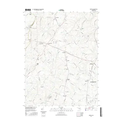
 2011 Winfield2011 Print · USGSCovers Piney Run Estates, including Woodbine Acres, Tarson Manor, and other nearby areas
 - 2014 Map of Winfield, 2014 Print
 2014 Winfield2014 Print · USGSCovers Piney Run Estates, including Woodbine Acres, Tarson Manor, and other nearby areas
 - 2016 Map of Winfield, 2016 Print
 2016 Winfield2016 Print · USGSCovers Piney Run Estates, including Woodbine Acres, Tarson Manor, and other nearby areas
 - 2019 Map of Winfield, 2019 Print
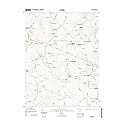
 2019 Winfield2019 Print · USGSCovers Piney Run Estates, including Woodbine Acres, Tarson Manor, and other nearby areas
 - 2023 Map of Winfield, 2023 Print
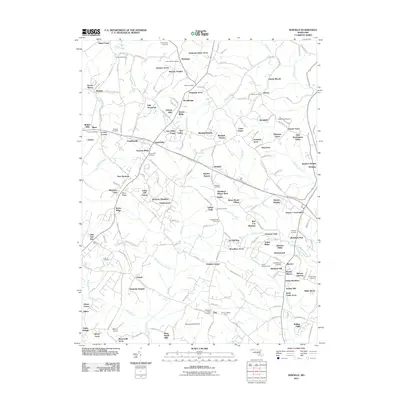
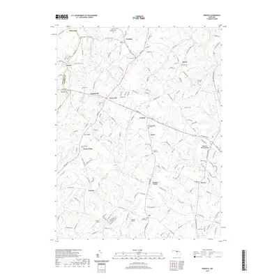
 2023 Winfield2023 Print · USGSCarroll County's rural landscape is surveyed here in the early twenty-first century, showing the enduring pattern of crossroads hamlets and family-run airfields. Researchers can locate numerous historic burial grounds and churches, such as Saint James Cem and Morgans Chapel Cem, along the slopes of Parrs Ridge.
End of results
Showing maps 1-17 of 17
Top cities near Piney Run Estates
- Columbia historical maps
- Ellicott City historical maps
- Randallstown historical maps
- Owings Mills historical maps
- Eldersburg historical maps
- Reisterstown historical maps
See more
Frequently asked questions
- What are the different types of historical maps available for Piney Run Estates?
- What is the oldest map of Piney Run Estates?
- Where can I purchase historical maps of Piney Run Estates for my home or office?
- Where can I download high-res historical maps of Piney Run Estates?
- Are there historical topographic maps available for Piney Run Estates?
- Is there historical aerial imagery available for Piney Run Estates?
- Where are historical maps of Piney Run Estates sourced from?